McGinty Mountain
McGinty Mountain is a mountain located in San Diego County.
| McGinty Mountain | |
|---|---|
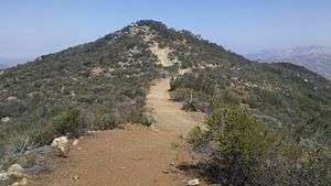 Top of McGinty Mountain | |
| Highest point | |
| Elevation | 2,183 ft (665 m) |
| Prominence | 223 ft (68 m) |
| Isolation | 1.39 mi (2.24 km) |
| Coordinates | 32°45′09″N 116°51′38″W |
| Geography | |
| Location | San Diego County, California, U.S. |
The chaparral covered mountain is part of the Cleveland National Forest and accessible through a hiking trail.[1]
This article is issued from Wikipedia. The text is licensed under Creative Commons - Attribution - Sharealike. Additional terms may apply for the media files.