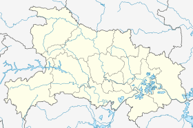
Mawan, Hubei
Mawan[2] (simplified Chinese: 马湾; traditional Chinese: 馬灣; pinyin: Mǎwān) is a town of about 41,000 in the east-central part of Hubei province, People's Republic of China. It is under the administration of the sub-prefecture-level city of Tianmen, 19 kilometres (12 mi) to the west-northwest. To the north is Lake Chen (沉湖), and to the north is Lake Hua (华湖).
Mawan 马湾镇 | |
|---|---|
Town | |
 Mawan Location in Hubei | |
| Coordinates: 30°34′23″N 113°20′03″E | |
| Country | People's Republic of China |
| Province | Hubei |
| Sub-prefecture-level city | Tianmen |
| Area | |
| • Total | 83.4 km2 (32.2 sq mi) |
| Elevation | 31 m (103 ft) |
| Population (2010)[1] | |
| • Total | 36,632 |
| • Density | 440/km2 (1,100/sq mi) |
| Time zone | UTC+8 (China Standard) |
| Postal code | 431700 |
| Area code(s) | 0728 |
Administrative divisions
Mawan has undergone several administrative changes since the founding of the People's Republic: in 1950, it was created as a township, changed to a people's commune in 1976, upgraded to a district in 1984, and with the formation of Tianmen as a sub-prefecture-level city, downgraded to a town in 1987.[1] It is noted for being the ancestral hometown of overseas Chinese, spread across 34 nations and territories on 5 continents.
Twenty-five villages:
- Machang (马场村), Chenma (陈马村), Luwan (卢湾村), Zouwan (邹湾村), Zhengwan (郑湾村), Bianhekou (便河口村), Litan (李滩村), Yangang (鄢港村), Zhawu (榨屋村), Hengdi (横堤村), Nanzha (南闸村), Zhangwan (张湾村), Chenhuang (陈黄村), Liaowan (廖湾村), Jianghu (蒋湖村), Zengliu (曾刘村), Guozui (郭咀村), Datai (大台村), Wangchen (汪陈村), Hedi (河堤村), Xiaohu (小湖村), Kuangtai (匡台村), Tukeng (土坑村), Chendu (陈渡村), Chengang (陈港村)
References
- 马湾镇 [Mawan Town] (in Chinese). XZQH.org. 1 August 2014. Retrieved 19 August 2018.
常住人口36632人(2010年六普)。辖1个居委会、25个行政村。{...}1984年设马湾区。1987年撤区,由原马湾区的马湾镇和华湖、变市两乡合并为市辖马湾镇。{...}2004年,镇政府驻马湾场,人口47463人,面积83.4平方千米,{...}【2013年代码及城乡分类】429006113:~001 121马湾居委会 ~201 122马场村 ~202 122陈马村 ~203 122卢湾村 ~204 220邹湾村 ~205 220郑湾村 ~206 220便河口村 ~207 220李滩村 ~208 220鄢港村 ~209 220榨屋村 ~210 220横堤村 ~211 220南闸村 ~212 122张湾村 ~213 122陈黄村 ~214 122廖湾村 ~215 220蒋湖村 ~216 220曾刘村 ~217 220郭咀村 ~218 220大台村 ~219 220汪陈村 ~220 220河堤村 ~221 220小湖村 ~222 220匡台村 ~223 220土坑村 ~224 220陈渡村 ~225 220陈港村
- Mawan (Approved - N) at GEOnet Names Server, United States National Geospatial-Intelligence Agency
- 2017年统计用区划代码和城乡划分代码:马湾镇 [2017 Statistical Area Numbers and Rural-Urban Area Numbers: Mawan Town]. National Bureau of Statistics of the People's Republic of China. 2017. Retrieved 19 August 2018.
统计用区划代码 城乡分类代码 名称 429006113001 121 马湾居委会 429006113201 122 马场村委会 429006113202 122 陈马村委会 429006113203 122 卢湾村委会 429006113204 220 邹湾村委会 429006113205 220 郑湾村委会 429006113206 220 便河口村委会 429006113207 220 李滩村委会 429006113208 220 鄢港村委会 429006113209 220 榨屋村委会 429006113210 220 横堤村委会 429006113211 220 南闸村委会 429006113212 122 张湾村委会 429006113213 122 陈黄村委会 429006113214 122 廖湾村委会 429006113215 220 蒋湖村委会 429006113216 220 曾刘村委会 429006113217 220 郭咀村委会 429006113218 220 大台村委会 429006113219 220 汪陈村委会 429006113220 220 河堤村委会 429006113221 220 小湖村委会 429006113222 220 匡台村委会 429006113223 220 土坑村委会 429006113224 220 陈渡村委会 429006113225 220 陈港村委会
- "Bing Maps". Retrieved 7 May 2019.
Mawan Town Chenma Village Zouwan Village Bianhekou Village Zhawu Village Nanzha Village Zhangwan Village Chenhuang Village Jianghu Village Zengliu Village Wangchen Village Xiaohu Village Kuangtai Village Chendu Village Chen'gang Village
- 天门市人民政府:马湾镇简介 Archived 2011-06-29 at the Wayback Machine