Maryland Route 588
Maryland Route 588 (MD 588) is a state highway in the U.S. state of Maryland. The state highway runs 1.94 miles (3.12 km) from MD 7 in Rosedale north to the end of state maintenance in Overlea. MD 588 was constructed in the mid-1930s.
| ||||
|---|---|---|---|---|
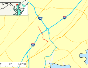 Maryland Route 588 highlighted in red | ||||
| Route information | ||||
| Maintained by MDSHA | ||||
| Length | 1.94 mi[1] (3.12 km) | |||
| Existed | 1935–present | |||
| Major junctions | ||||
| South end | ||||
| North end | End of state maintenance in Overlea | |||
| Location | ||||
| Counties | Baltimore | |||
| Highway system | ||||
| ||||

Route description

MD 588 begins at an intersection with MD 7 (Philadelphia Road) just west of Interstate 695 (I-695) (Baltimore Beltway) in Rosedale. Golden Ring Road continues south as a county highway toward U.S. Route 40 on the south side of the intersection. MD 588 heads north as a two-lane undivided road through residential subdivisions. At Kenwood Avenue, MD 588 leaves Golden Ring Road and continues north on Kenwood Avenue. The state highway passes through a commercial area before crossing I-95 with no access. MD 588 continues north through a residential area of Overlea, passing Overlea High School before reaching its northern terminus just beyond the intersection with Brookwood Avenue.[1][2]
History
MD 588 was brought into the state highway system when the existing county highway was widened with concrete shoulders and resurfaced with macadam in 1935.[3][4] The state highway has changed little since then.
Junction list
The entire route is in Baltimore County.
| Location | mi[1] | km | Destinations | Notes | |
|---|---|---|---|---|---|
| Rosedale | 0.00 | 0.00 | Southern terminus | ||
| 0.58 | 0.93 | Golden Ring Road north / Kenwood Road south | MD 588 turns north onto Kenwood Road | ||
| Overlea | 1.94 | 3.12 | Kenwood Road north | Northern terminus; end of state maintenance | |
| 1.000 mi = 1.609 km; 1.000 km = 0.621 mi | |||||
See also

References
- Highway Information Services Division (December 31, 2013). Highway Location Reference. Maryland State Highway Administration. Retrieved 2011-05-31.
- Baltimore County (PDF).
- Google (2010-06-10). "Maryland Route 588" (Map). Google Maps. Google. Retrieved 2010-06-10.
- Byron, William D.; Lacy, Robert (December 28, 1934). Report of the State Roads Commission of Maryland (1931–1934 ed.). Baltimore: Maryland State Roads Commission. p. 321. Retrieved 2011-05-31.
- Maryland Geological Survey (1935). Map of Maryland Showing State Road System: State Aid Roads and Improved County Road Connections (Map). Baltimore: Maryland Geological Survey.