Marum
Marum (Dutch pronunciation: [ˈmaːrɵm] (![]()
Marum | |
|---|---|
Former municipality | |
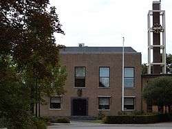 Marum town hall | |
 Flag  Coat of arms | |
.svg.png) Location in Groningen | |
| Coordinates: 53°9′N 6°16′E | |
| Country | Netherlands |
| Province | Groningen |
| Government | |
| • Body | Municipal council |
| • Mayor | Henk Kosmeijer (PvdA) |
| Area | |
| • Total | 64.89 km2 (25.05 sq mi) |
| • Land | 64.52 km2 (24.91 sq mi) |
| • Water | 0.37 km2 (0.14 sq mi) |
| Elevation | 3 m (10 ft) |
| Time zone | UTC+1 (CET) |
| • Summer (DST) | UTC+2 (CEST) |
| Postcode | 9360–9369, 9824–9825 |
| Area code | 0594 |
| Website | www |
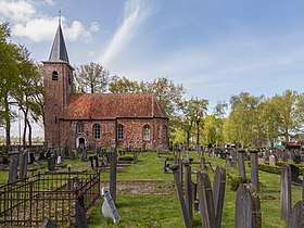
Marum, reformed church
Population centres
Boerakker, Jonkersvaart, Lucaswolde, Marum, Niebert, Noordwijk, Nuis, De Wilp.
Topography
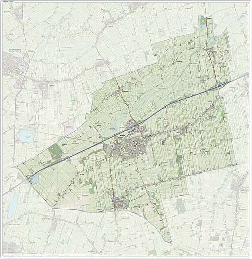
Dutch Topographic map of the municipality of Marum, June 2015
gollark: Okay, send me it.
gollark: Okay, it works if I make it less punishingly cold.
gollark: Anyway, does anyone know how I can breed slightly faster work genes into the bees and/or make industrious bees with cold resistance?
gollark: [REDACTED]
gollark: Very unweary of them.
References
- "Samenstelling B en W" [Members of the board of mayor and aldermen] (in Dutch). Gemeente Marum. Archived from the original on 3 February 2014. Retrieved 30 January 2014.
- "Kerncijfers wijken en buurten" [Key figures for neighbourhoods]. CBS Statline (in Dutch). CBS. 2 July 2013. Retrieved 12 March 2014.
- "Postcodetool for 9363BA". Actueel Hoogtebestand Nederland (in Dutch). Het Waterschapshuis. Archived from the original on 21 September 2013. Retrieved 30 January 2014.
- "Gemeentelijke indeling op 1 januari 2019". CBS (in Dutch). Retrieved 30 November 2019.
External links
| Wikimedia Commons has media related to Marum. |
Places adjacent to Marum | ||||||||||
|---|---|---|---|---|---|---|---|---|---|---|
| ||||||||||
This article is issued from Wikipedia. The text is licensed under Creative Commons - Attribution - Sharealike. Additional terms may apply for the media files.