Marsh Island (Maine)
Marsh Island is an island on the Penobscot River in Penobscot County. The Penobscot River borders the eastern side of the island, while the Stillwater River, a side arm of the Penobscot, borders the western side of the island.
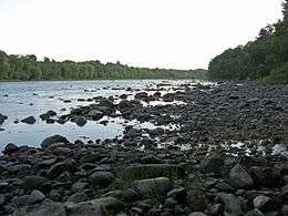 Penobscot River from Marsh Island | |
 Marsh Island | |
| Geography | |
|---|---|
| Coordinates | 44°55′N 68°39′W |
| Length | 5.23 mi (8.42 km) |
| Width | 2.52 km (1.566 mi) |
| Highest elevation | 190 ft (58 m) |
| Administration | |
United States | |
| State | Maine |
| County | Penobscot |
Overview
Portions of Old Town and Orono occupy Marsh Island. The University of Maine campus occupies the southwestern corner of the island while Old Town Municipal Airport and Seaplane Base are at the island's northern end. U.S. Route 2 crosses the island and connects Old Town and Orono.
A former Georgia-Pacific paper mill is located on the island in Old Town. In 2011 Marsh Island was opened to bow deer hunting.[1]
Gallery
 Main Street in Old Town on Marsh Island
 The University of Maine on Marsh Island
 Wetland on Marsh Island
 Fall on Marsh Island
gollark: I don't care about that, I just mean that running something in an emulator is not actually what porting means.
gollark: Emulators aren't technically the same thing.
gollark: Also, they probably make money off console sales.
gollark: Porting things between platforms is sometimes actually very hard.
gollark: See: the entire history of DRM systems.
This article is issued from Wikipedia. The text is licensed under Creative Commons - Attribution - Sharealike. Additional terms may apply for the media files.