Marsden Bay, New Zealand
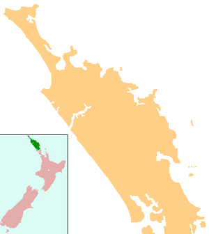
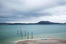
Marsden Bay is a locality and bay at the south head of Whangārei Harbour in Northland, New Zealand. The western side of Marsden Bay is a coastal community called One Tree Point, and the eastern side is the industrial development of Marsden Point. Ruakākā lies about 9 km to the south.[1][2]
Marsden Bay | |
|---|---|
 Marsden Bay | |
| Coordinates: 35°49′53″S 174°27′57″E | |
| Country | New Zealand |
| Region | Northland Region |
| District | Whangarei District |
| Population (2018) | |
| • Total | 2,208 |
History

One Tree Point was called "Single Tree Point" by Captain Lort Stokes of the Acheron in 1849.[4]
The town of Marsden, situated where Marsden Point is now, was originally intended to be the commercial centre for the district, due to the access to deep water, and because it was closer to Auckland than the area which is now Whangārei. The government purchased 200 acres (81 ha) on the point in the mid-1850s and laid it out in quarter-acre sections. The development of the kauri gum industry changed the focus of settlement to Whangarei.[5]
The Marsden Point oil refinery was built in the 1960s and expanded in the 1980s.[6]
Demographics
| Year | Pop. | ±% p.a. |
|---|---|---|
| 2006 | 999 | — |
| 2013 | 1,494 | +5.92% |
| 2018 | 2,208 | +8.13% |
| Source: [7] | ||
Marsden Bay had a population of 2,208 at the 2018 New Zealand census, an increase of 714 people (47.8%) since the 2013 census, and an increase of 1,209 people (121.0%) since the 2006 census. There were 843 households. There were 1,074 males and 1,137 females, giving a sex ratio of 0.94 males per female. Of the total population, 423 people (19.2%) were aged up to 15 years, 234 (10.6%) were 15 to 29, 972 (44.0%) were 30 to 64, and 579 (26.2%) were 65 or older. Figures may not add up to the total due to rounding.
Ethnicities were 86.5% European/Pākehā, 19.3% Māori, 3.1% Pacific peoples, 3.9% Asian, and 2.0% other ethnicities. People may identify with more than one ethnicity.
The percentage of people born overseas was 20.7, compared with 27.1% nationally.
Although some people objected to giving their religion, 52.9% had no religion, 36.3% were Christian, and 3.8% had other religions.
Of those at least 15 years old, 294 (16.5%) people had a bachelor or higher degree, and 360 (20.2%) people had no formal qualifications. The median income was $31,800. The employment status of those at least 15 was that 774 (43.4%) people were employed full-time, 234 (13.1%) were part-time, and 45 (2.5%) were unemployed.[7]
Education
One Tree Point School is a coeducational contributing primary (years 1-6) school with a roll of 209 students as of March 2020.[8][9] The school was established in 1972.[10]
Notes
- Peter Dowling (editor) (2004). Reed New Zealand Atlas. Reed Books. pp. map 8. ISBN 0-7900-0952-8.CS1 maint: extra text: authors list (link)
- Roger Smith, GeographX (2005). The Geographic Atlas of New Zealand. Robbie Burton. pp. map 28. ISBN 1-877333-20-4.
- "Patuharakeke Te Iwi Trust Board Report to Trustees". Takahiwai Marae. 9 September 2006. Archived from the original on 4 August 2008. Retrieved 25 April 2008.
- Parkes, W. F. (1992). Guide to Whangarei City and District. p. 15. ISBN 0-473-01639-7.
- Pickmere, Nancy Preece (1986). Whangarei: The Founding Years. pp. 79–81.
- "Preface: Energy in New Zealand - A Short History". New Zealand Ministry of Economic Development. 27 October 2004.
- "Statistical area 1 dataset for 2018 Census". Statistics New Zealand. March 2020. Marsden Bay (108700). 2018 Census place summary: Marsden Bay
- "New Zealand Schools Directory". New Zealand Ministry of Education. Retrieved 26 April 2020.
- Education Counts: One Tree Point School
- "General Information". One Tree Point School. Archived from the original on 2008-10-14. Retrieved 2008-04-24.