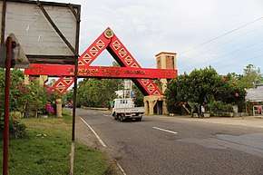
Maria Clara L. Lobregat Highway
The Maria Clara Lorenzo Lobregat Highway (commonly known as MCLL Highway) is a two-to -four lane national highway running in the east coast part of Zamboanga City, Philippines from Barangay Licomo to Sta. Cruz Intersection.[1] Under Republic Act No. 9270 approved on March 19, 2004 the highway was named after the late Mayor Maria Clara Lobregat. [2]
| |
|---|---|
| Pagadian–Zamboanga City Road | |
 The Zamboanga Sibugay–Zamboanga City boundary along the highway | |
| Route information | |
| Part of AH26 | |
| Maintained by Department of Public Works and Highways (DPWH) | |
| Length | 85 km (53 mi) |
| Component highways | |
| Major junctions | |
| North end | |
| South end | |
| Highway system | |
| |
_sign.svg.png)
The highway is also part of the Pan-Philippine Highway and a designated component of the Philippine highway network.
Incidents
- On July 29, 2008- some 100 meters of the portion of the highway in barangay Victoria located 28 km from the city collapsed by 20 feet due to torrential rains that liquefied the soil beneath the highway. There were no reports of accidents or injuries, but hundreds of commuters were stranded in Zamboanga City because provincial buses could not pass through.[3]
gollark: Sure it is!
gollark: And do whether the time is:- a triangular number- a square number
gollark: Ooh, make it live-update!
gollark: If it's interesting enough I can rehost on osmARKS.tk.
gollark: Are you implying it is *not* good? I am insulted.
References
- "Zamboanga City". www.dpwh.gov.ph. Retrieved 2018-12-05.
- "Text of Republic Act 9270". The ChanRobles Group. Retrieved 2009-05-01.
- "Celso seeks Ebdane's Help in Victoria highway collapse". Daily Zamboanga Times. 2008-08-01. Retrieved 2009-05-01.
This article is issued from Wikipedia. The text is licensed under Creative Commons - Attribution - Sharealike. Additional terms may apply for the media files.