Mameyes Arriba
Mameyes Arriba is a barrio in the municipality of Jayuya, Puerto Rico. Its population in 2010 was 2,240.[3][4][5]
Mameyes Arriba | |
|---|---|
Barrio | |
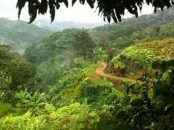 Unpaved road in the mountains of Mameyes Arriba | |
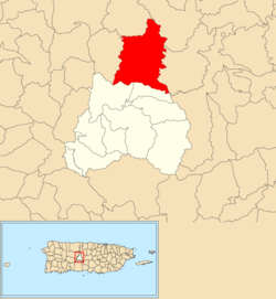 Location of Mameyes Arriba within the municipality of Jayuya shown in red | |
 Mameyes Arriba Location of Puerto Rico | |
| Coordinates: 18°15′45″N 66°34′39″W[1] | |
| Commonwealth | |
| Municipality | |
| Area | |
| • Total | 9.515 sq mi (24.64 km2) |
| • Land | 9.514 sq mi (24.64 km2) |
| • Water | 0.001 sq mi (0.003 km2) |
| Elevation | 1,696 ft (517 m) |
| Population (2010) | |
| • Total | 2,240 |
| • Density | 235.3/sq mi (90.8/km2) |
| Source: 2010 Census | |
| Time zone | UTC−4 (AST) |
Gallery
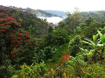 Mountains and clouds in Mameyes Arriba
gollark: Exactly how many old bases do you have?
gollark: Networking incursed.
gollark: Information screens good, heav.
gollark: Computers are fast, FFTs are O(n log n) or something, just do so.
gollark: I guess there might be precision issues in reality™ but still.
See also
References
- "US Gazetteer 2019". US Census. US Government.
- U.S. Geological Survey Geographic Names Information System: Mameyes Arriba Barrio
- Picó, Rafael; Buitrago de Santiago, Zayda; Berrios, Hector H. Nueva geografía de Puerto Rico: física, económica, y social, por Rafael Picó. Con la colaboración de Zayda Buitrago de Santiago y Héctor H. Berrios. San Juan Editorial Universitaria, Universidad de Puerto Rico,1969.
- Gwillim Law (20 May 2015). Administrative Subdivisions of Countries: A Comprehensive World Reference, 1900 through 1998. McFarland. p. 300. ISBN 978-1-4766-0447-3. Retrieved 25 December 2018.
- Puerto Rico:2010:population and housing unit counts.pdf (PDF). U.S. Dept. of Commerce, Economics and Statistics Administration, U.S. Census Bureau. 2010.
This article is issued from Wikipedia. The text is licensed under Creative Commons - Attribution - Sharealike. Additional terms may apply for the media files.