Makardhokada Dam
Makardhokada Dam, is an earthfill dam on Amb river near Umred, Nagpur district in state of Maharashtra in India.
| Makardhokada Dam | |
|---|---|
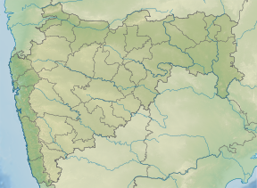
 Location of Makardhokada Dam in Maharashtra | |
| Official name | Makardhokada Dam |
| Location | Umred |
| Coordinates | 20.8678°N 79.2126°E |
| Opening date | 1978[1] |
| Owner(s) | Government of Maharashtra, India |
| Dam and spillways | |
| Type of dam | Earthfill |
| Impounds | Amb river |
| Height | 18.81 m (61.7 ft) |
| Length | 1,645 m (5,397 ft) |
| Dam volume | 652.87 km3 (156.63 cu mi) |
| Reservoir | |
| Total capacity | 19,931 km3 (4,782 cu mi) |
| Surface area | 322 km2 (124 sq mi) |
Specifications
The height of the dam above lowest foundation is 18.81 m (61.7 ft) while the length is 1,645 m (5,397 ft). The volume content is 652.87 km3 (156.63 cu mi) and gross storage capacity is 21,356.00 km3 (5,123.58 cu mi).[2]
Purpose
- Irrigation
gollark: They don't even have full-color screens?
gollark: They're definitely computers, as you can run Doom on them.
gollark: The Casio graphing ones which are popular here have some weird Renesas microcontrollers.
gollark: I guess it could *technically* go on your lap.
gollark: I mean, it's obviously much worse in terms of calculation throughput.
See also
- Dams in Maharashtra
- List of reservoirs and dams in India
References
- "Makardhokada D01402". Retrieved 28 February 2013.
- Specifications of large dams in India Archived 21 July 2011 at the Wayback Machine
This article is issued from Wikipedia. The text is licensed under Creative Commons - Attribution - Sharealike. Additional terms may apply for the media files.