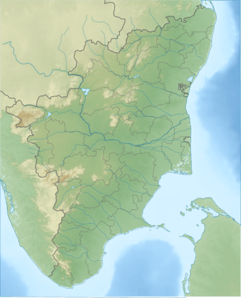
Mahendragiri, Tamil Nadu
Mahendragiri is the name of a hill in Tirunelveli District, South Tamil Nadu.[1] The hill is located in Tirunelveli District [2] and is part of the southern range of the Western Ghats, with an elevation of 1,645.2 metres (5,398 ft).[3]
| Mahendragiri மகேந்திரகிரி | |
|---|---|
 Mahendragiri மகேந்திரகிரி | |
| Highest point | |
| Elevation | 1,654 m (5,427 ft) |
| Coordinates | 8°23′18″N 77°31′17″E |
| Geography | |
| Location | Radhapuram taluk of Tirunelveli District, Tamil Nadu |
| Parent range | Western Ghats |
| Climbing | |
| Easiest route | Hike/scramble |
IPRC, a test facility for Indian Space Research Organisation's launch vehicle and satellite propulsion systems, is situated on the lower slopes of this mountains.
Citations
- "Archived copy". Archived from the original on 27 September 2013. Retrieved 30 July 2013.CS1 maint: archived copy as title (link)
- https://www.thehindu.com/todays-paper/tp-national/tp-tamilnadu/set-up-iipt-at-mahendragiri/article5679659.ece
- "Archived copy". Archived from the original on 23 March 2008. Retrieved 26 February 2008.CS1 maint: archived copy as title (link)
gollark: Or you can just photosynthesize.
gollark: Suuuuure you can, for a while.
gollark: I live in the Britainian realms, though, which are reasonably temperate most of the time, so I have the door open and stuff now.
gollark: Doesn't mean not having those is nice.
gollark: Humans have lived without... air conditioning, indoor toilets, reasonably reliable food supplies, shoes, and a lot of other things.
References
- Nagar, Shanti Lal (1999). Genesis and evolution of the Rāma kathā in Indian art, thought, literature, and culture: from the earliest period to the modern times, Volume 2. B.R. Pub. Co. ISBN 81-7646-084-2.
This article is issued from Wikipedia. The text is licensed under Creative Commons - Attribution - Sharealike. Additional terms may apply for the media files.