Machipongo River
The Machipongo River[1] is a 16.5-mile-long (26.6 km)[2] river in Accomack County on the Eastern Shore of the U.S. state of Virginia.
| Machipongo River | |
|---|---|
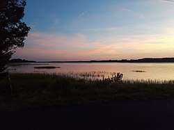 Sunset along the Machipongo, July 2018 | |
| Location | |
| Country | United States |
| Physical characteristics | |
| Source | |
| • location | Virginia |
See also
References
- U.S. Geological Survey Geographic Names Information System: Machipongo River
- U.S. Geological Survey. National Hydrography Dataset high-resolution flowline data. The National Map Archived 2012-04-05 at WebCite, accessed April 1, 2011
- USGS Hydrologic Unit Map – State of Virginia (1974)
- Salmon, Emily J.; Edward D. C. Campbell, Jr., eds. (1994). The Hornbook of Virginia History (4th ed.). Richmond, VA: Virginia Office of Graphic Communications. ISBN 0-88490-177-7.
This article is issued from Wikipedia. The text is licensed under Creative Commons - Attribution - Sharealike. Additional terms may apply for the media files.