M13 (Cape Town)
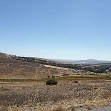
The M13 is a metropolitan route in the City of Cape Town linking Durbanville and Bothasig in South Africa. The route begins at the intersection with the R302 in Durbanville Central, winds through the Durbanville Wine Valley and ends at the intersection with the M14 in Bothasig.
| Metropolitan route M13 | |
|---|---|
| Route information | |
| Maintained by the City of Cape Town | |
| Length | 14 km (9 mi) |
| Major junctions | |
| North end | Durbanville Avenue |
| South end | Plattekloof Road M14 in Bothasig |
| Highway system | |
| Numbered routes of South Africa | |
Route
The route begins at a traffic light intersection with the R302 (Durbanville Avenue) in Durbanville Central as Church Street and heads in a south-westerly direction. It then intersects with High Street through a new traffic circle and changes its name to Race Course Road. It then bypasses Durbanville Race Course and Durbanville Nature Reserve heading in a westerly direction. It intersects with Jip de Jager (M16), St Johns Road and the M31 and then enters the Durbanville Wine Valley and changes its name for the last time to Tygerberg Valley Road.

It winds through the wine valley passing through 8 wineries from D'Aria to Durbanville Hills. Shortly after the Durbanville Wine Valley it heads south-west and intersects with Contermanskloof Road and Giel Basson Drive which gives access to the N7 (to Malmesbury, Namibia and Cape Town). It goes through the neighbourhoods of Richwood and Burgundy Estate before ending at the intersection with the M14 (Plattekloof Road) north of Bothasig.[1][2][3][4][5]
Suburbs
The M13 passes through the following suburbs:
- Durbanville
- Richwood
- Burgundy Estate
References
- Roberts, Trygve. "Tyger Valley Road (M13) - Mountain Passes South Africa". www.mountainpassessouthafrica.co.za. Retrieved August 3, 2020.
- Google (August 3, 2020). "M13 (Cape Town)" (Map). Google Maps. Google. Retrieved August 3, 2020.
- "Home". Hillcrest Wine Farm. Retrieved August 3, 2020.
- "Driving directions to Church St (M13), Durbanville, Cape Town - provided by Waze". Waze. Retrieved August 3, 2020.
- Staff Reporter (September 22, 2016). "Upgrade on the road". Northern News. Retrieved August 3, 2020.