M-41 (Michigan highway)
M-41 was the designation of a former state trunkline highway in the Lower Peninsula of the US state of Michigan that began near Holton and ran north- and northwest-ward, ending at Hart. The highway was created by 1919 and lasted until 1926. The designation has not been reused since.
| ||||
|---|---|---|---|---|
%26groups%3D_b2f7f17c486c1cea5906ce6ffe9eb06d08eb781e.svg)
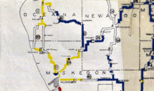
M-41 highlighted in red on a modern map | ||||
| Route information | ||||
| Length | 38.1 mi[1] (61.3 km) | |||
| Existed | c. July 1, 1919[2]–c. November 11, 1926[3] | |||
| Major junctions | ||||
| South end | ||||
| North end | ||||
| Location | ||||
| Counties | Muskegon, Newaygo, Oceana | |||
| Highway system | ||||
| ||||

Route description
M-41 followed the present day route of M-120 between Holton and Hesperia. The roadway ran northeast to the Muskegon–Newaygo county line. The highway turned north along the county line to the tri-point between Muskegon, Newaygo and Oceana counties. From there, M-41 followed the Oceana–Newaygo county line north to Hesperia. There it turned west to Ferry and then northwest to Hart.[2]
History
When the state highway system was first signed in 1919,[4] M-41 was designated between Holton and Hart.[2] After the creation of the United States Numbered Highway System on November 11, 1926,[5] and the designation of U.S. Highway 41 in the Upper Peninsula,[6] the Michigan State Highway Department renumbered the state highways that had numbers that duplicated the then-new US Highways. In the process, the M-41 designation was decommissioned. the southern half became part of a newly designated M-20. The northern half was made part of M-82.[3]
Major intersections
| County | Location | mi[1] | km | Destinations | Notes | |||
|---|---|---|---|---|---|---|---|---|
| Muskegon | Holton | 0.0 | 0.0 | |||||
| Newaygo |
No major junctions | |||||||
| Oceana | Hart | 38.1 | 61.3 | |||||
| 1.000 mi = 1.609 km; 1.000 km = 0.621 mi | ||||||||
See also

References
- Google (February 22, 2012). "Overview Map of Former M-41" (Map). Google Maps. Google. Retrieved February 22, 2012.
- Michigan State Highway Department (July 1, 1919). State of Michigan (Map). Scale not given. Lansing: Michigan State Highway Department. Lower Peninsula sheet. OCLC 15607244. Retrieved October 17, 2019 – via Archives of Michigan.
- Michigan State Highway Department (December 1, 1926). Official Highway Condition Map (Map). [c. 1:823,680]. Lansing: Michigan State Highway Department.
- "Michigan May Do Well Following Wisconsin's Road Marking System". The Grand Rapids Press. September 20, 1919. p. 10. OCLC 9975013.
- McNichol, Dan (2006). The Roads that Built America: The Incredible Story of the US Interstate System. New York: Sterling. p. 74. ISBN 1-4027-3468-9.
- Bureau of Public Roads & American Association of State Highway Officials (November 11, 1926). United States System of Highways Adopted for Uniform Marking by the American Association of State Highway Officials (Map). 1:7,000,000. Washington, DC: U.S. Geological Survey. OCLC 32889555. Retrieved November 7, 2013 – via Wikimedia Commons.
External links
- M-41 at Michigan Highways