Lusby's Mill, Kentucky
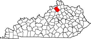
Lusby's Mill is an unincorporated community in northern Owen County, Kentucky, United States. It is located six miles east of Owenton on Kentucky Route 330.
Lusby's Mill, Kentucky | |
|---|---|
unincorporated community | |
 Lusby's Mill, Kentucky Location of New Liberty in the Commonwealth of Kentucky | |
| Coordinates: 38.5301329°N 84.7193623°W | |
| Country | United States |
| State | Kentucky |
| County | Owen |
| Time zone | UTC-5 (EST) |
| • Summer (DST) | UTC-4 (EDT) |
| ZIP code | 40359 |
| Area code(s) | 502 |
| GNIS feature ID | 2567400 |
History

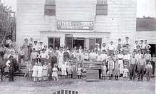
The area was originally settled by the Cobb family and a mill was built by William Jones for the family. Around 1852 the mill was acquired by John or William Lusby. There was a post office that operated in Lusby's Mill from 1852 to 1904 and the town was incorporated in 1869. During the Civil War a Confederate training camp, Camp Humphrey was here.[1] One of the oldest houses in town is the Gunboat House, which received its name during the Civil War. There was a distillery that was said to produce “fine quality of pure old copper distilled whiskey” which closed in 1897.[2] In 1871, the Lusby's Mill Bridge, a 140-foot covered bridge, was built, but was destroyed by fire in 1927.[3] The town had a population of 81 as of the 1880 census.[4] Margaret Hammon donated the land for the first school in town, and the Lusby Central High School operated until 1934. After a bypass road was constructed, business activity diminished in the settlement, and it is no longer incorporated.[1]
Notable people
The poet Perry Jones was from Lusby's Mill.[1]
References
- "Chapter L". Encyclopedia of Northern Kentucky. Retrieved June 1, 2018.
- Strassell, Bonnie (December 6, 2017). "Lusby's Mill past rife with colorful characters". Owenton News-Herald. Retrieved June 5, 2018.
- Laughlin, Robert; Jurgensen, Melissa (2007). Kentucky's Covered Bridges. Arcadia Publishing. p. 21. ISBN 0738544043.
- Compendium of the Tenth Census (June 1, 1880)
