Lower Tapi Dam
Lower Tapi Dam (or Padalsare Dam) is an earthfill dam on Tapti river near Amalner, but in Jalgaon district in state of Maharashtra in India.[1]
| Lower Tapi Dam | |
|---|---|
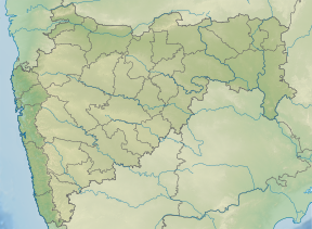
 Location of Lower Tapi Dam in Maharashtra | |
| Official name | Lower Tapi (Padalsare) Dam D03032 |
| Location | Nashik |
| Coordinates | 21.1869627°N 75.0004005°E |
| Owner(s) | Government of Maharashtra, India |
| Dam and spillways | |
| Type of dam | Earthfill |
| Impounds | Tapi river |
| Height | 21.8 m (72 ft) |
| Length | 860 m (2,820 ft) |
| Dam volume | 303.72 km3 (72.87 cu mi) |
| Reservoir | |
| Total capacity | 11,470 km3 (2,750 cu mi) |
| Surface area | 3,150 km2 (1,220 sq mi) |
Specifications
The height of the dam above lowest foundation is 21.8 m (72 ft) while the length is 860 m (2,820 ft). The volume content is 303.72 km3 (72.87 cu mi) and gross storage capacity is 16,460.00 km3 (3,948.96 cu mi).[2]
Purpose
- Irrigation
gollark: It's bad at being a programming language, and bad at being a configuration language.
gollark: The osmarks.net™ service manager, used absolutely nowhere, uses TOML for this.
gollark: I don't actually *want* a programming language mostly, I want to specify a bunch of configuration options for what to do when starting the service and such.
gollark: fish is somewhat nicer.
gollark: It's too stringy, unsafe (not in the memory-safety way), lacking useful constructs from any modern language ever (USABLE ARRAYS?!), and... well, that's it really.
See also
- Dams in Maharashtra
- List of reservoirs and dams in India
References
- "Lower Tapi ( Padalse ) D03032". Retrieved March 13, 2013.
- Specifications of large dams in India Archived 2011-07-21 at the Wayback Machine
This article is issued from Wikipedia. The text is licensed under Creative Commons - Attribution - Sharealike. Additional terms may apply for the media files.