Little White River (Ontario)
The Little White River is a river in the Unorganized North Part of Algoma District in Northeastern Ontario, Canada.[1] It is in the Great Lakes Basin and is a left tributary of the Mississagi River.
| Little White River | |
|---|---|
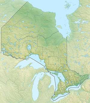 Location of the mouth of the river in Ontario | |
| Location | |
| Country | Canada |
| Province | Ontario |
| Region | Northeastern Ontario |
| District | Algoma |
| Part | Unorganized North |
| Physical characteristics | |
| Source | Unnamed lake |
| • location | Fabbro Township |
| • coordinates | 46°48′14″N 82°32′37″W |
| • elevation | 489 m (1,604 ft) |
| Mouth | Mississagi River |
• location | Wells Township |
• coordinates | 46°22′54″N 83°20′02″W |
• elevation | 213 m (699 ft) |
| Basin features | |
| River system | Great Lakes Basin |
Course
The river begins at an unnamed lake in geographic Fabbro Township.[2] It heads southwest through Sixpack Lake and then under Ontario Highway 546, from which point the highway follows the river valley, where it takes in the left tributary Sister River and the right tributary Kindiogami River. It loops back and forth under the highway, continues southwest, takes in the left tributary Boland River and right tributary West Little White River, passes under Ontario Highway 554, and reaches its mouth at the Mississagi River at geographic Wells Township[3] southeast of the community Wharncliffe. The Mississagi River flows to the North Channel on Lake Huron.
Tributaries
- Casselman's Creek (left)
- Kynoch Creek (right)
- West Little White River (right)
- Boland River (left)
- Kindiogami River (right)
- Sister River (left)
See also
References
- "Little White River". Geographical Names Data Base. Natural Resources Canada. Retrieved 2014-06-28.
- "Fabbro" (PDF). Geology Ontario - Historic Claim Maps. Ontario Ministry of Northern Development, Mines and Forestry. Archived from the original (PDF) on 2016-03-04. Retrieved 2014-06-28.
- "Wells" (PDF). Geology Ontario - Historic Claim Maps. Ontario Ministry of Northern Development, Mines and Forestry. Retrieved 2014-06-28.
Sources
- Map 12 (PDF) (Map). 1 : 1,600,000. Official road map of Ontario. Ministry of Transportation of Ontario. 2014. Retrieved 2014-06-28.
- Restructured municipalities - Ontario map #4 (Map). Restructuring Maps of Ontario. Ontario Ministry of Municipal Affairs and Housing. 2006. Retrieved 2014-06-28.