Little Schoharie Creek
Little Schoharie Creek converges with the Schoharie Creek in Middleburgh, New York.[2]
| Little Schoharie Creek | |
|---|---|
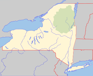 Location of mouth within New York  Little Schoharie Creek (the United States) | |
| Location | |
| Country | United States |
| State | New York |
| Counties | Schoharie, Albany |
| Physical characteristics | |
| Source | |
| • location | East of Huntersland |
| • coordinates | 42°33′42″N 74°11′40″W[1] |
| Mouth | Schoharie Creek |
• location | Middleburgh |
• coordinates | 42°35′31″N 74°20′32″W[1] |
• elevation | 617 ft (188 m)[1] |
| Basin size | 24.5 sq mi (63 km2) |
Hydrology
Discharge
The United States Geological Survey (USGS) maintains stream gauges along Little Schoharie Creek. The station by Middleburgh in operation since December 2017, 1.6 miles (2.6 km) upstream from the mouth, had a maximum discharge of 442 cubic feet (12.5 m3) per second on April 16, 2018, and a minimum discharge of 0.75 cubic feet (0.021 m3) per second on July 21, 2018.[3]
References
- "Little Schoharie Creek". Geographic Names Information System. United States Geological Survey. Retrieved 2017-10-29.
- "Little Schoharie creek". usgs.gov. usgs. 1995. Retrieved 23 April 2017.
data
- "USGS 01350480 LITTLE SCHOHARIE CREEK NEAR MIDDLEBURGH NY". United States Geological Survey. Retrieved 3 May 2020.
This article is issued from Wikipedia. The text is licensed under Creative Commons - Attribution - Sharealike. Additional terms may apply for the media files.