Little Brown Creek (Brown Creek tributary, right bank)
Little Brown Creek is a 8.79 mi (14.15 km) long 3rd order tributary to Brown Creek in Anson County, North Carolina. This creek is located on the right bank of Brown Creek and is different than the one on the left bank located upstream.
| Little Brown Creek Tributary to Brown Creek on the right bank | |
|---|---|
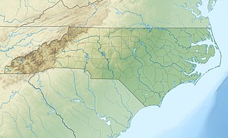
 Location of Little Brown Creek mouth  Little Brown Creek (Brown Creek tributary, right bank) (the United States) | |
| Location | |
| Country | United States |
| State | North Carolina |
| County | Anson |
| Physical characteristics | |
| Source | divide between Little Brown Creek and Middle Fork Jones Creek |
| • location | pond about 3 miles northeast of Lowry, North Carolina |
| • coordinates | 34°54′01″N 080°09′28″W[1] |
| • elevation | 505 ft (154 m)[2] |
| Mouth | Brown Creek |
• location | about 0.5 miles southeast of Polkton, North Carolina |
• coordinates | 35°00′07″N 080°11′04″W[1] |
• elevation | 243 ft (74 m)[2] |
| Length | 8.79 mi (14.15 km)[3] |
| Basin size | 15.42 square miles (39.9 km2)[4] |
| Discharge | |
| • location | Brown Creek |
| • average | 17.06 cu ft/s (0.483 m3/s) at mouth with Brown Creek[4] |
| Basin features | |
| Progression | generally north |
| River system | Pee Dee River |
| Tributaries | |
| • left | unnamed tributaries |
| • right | Leggett Branch |
| Bridges | White Store Road, Mills Road, US 74 |
Course
Little Brown Creek rises in a pond about 3 miles north of Lowry, North Carolina. Little Brown Creek then flows north to meet Brown Creek about 0.5 miles southeast of Polkton, North Carolina.[2]
Watershed
Little Brown Creek drains 15.42 square miles (39.9 km2) of area, receives about 48.0 in/year of precipitation, has a topographic wetness index of 432.95 and is about 69% forested.[4]
gollark: Finally, stick a turtle on a modem on the external network.
gollark: The server (a computer) must have one side plugged into the external network and one onto the chests.
gollark: Chests plugged into modems. Two modems per dropper, one on each side (one connected to chests, one to external network).
gollark: <@!111569489971159040>
gollark: Also a good idea. But useless for my intended use case: efficient quarrying.
References
- "GNIS Detail - Little Brown Creek". geonames.usgs.gov. US Geological Survey. Retrieved 21 October 2019.
- "Brown Creek Topo Map, Anson County NC (Ansonville Area)". TopoZone. Locality, LLC. Retrieved 21 October 2019.
- "Water Quality Ratings". www.nconemap.gov. State of North Carolina. Retrieved 21 October 2019.
- "Little Brown Creek Watershed Report". Waters Geoviewer. US EPA. Retrieved 21 October 2019.
This article is issued from Wikipedia. The text is licensed under Creative Commons - Attribution - Sharealike. Additional terms may apply for the media files.