List of listed buildings in Tiree, Argyll and Bute
List
| Name | Location | Date Listed | Grid Ref. [note 1] | Geo-coordinates | Notes | LB Number [note 2] | Image |
|---|---|---|---|---|---|---|---|
| Hynish, Harbour And Lighthouse Establishment, Including Signal Tower, Housing, Sheds/Stores, Dam And Walled Enclosures | 56°26′52″N 6°53′40″W | Category A | 17848 | 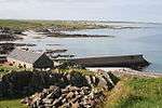 | |||
| Balevullin Cottage Owned By Frances Walker | 56°31′00″N 6°57′11″W | Category B | 17852 |  | |||
| Kilkenneth | 56°29′39″N 6°57′58″W | Category B | 17862 | | |||
| The Green | 56°31′40″N 6°56′03″W | Category B | 17864 | | |||
| Mannal | 56°27′40″N 6°53′35″W | Category B | 17866 | | |||
| Heanish, Brandon Cottage | 56°29′31″N 6°48′53″W | Category B | 19836 | | |||
| Sandaig, The Terrace (South End Dwelling) | 56°28′53″N 6°58′18″W | Category C(S) | 18476 | | |||
| St Columba's Chapel, Near Kirkapol Burial Ground | 56°31′29″N 6°48′42″W | Category B | 17842 | | |||
| St. Kenneth's Chapel (Cill Choinnich) Kilkenneth Burial Ground | 56°29′44″N 6°58′07″W | Category B | 17847 | | |||
| 4 Balevullin | 56°30′51″N 6°56′42″W | Category B | 18477 | | |||
| Dun Beag Cottage, (L Maclean) Scarinish | 56°30′07″N 6°48′30″W | Category B | 17845 | | |||
| Barrapol Clachan Dubh | 56°28′46″N 6°57′27″W | Category B | 17853 | | |||
| Ruaig 5A, B, C, D, E Brock | 56°31′39″N 6°46′20″W | Category B | 17867 | | |||
| Hynish, Hynish Farm Steading | 56°26′48″N 6°53′49″W | Category C(S) | 49356 | | |||
| Sandaig, The Terrace (North End And Centre Dwellings) | 56°28′53″N 6°58′19″W | Category B | 18475 | | |||
| 3 Kilmoluaig | 56°30′20″N 6°55′45″W | Category A | 17857 | | |||
| 3 Moss | 56°29′14″N 6°56′29″W | Category B | 17860 | | |||
| Balmartine Tigh Fiona Ghall | 56°28′08″N 6°53′47″W | Category B | 17863 | | |||
| The Green | 56°31′42″N 6°56′04″W | Category B | 17865 | | |||
| Cornaig, Congregational Church | 56°31′16″N 6°54′23″W | Category C(S) | 50169 | | |||
| Island House, Loch An Eilean, Heylipol | 56°29′13″N 6°53′53″W | Category B | 19834 | | |||
| Barrapol (Hector Mcneill) | 56°28′15″N 6°57′12″W | Category B | 17854 | | |||
| 13 Kilmoluaig | 56°30′32″N 6°55′31″W | Category A | 17859 | | |||
| Barrapol (Morvan House) Or 'Drover's | 56°28′48″N 6°57′00″W | Category B | 17861 | | |||
| Tiree Parish Church Kirkapol | 56°31′12″N 6°48′48″W | Category B | 17594 | | |||
| Kirkapol Chapel (St Peter's) Cladh Beag, Kirkapol Burial Ground | 56°31′27″N 6°48′41″W | Category B | 17595 | | |||
| Skerryvore Lighthouse | 56°19′23″N 7°06′58″W | Category A | 17849 |  | |||
| Cottages, (John Henderson's) Moss | 56°29′37″N 6°56′29″W | Category B | 17846 | | |||
| 7 Balevullin (Cameron) | 56°30′36″N 6°56′49″W | Category B | 17850 | | |||
| Kenovay, (Crawford) | 56°30′42″N 6°53′09″W | Category B | 17856 | | |||
| Balmartine | 56°28′05″N 6°53′50″W | Category B | 19835 | | |||
| Scarinish | 56°29′59″N 6°48′37″W | Category B | 19837 | | |||
| Tishabet, Formerly (Tiree Manse) Gott | 56°30′37″N 6°48′28″W | Category B | 17843 | | |||
| Pierview Cottage (J Maclean's) Scarinish | 56°30′09″N 6°48′31″W | Category B | 17844 | | |||
| Balevullin Creag Chrom | 56°31′10″N 6°57′26″W | Category B | 17851 | |
Key
The scheme for classifying buildings in Scotland is:
- Category A: "buildings of national or international importance, either architectural or historic; or fine, little-altered examples of some particular period, style or building type."[1]
- Category B: "buildings of regional or more than local importance; or major examples of some particular period, style or building type, which may have been altered."[1]
- Category C: "buildings of local importance; lesser examples of any period, style, or building type, as originally constructed or moderately altered; and simple traditional buildings which group well with other listed buildings."[1]
In March 2016 there were 47,288 listed buildings in Scotland. Of these, 8% were Category A, and 50% were Category B, with the remaining 42% being Category C.[2]
gollark: Queue position arbitrage seems like a cool idea, actually.
gollark: I have a mostly underutilized VPS running random routing tasks and monitoring for this sort of thing.
gollark: Excellent, guess I'll consider using that.
gollark: I was looking at it, but since I think the backend is closed source I currently just operate a somewhat accursed Wireguard network with routing.
gollark: I feel mostly safe due to having been (partly, at least) vaccinated and being young enough to not be at significant risk anyway.
Notes
- Sometimes known as OSGB36, the grid reference (where provided) is based on the British national grid reference system used by the Ordnance Survey.
• "Guide to National Grid". Ordnance Survey. Retrieved 2007-12-12.
• "Get-a-map". Ordnance Survey. Retrieved 2007-12-17. - Historic Environment Scotland assign a unique alphanumeric identifier to each designated site in Scotland, for listed buildings this always begins with "LB", for example "LB12345".
References
- All entries, addresses and coordinates are based on data from Historic Scotland. This data falls under the Open Government Licence
- "What is Listing?". Historic Environment Scotland. Retrieved 29 May 2018.
- Scotland's Historic Environment Audit 2016 (PDF). Historic Environment Scotland and the Built Environment Forum Scotland. pp. 15–16. Retrieved 29 May 2018.
This article is issued from Wikipedia. The text is licensed under Creative Commons - Attribution - Sharealike. Additional terms may apply for the media files.