List of listed buildings in Stenton, East Lothian
List
| Name | Location | Date Listed | Grid Ref. [note 1] | Geo-coordinates | Notes | LB Number [note 2] | Image |
|---|---|---|---|---|---|---|---|
| Biel House With Terrace Walls, Chapel Remains, Sundial, Boundary Walls, Gateway, Summer House, Archway, Kennels And Service Court | 55°58′29″N 2°35′18″W | Category A | 14764 |  | |||
| Biel Mill, Beech Cottage | 55°58′24″N 2°36′13″W | Category B | 14768 | | |||
| Stenton Rood Well With Retaining Wall | 55°57′41″N 2°36′15″W | Category A | 14783 | 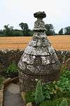 | |||
| Stenton, East Green, Tron | 55°57′34″N 2°36′29″W | Category B | 14803 | | |||
| Stenton, Main Street, Barn | 55°57′33″N 2°36′27″W | Category C(S) | 14805 | | |||
| Stenton, Main Street, Mid House | 55°57′32″N 2°36′30″W | Category B | 14808 | | |||
| Stenton, Stenton Primary School With Outbuildings And Retaining Walls | 55°57′27″N 2°36′35″W | Category B | 14814 | | |||
| Stenton, West Green, The Smiddy With Outbuildings And Retaining Walls | 55°57′28″N 2°36′36″W | Category B | 14819 | | |||
| Stenton, Stenton House With Stable Court, Retaining Walls And Gatepiers | 55°57′35″N 2°36′24″W | Category B | 14821 | | |||
| Biel House, West Lodge With Gatepiers | 55°58′27″N 2°36′22″W | Category B | 14767 | | |||
| Biel Mill Bridge | 55°58′25″N 2°36′18″W | Category C(S) | 14769 | | |||
| Little Spott Cottages | 55°57′56″N 2°33′06″W | Category C(S) | 14773 | | |||
| Little Spott Farmhouse | 55°57′53″N 2°33′19″W | Category B | 14774 | | |||
| Pitcox Cottages | 55°58′08″N 2°34′23″W | Category B | 14776 | | |||
| Stenton, Main Street, St Mary's With Retaining Walls | 55°57′33″N 2°36′29″W | Category B | 14777 | | |||
| Stenton, Main Street, Wayside | 55°57′33″N 2°36′29″W | Category B | 14778 | | |||
| Bielgrange Farmhouse With Terrace And Retaining Walls | 55°58′19″N 2°36′47″W | Category A | 14796 | | |||
| Pressmennan Farm Steading And Stalk | 55°57′10″N 2°35′43″W | Category C(S) | 14802 | | |||
| Stenton, Main Street, Floral Cottage | 55°57′34″N 2°36′31″W | Category C(S) | 14807 | | |||
| Stenton, Main Street, Pantiles | 55°57′32″N 2°36′31″W | Category C(S) | 14813 | | |||
| Stenton, The Wynd, Woodlea With Garden Walls | 55°57′36″N 2°36′33″W | Category B | 14815 | | |||
| Stenton, West Green, Cottage | 55°57′28″N 2°36′33″W | Category B | 14818 | | |||
| Deuchrie Farmhouse With Retaining Walls | 55°56′05″N 2°36′17″W | Category C(S) | 14772 | | |||
| Newbarn Farmhouse With Retaining Walls And Gatepiers | 55°57′54″N 2°35′54″W | Category B | 14775 | | |||
| Stenton, Main Street, Old Bakehouse | 55°57′33″N 2°36′30″W | Category B | 14809 | | |||
| Stenton War Memorial | 55°57′36″N 2°36′25″W | Category C(S) | 14817 | | |||
| Pitcox, K6 Telephone Kiosk | 55°58′09″N 2°34′30″W | Category B | 16845 | | |||
| Biel Mill Lodge | 55°58′25″N 2°36′12″W | Category C(S) | 14770 | | |||
| Stenton Parish Church With Graveyard Walls And Gatepiers | 55°57′36″N 2°36′25″W | Category B | 14782 | | |||
| Biel, Beesknowe | 55°58′31″N 2°35′32″W | Category B | 14795 | | |||
| 2 And 3 Pitcox Cottages, (Gardener's And Shepherds) | 55°58′07″N 2°34′32″W | Category B | 14797 | | |||
| Stenton, West Green, West Knowe | 55°57′28″N 2°36′33″W | Category C(S) | 14820 | | |||
| Biel House, Dovecot | 55°58′27″N 2°34′51″W | Category B | 14765 | | |||
| Pitcox Lodge | 55°58′09″N 2°34′31″W | Category C(S) | 14799 | | |||
| Pitcox Smithy | 55°58′08″N 2°34′36″W | Category B | 14800 | | |||
| Pressmennan Farmhouse With Terrace Walls And Gatepiers | 55°57′08″N 2°35′41″W | Category B | 14801 | | |||
| Stenton, Main Street, Old School Hall With Retaining Walls And Gatepiers | 55°57′29″N 2°36′32″W | Category B | 14811 | | |||
| Stenton, Main Street, Craigroy | 55°57′34″N 2°36′30″W | Category C(S) | 14806 | | |||
| Stenton, Main Street, Old Playground Cottage | 55°57′29″N 2°36′32″W | Category C(S) | 14810 | | |||
| Biel House, North Gatepiers | 55°59′22″N 2°35′55″W | Category B | 14766 | | |||
| Biel Park Cottage | 55°58′22″N 2°36′09″W | Category C(S) | 14771 | | |||
| Stenton, Main Street, Houses Adjoined To White Briar Cottage | 55°57′31″N 2°36′31″W | Category B | 14779 | | |||
| Stenton, Mid Green, Daw's Well | 55°57′32″N 2°36′34″W | Category B | 14780 | | |||
| Stenton Old Parish Church | 55°57′36″N 2°36′28″W | Category B | 14781 | | |||
| Pitcox Farmhouse With Gatepiers And Retaining Walls | 55°58′10″N 2°34′27″W | Category B | 14798 | | |||
| Stenton, East Green, Tron Cottage (Known As Church Officer's House) | 55°57′35″N 2°36′30″W | Category B | 14804 | | |||
| Stenton, The Wynd | 55°57′35″N 2°36′30″W | Category C(S) | 14816 | | |||
| Biel House Bridge | 55°58′26″N 2°35′02″W | Category B | 19859 | | |||
| Stenton, Main Street, Old School House With Retaining Walls And Gatepiers | 55°57′30″N 2°36′32″W | Category B | 14812 | |
Key
The scheme for classifying buildings in Scotland is:
- Category A: "buildings of national or international importance, either architectural or historic; or fine, little-altered examples of some particular period, style or building type."[1]
- Category B: "buildings of regional or more than local importance; or major examples of some particular period, style or building type, which may have been altered."[1]
- Category C: "buildings of local importance; lesser examples of any period, style, or building type, as originally constructed or moderately altered; and simple traditional buildings which group well with other listed buildings."[1]
In March 2016 there were 47,288 listed buildings in Scotland. Of these, 8% were Category A, and 50% were Category B, with the remaining 42% being Category C.[2]
gollark: I'll go to the nonexistent salt channel.
gollark: Golden wyverns are *pure evil*.
gollark: The trick is to ignore the new release.
gollark: If it's a trade and not a transfer, check your notifications?
gollark: How nebulous.
Notes
- Sometimes known as OSGB36, the grid reference (where provided) is based on the British national grid reference system used by the Ordnance Survey.
• "Guide to National Grid". Ordnance Survey. Retrieved 2007-12-12.
• "Get-a-map". Ordnance Survey. Retrieved 2007-12-17. - Historic Environment Scotland assign a unique alphanumeric identifier to each designated site in Scotland, for listed buildings this always begins with "LB", for example "LB12345".
References
- All entries, addresses and coordinates are based on data from Historic Scotland. This data falls under the Open Government Licence
- "What is Listing?". Historic Environment Scotland. Retrieved 29 May 2018.
- Scotland's Historic Environment Audit 2016 (PDF). Historic Environment Scotland and the Built Environment Forum Scotland. pp. 15–16. Retrieved 29 May 2018.
This article is issued from Wikipedia. The text is licensed under Creative Commons - Attribution - Sharealike. Additional terms may apply for the media files.