List of listed buildings in St Andrews, Fife
List
| Name | Location | Date Listed | Grid Ref. [note 1] | Geo-coordinates | Notes | LB Number [note 2] | Image |
|---|---|---|---|---|---|---|---|
| 112 South Street (First House In Close), Including Walled Courtyard | 56°20′20″N 2°47′48″W | Category C(S) | 44609 |  | |||
| 2-10 Greyfriars Garden | 56°20′27″N 2°47′55″W | Category B | 40895 | 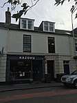 | |||
| 12-16 Greyfriars Garden And 150 North Street | 56°20′30″N 2°47′55″W | Category B | 40897 | 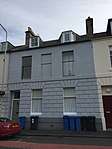 | |||
| 1-14 Hope Street | 56°20′28″N 2°48′04″W | Category B | 40902 | | |||
| 1-13 Abbotsford Crescent, Abbotsford House And Macintosh Hall | 56°20′31″N 2°48′06″W | Category B | 40904 | | |||
| 1-6 Alexandra Place, (Old Station Hotel) | 56°20′24″N 2°48′04″W | Category B | 40908 | | |||
| Kinburn House, Doubledykes Road | 56°20′23″N 2°48′19″W | Category B | 40917 | | |||
| Lade Braes, Law Mill Over Kinness Burn | 56°19′56″N 2°49′25″W | Category C(S) | 40931 | | |||
| Bogward Dovecot | 56°19′48″N 2°49′24″W | Category A | 40932 | 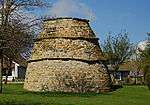 | |||
| Argyle Street, K6 Telephone Kiosk | 56°20′19″N 2°48′05″W | Category B | 40933 | 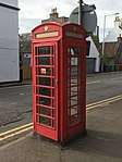 | |||
| 104 And 106 Hepburn Gardens, Abbot's Inch And Fulwood House (Formerly Priory Acres), Including Boundary Walls And Gatepiers | 56°19′59″N 2°49′06″W | Category B | 40936 | | |||
| 1-8 Playfair Terrace | 56°20′32″N 2°48′02″W | Category B | 40806 | | |||
| 5-7 Pilmour Place | 56°20′32″N 2°48′06″W | Category B | 40808 | | |||
| 1-8 St. Gregory's East Scores And Gregory's Lane | 56°20′27″N 2°47′18″W | Category C(S) | 40812 | | |||
| The Swallowgate, The Scores | 56°20′33″N 2°47′43″W | Category B | 40822 | | |||
| 5 & 5A Gillespie Terrace, The Scores | 56°20′34″N 2°48′01″W | Category C(S) | 40828 | | |||
| 4-21 Queen's Gardens | 56°20′19″N 2°47′43″W | Category C(S) | 40842 | | |||
| St. Regulus Hall, Queen's Gardens And Queen's Terrace | 56°20′14″N 2°47′43″W | Category C(S) | 40843 | | |||
| 16, 18 South Castle Street | 56°20′26″N 2°47′28″W | Category C(S) | 40849 | | |||
| 29 North Castle Street | 56°20′27″N 2°47′26″W | Category C(S) | 40852 | | |||
| 35 - 39 North Castle Street | 56°20′28″N 2°47′25″W | Category B | 40855 | | |||
| 45-49 North Castle Street | 56°20′29″N 2°47′24″W | Category C(S) | 40858 | | |||
| 5 College Street | 56°20′26″N 2°47′42″W | Category C(S) | 40866 | | |||
| 15 College Street | 56°20′27″N 2°47′42″W | Category B | 40869 | | |||
| 10 College Street | 56°20′27″N 2°47′43″W | Category C(S) | 40873 | | |||
| 25, 27 Church Street | 56°20′23″N 2°47′41″W | Category C(S) | 40880 | | |||
| 134-138 South Street | 56°20′19″N 2°47′57″W | Category C(S) | 40710 | | |||
| 142-148 South Street, Including Garden Walls | 56°20′19″N 2°47′58″W | Category B | 40713 | | |||
| 150-154 South Street, Including Garden Walls Of Lang Rig | 56°20′19″N 2°47′58″W | Category C(S) | 40716 | | |||
| 160, 162 South Street | 56°20′19″N 2°48′00″W | Category C(S) | 40719 | | |||
| 96, 98 Market Street | 56°20′25″N 2°47′47″W | Category C(S) | 40748 | | |||
| Bee-Boles, 93 Market Street | 56°20′26″N 2°47′46″W | Category B | 40749 | | |||
| Former West Infant School, Market Street | 56°20′27″N 2°47′59″W | Category C(S) | 40750 | | |||
| 6 St. Mary's Place | 56°20′24″N 2°48′01″W | Category C(S) | 40754 | | |||
| Dean's Court, North Street (Including Walls Of Courtyard And Of Garden To North Street.) | 56°20′25″N 2°47′22″W | Category A | 40756 | | |||
| 37 North Street | 56°20′27″N 2°47′28″W | Category C(S) | 40764 | | |||
| St Salvator's ChapelSt. Salvator's Chapel, Tower And Hebdomadar's Building | 56°20′29″N 2°47′41″W | Category A | 40771 | 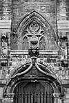 | |||
| United College Of St Salvator And St Leonard Including Boundary Walls To Butts Wynd And The Scores | 56°20′29″N 2°47′39″W | Category B | 40772 | | |||
| 28-32 North Street | 56°20′26″N 2°47′28″W | Category B | 40780 | | |||
| 34 North Street | 56°20′26″N 2°47′29″W | Category C(S) | 40781 | | |||
| 70 North Street | 56°20′27″N 2°47′37″W | Category B | 40793 | | |||
| 112-118 North Street | 56°20′29″N 2°47′48″W | Category C(S) | 40798 | | |||
| 17 South Street | 56°20′23″N 2°47′26″W | Category B | 40606 | | |||
| 23, 25 South Street | 56°20′23″N 2°47′28″W | Category B | 40608 | | |||
| 67, 69 South Street | 56°20′23″N 2°47′37″W | Category A | 40623 | | |||
| 109-121 South Street Albert Buildings | 56°20′22″N 2°47′46″W | Category B | 40634 | | |||
| 141 South Street Within Burgher Close | 56°20′22″N 2°47′52″W | Category B | 40640 | | |||
| 175 South Street | 56°20′21″N 2°47′57″W | Category C(S) | 40650 | | |||
| 197, 199 South Street | 56°20′20″N 2°47′59″W | Category C(S) | 40655 | | |||
| Warehouse Within Court At Rear Of 203 South Street | 56°20′21″N 2°48′01″W | Category C(S) | 40657 | | |||
| St Leonard's College, Pend Arch | 56°20′21″N 2°47′23″W | Category B | 40667 | | |||
| 58 South Street, With Garden Wall Of Lang Rig | 56°20′22″N 2°47′35″W | Category B | 40683 | | |||
| University Library 1889-90 Extension | 56°20′19″N 2°47′38″W | Category B | 40688 | | |||
| 68-78 South Street | 56°20′21″N 2°47′43″W | Category B | 40694 | | |||
| 96-100 South Street | 56°20′21″N 2°47′46″W | Category C(S) | 40696 | | |||
| 102-104 South Street | 56°20′20″N 2°47′46″W | Category B | 40697 | | |||
| 16, 17, 18 And 18A Pilmour Links Including Boundary Walls | 56°20′33″N 2°48′16″W | Category C(S) | 45917 | | |||
| 12 The Links, St Rule Club With Boundary Wall And Railings | 56°20′34″N 2°48′12″W | Category C(S) | 46274 | | |||
| 2-4 (Even Nos) Golf Place, Auchterlonie's, And 1 Pilmour Links, Kinloch Cottage | 56°20′32″N 2°48′09″W | Category C(S) | 46276 | | |||
| 12-24 (Even Nos) Golf Place | 56°20′34″N 2°48′09″W | Category C(S) | 46277 | | |||
| 6, 7 And 8 Balfour Place Including Boundary Walls | 56°20′13″N 2°47′01″W | Category C(S) | 50155 | | |||
| Kennedy Gardens, Rathelpie (Former Free Church Manse) Including Boundary Walls | 56°20′21″N 2°48′24″W | Category C(S) | 50925 | | |||
| Kilrymont Road, Madras College, Kilrymont Road Building Including Sports Hall And Boundary Walls And Railings | 56°19′47″N 2°47′28″W | Category B | 50926 | | |||
| 14-32 Bell Street | 56°20′23″N 2°47′56″W | Category C(S) | 40900 | | |||
| Hepburn Gardens And Donaldson Gardens, St Leonard's Parish Church (Church Of Scotland) Including Church Hall, Boundary Walls And Gatepiers | 56°20′13″N 2°48′35″W | Category B | 40925 | 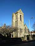 | |||
| 4-7 Ellice Place | 56°20′31″N 2°47′58″W | Category C(S) | 40805 | | |||
| 1-10 Gibson Place | 56°20′34″N 2°48′20″W | Category C(S) | 40809 | | |||
| University House, (Principal's Residence), The Scores | 56°20′34″N 2°47′40″W | Category B | 40815 | | |||
| Bandstand, The Scores | 56°20′37″N 2°48′04″W | Category B | 40818 | | |||
| St. Nicholas House, Abbey Walk | 56°20′14″N 2°47′26″W | Category B | 40838 | | |||
| Burgh Offices, Queen's Gardens (Former Commercial Bank) | 56°20′20″N 2°47′43″W | Category B | 40840 | | |||
| 41 North Castle Street | 56°20′28″N 2°47′25″W | Category B | 40856 | | |||
| All Saint's Episcopal Church And Ancillary Buildings, North Castle Street | 56°20′28″N 2°47′27″W | Category A | 40861 | 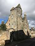 | |||
| 11 Union Street | 56°20′27″N 2°47′37″W | Category C(S) | 40865 | | |||
| 6 College Street | 56°20′27″N 2°47′43″W | Category C(S) | 40871 | | |||
| Madras College Schoolhouse West | 56°20′19″N 2°47′55″W | Category B | 40705 | 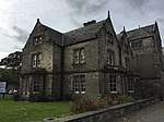 | |||
| South Street 2-5 And 7 Rose Lane | 56°20′17″N 2°47′55″W | Category C(S) | 40708 | | |||
| 1-4 Louden's Close, South Street, Including Garden Walls Of Lang Rig | 56°20′18″N 2°47′58″W | Category B | 40714 | | |||
| 23 Market Street | 56°20′25″N 2°47′33″W | Category B | 40728 | | |||
| 25 Market Street | 56°20′25″N 2°47′34″W | Category C(S) | 40729 | | |||
| 49-51 Market Street | 56°20′26″N 2°47′38″W | Category B | 40730 | | |||
| 80 Market Street And 2-4 Church Street | 56°20′25″N 2°47′43″W | Category C(S) | 40745 | | |||
| 3 St. Mary's Place | 56°20′24″N 2°47′58″W | Category B | 40755 | | |||
| 1 North Street | 56°20′26″N 2°47′20″W | Category B | 40757 | | |||
| St. Salvator's Hall North Street And The Scores, Including Boundary Wall To The Scores With Remains Of Swallow Port At East | 56°20′31″N 2°47′32″W | Category B | 40766 | | |||
| 65 North Street | 56°20′28″N 2°47′34″W | Category C(S) | 40769 | | |||
| 79-83 North Street | 56°20′29″N 2°47′43″W | Category B | 40774 | | |||
| 38-44 North Street | 56°20′26″N 2°47′30″W | Category C(S) | 40783 | | |||
| 82 North Street And 19 College Street | 56°20′28″N 2°47′42″W | Category B | 40796 | | |||
| 84, 86 North Street And 20-24 College Street | 56°20′28″N 2°47′43″W | Category B | 40797 | | |||
| Church Of The Blessed Mary Of The Rock (St Mary's Kirkheugh) | 56°20′23″N 2°47′06″W | Category B | 40595 | | |||
| St Andrews Castle | 56°20′32″N 2°47′24″W | Category A | 40599 | 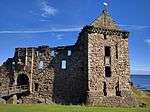 | |||
| 7, (9) South Street | 56°20′24″N 2°47′24″W | Category B | 40603 | | |||
| 133-139 South Street | 56°20′21″N 2°47′50″W | Category B | 40639 | | |||
| 153, 155 South Street | 56°20′21″N 2°47′52″W | Category C(S) | 40644 | | |||
| 161-3 South Street And 45 Bell Street | 56°20′21″N 2°47′54″W | Category C(S) | 40647 | | |||
| St Leonard's Chapel | 56°20′21″N 2°47′23″W | Category A | 40666 | | |||
| St. Leonard's, Oliphant Memorial Dial | 56°20′19″N 2°47′14″W | Category B | 40671 | | |||
| Town Hall, South Street And Queen's Gardens | 56°20′21″N 2°47′43″W | Category B | 40695 | | |||
| 116 South Street | 56°20′20″N 2°47′48″W | Category C(S) | 40701 | | |||
| St Rule's Church | 56°20′23″N 2°47′11″W | Category A | 40588 | 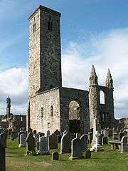 | |||
| Well-House, Eastern Cemetery | 56°20′20″N 2°47′11″W | Category B | 40591 | | |||
| 3 Windmill Road, Cryanreuch Including Gate Piers And Boundary Walls | 56°20′30″N 2°48′18″W | Category C(S) | 49603 | | |||
| The Links, St Andrews Woollen Mill | 56°20′34″N 2°48′11″W | Category C(S) | 45570 | | |||
| 8, 9, 10, 11 Logie's Lane | 56°20′24″N 2°47′47″W | Category C(S) | 40889 | | |||
| 1 Greyfriars Garden And Chestney House, 149 Market Street | 56°20′26″N 2°47′55″W | Category B | 40894 | 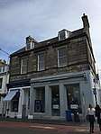 | |||
| 5-33 Bell Street | 56°20′23″N 2°47′54″W | Category C(S) | 40899 | | |||
| 32, 34 Bell Street And 165, 167 South Street | 56°20′21″N 2°47′55″W | Category B | 40901 | | |||
| 29 Kinnessburn Road | 56°20′11″N 2°47′57″W | Category C(S) | 40916 | | |||
| 102 Hepburn Gardens, West House Including Boundary Walls And Gatepiers | 56°19′59″N 2°49′04″W | Category B | 40928 | | |||
| North Street, K6 Telephone Kiosk | 56°20′28″N 2°47′33″W | Category B | 40934 | | |||
| 90 Market Street | 56°20′25″N 2°47′45″W | Category B | 40938 | | |||
| St. James Rc Church, The Scores | 56°20′35″N 2°47′51″W | Category B | 40816 | 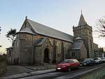 | |||
| The Scores, Castlecliffe House, Garden Wall And Gatepiers | 56°20′33″N 2°47′29″W | Category B | 40819 | | |||
| 10 Abbey Street | 56°20′21″N 2°47′29″W | Category C(S) | 40832 | | |||
| 16, 18 Greenside Place | 56°20′15″N 2°47′30″W | Category C(S) | 40834 | | |||
| Abbey Cottage, Abbey Walk | 56°20′13″N 2°47′06″W | Category B | 40839 | | |||
| Castlegate, 51 North Castle Street | 56°20′29″N 2°47′24″W | Category C(S) | 40859 | | |||
| 9 Union Street | 56°20′27″N 2°47′38″W | Category B | 40864 | | |||
| 17 College Street | 56°20′28″N 2°47′42″W | Category C(S) | 40870 | | |||
| 7, 9 Church Street | 56°20′24″N 2°47′42″W | Category C(S) | 40874 | | |||
| 15, 17 Church Street | 56°20′24″N 2°47′42″W | Category C(S) | 40877 | | |||
| 21, 23 Church Street | 56°20′23″N 2°47′41″W | Category C(S) | 40879 | | |||
| 29 Church Street | 56°20′23″N 2°47′42″W | Category C(S) | 40881 | | |||
| Blackfriars' Chapel | 56°20′20″N 2°47′53″W | Category B | 40706 | | |||
| Market Place, Melville Memorial Fountain | 56°20′25″N 2°47′44″W | Category B | 40724 | | |||
| 8 Market Street | 56°20′25″N 2°47′30″W | Category B | 40736 | | |||
| 10-14 Market Street | 56°20′25″N 2°47′31″W | Category C(S) | 40737 | | |||
| 50-54 Market Street | 56°20′25″N 2°47′38″W | Category C(S) | 40738 | | |||
| 86-88 Market Street | 56°20′25″N 2°47′45″W | Category B | 40746 | | |||
| Star Hotel, 92, 94 Market Street | 56°20′25″N 2°47′46″W | Category C(S) | 40747 | | |||
| 15, 17 North Street | 56°20′26″N 2°47′23″W | Category C(S) | 40758 | | |||
| 71 North Street | 56°20′29″N 2°47′38″W | Category A | 40770 | | |||
| Fine Arts Buildings, 89, 91, 93 North Street | 56°20′29″N 2°47′46″W | Category B | 40775 | | |||
| 12, 16 North Street, | 56°20′26″N 2°47′25″W | Category B | 40776 | | |||
| 72 North Street, Including Garden Wall To Union Street | 56°20′27″N 2°47′38″W | Category B | 40794 | | |||
| Bellrock Tavern, (Mrs Sekaleka) Shorehead | 56°20′23″N 2°47′03″W | Category B | 40597 | | |||
| 11, 13 South Street | 56°20′24″N 2°47′25″W | Category B | 40604 | | |||
| 33-37 South Street | 56°20′23″N 2°47′30″W | Category C(S) | 40612 | | |||
| 43 South Street | 56°20′23″N 2°47′32″W | Category B | 40614 | | |||
| 55, 57 South Street | 56°20′23″N 2°47′35″W | Category C(S) | 40619 | | |||
| 65 South Street | 56°20′23″N 2°47′36″W | Category B | 40622 | | |||
| 101-103 South Street | 56°20′23″N 2°47′41″W | Category C(S) | 40631 | | |||
| 189, 191 South Street | 56°20′21″N 2°47′58″W | Category C(S) | 40653 | | |||
| 201 South Street | 56°20′20″N 2°48′00″W | Category C(S) | 40656 | | |||
| 209 South Street | 56°20′20″N 2°48′02″W | Category C(S) | 40659 | | |||
| 24 South Street | 56°20′22″N 2°47′27″W | Category B | 40673 | | |||
| 40 (A-H), 42 South Street, South Court | 56°20′21″N 2°47′31″W | Category A | 40676 | | |||
| 56 South Street, With Garden Walls Of Lang Rig | 56°20′22″N 2°47′35″W | Category B | 40682 | | |||
| St Andrews Priory | 56°20′22″N 2°47′15″W | Category A | 40586 | | |||
| St Mary's Place, Inchcape House | 56°20′24″N 2°47′59″W | Category B | 46259 | | |||
| 7 Pilmour Links With Boundary Walls, Gate And Railings | 56°20′33″N 2°48′12″W | Category C(S) | 46272 | | |||
| 4 And 5 Balfour Place | 56°20′14″N 2°47′02″W | Category C(S) | 50156 | | |||
| 25 St Mary's Street Including Garden And Boundary Walls | 56°20′06″N 2°47′01″W | Category C(S) | 50927 | | |||
| 117 North Street, The New Picture House | 56°20′30″N 2°47′52″W | Category B | 51110 | 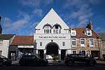 | |||
| 10 Church Street Including 2 Church Square Extension | 56°20′24″N 2°47′44″W | Category C(S) | 40883 | | |||
| Old House, Now Public Convenience, City Road | 56°20′20″N 2°48′03″W | Category C(S) | 40905 | | |||
| Gibson House, Argyle Street | 56°20′21″N 2°48′06″W | Category B | 40909 | 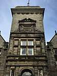 | |||
| 2 Hepburn Gardens Including Boundary Walls | 56°20′17″N 2°48′22″W | Category C(S) | 40922 | | |||
| 1-4 Pilmour Place | 56°20′32″N 2°48′04″W | Category B | 40807 | | |||
| Edgecliffe, The Scores | 56°20′34″N 2°47′37″W | Category B | 40814 | | |||
| Golfers' Bridge Across The Swilken Burn | 56°20′35″N 2°48′25″W | Category B | 40821 | | |||
| 3 Gillespie Terrace, The Scores | 56°20′34″N 2°48′02″W | Category C(S) | 40826 | | |||
| 4 Gillespie Terrace, The Scores | 56°20′34″N 2°48′01″W | Category C(S) | 40827 | | |||
| 3 Balfour Place | 56°20′13″N 2°47′02″W | Category C(S) | 40830 | | |||
| 13-15 South Castle Street | 56°20′25″N 2°47′27″W | Category B | 40847 | | |||
| Castlemount, North Castle Street | 56°20′30″N 2°47′26″W | Category C(S) | 40860 | | |||
| 7, 9 College Street | 56°20′27″N 2°47′42″W | Category C(S) | 40867 | | |||
| 132 South Street And 1 Rose Lane | 56°20′20″N 2°47′56″W | Category C(S) | 40709 | | |||
| Alison's Close At 140 South Street | 56°20′19″N 2°47′57″W | Category C(S) | 40712 | | |||
| Ivy Cottage, Louden's Close, Including Garden Walls Of Lang Rig | 56°20′18″N 2°47′57″W | Category C(S) | 40715 | | |||
| 53 Market Street And Shop, 1 Union Street | 56°20′26″N 2°47′38″W | Category B | 40731 | | |||
| 70-72 Market Street | 56°20′24″N 2°47′41″W | Category C(S) | 40743 | | |||
| St. Salvator's Hall Sundial, North Street And The Scores | 56°20′31″N 2°47′33″W | Category B | 40767 | | |||
| College Gate, North Street | 56°20′28″N 2°47′36″W | Category B | 40768 | | |||
| 62, 64 North Street | 56°20′27″N 2°47′35″W | Category C(S) | 40790 | | |||
| 66 North Street | 56°20′27″N 2°47′36″W | Category C(S) | 40791 | | |||
| Martyrs' Church And Halls, North Street | 56°20′28″N 2°47′39″W | Category B | 40795 | | |||
| 120 North Street | 56°20′29″N 2°47′49″W | Category B | 40799 | | |||
| New Inns, Entrance Archway (To The Hospice, Pends Road) | 56°20′20″N 2°47′15″W | Category B | 40592 | | |||
| St Andrews Harbour | 56°20′22″N 2°47′01″W | Category A | 40596 | 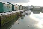 | |||
| 27 South Street | 56°20′23″N 2°47′29″W | Category C(S) | 40609 | | |||
| 71 South Street | 56°20′23″N 2°47′37″W | Category A | 40624 | 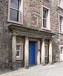 | |||
| 87-89 South Street | 56°20′23″N 2°47′39″W | Category B | 40627 | | |||
| 123, 125 South Street | 56°20′23″N 2°47′48″W | Category C(S) | 40635 | | |||
| 131 South Street | 56°20′22″N 2°47′50″W | Category C(S) | 40638 | | |||
| 193, 195 South Street | 56°20′21″N 2°47′59″W | Category C(S) | 40654 | | |||
| 211, 213 South Street And 3, 5, 7 City Road | 56°20′20″N 2°48′03″W | Category C(S) | 40660 | | |||
| St. Leonard's, Grant Memorial Dial | 56°20′19″N 2°47′23″W | Category B | 40672 | | |||
| 46 South Street, With Garden Walls Of Lang Rig | 56°20′22″N 2°47′32″W | Category B | 40678 | | |||
| 62 South Street | 56°20′22″N 2°47′37″W | Category B | 40685 | | |||
| 112, 114 South Street | 56°20′20″N 2°47′48″W | Category C(S) | 40700 | | |||
| Pilmour Links, Rusack's Hotel With Boundary Walls And Piers | 56°20′34″N 2°48′15″W | Category B | 45916 | | |||
| Hepburn Gardens, Hepburn Hall Including Ancillary Structure, Garden, Boundary Walls And Gatepiers | 56°20′07″N 2°48′40″W | Category C(S) | 46552 | | |||
| 18, 18A And 20 Hepburn Gardens (Toll Park) Including Boundary Walls | 56°20′14″N 2°48′26″W | Category C(S) | 50920 | | |||
| 112 South Street (Last House In Close), Including Garden Walls | 56°20′19″N 2°47′48″W | Category B | 44610 | | |||
| 2 Logie's Lane | 56°20′24″N 2°47′46″W | Category C(S) | 40887 | | |||
| 3, 4, 5 Logie's Lane | 56°20′24″N 2°47′46″W | Category C(S) | 40888 | | |||
| 9 Crail's Lane | 56°20′24″N 2°47′40″W | Category C(S) | 40890 | | |||
| Kinburn Hotel, Doubledykes Road | 56°20′21″N 2°48′15″W | Category C(S) | 40918 | | |||
| 96 Hepburn Gardens, Wayside And Easterwayside Including Boundary Walls And Gatepiers | 56°20′04″N 2°48′51″W | Category B | 40926 | | |||
| Lade Braes, Plash Mill Cottage (Formerly New Mill & New Park School Cottage) | 56°20′01″N 2°48′52″W | Category C(S) | 40927 | | |||
| Lade Braes, Law Mill And Lawmill Cottage[1] | 56°19′55″N 2°49′22″W[2]) | Category C(S) | 40930 | | |||
| Hepburn Gardens And Buchanan Gardens, K6 Telephone Kiosk | 56°20′08″N 2°48′45″W | Category B | 40935 | | |||
| 140-146 North Street | 56°20′29″N 2°47′54″W | Category B | 40802 | | |||
| 1, 2 Gregory Place | 56°20′27″N 2°47′19″W | Category C(S) | 40813 | | |||
| Martyrs' Monument, The Scores | 56°20′36″N 2°48′03″W | Category B | 40817 |  | |||
| Royal And Ancient Golf Club House, The Scores, Golf Place | 56°20′37″N 2°48′08″W | Category B | 40820 | 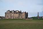 | |||
| 1 Gillespie Terrace, The Scores | 56°20′35″N 2°48′03″W | Category C(S) | 40824 | | |||
| 6 Gillespie Terrace, The Scores | 56°20′34″N 2°48′00″W | Category B | 40829 | | |||
| Abbey Walk, Abbey Park House Including Boundary Walls And Gatepiers | 56°20′10″N 2°47′19″W | Category B | 40837 | | |||
| 33 North Castle Street Frontage Only Excluding Building In Court | 56°20′27″N 2°47′26″W | Category C(S) | 40854 | | |||
| 43 North Castle Street | 56°20′28″N 2°47′25″W | Category B | 40857 | | |||
| 19 Church Street | 56°20′23″N 2°47′42″W | Category C(S) | 40878 | | |||
| 136 South Street (Within Close) | 56°20′19″N 2°47′57″W | Category B | 40711 | | |||
| 156 South Street, Including Garden Walls Of Lang Rig | 56°20′19″N 2°47′59″W | Category C(S) | 40717 | | |||
| 158 South Street, With Garden Walls Of Lang Rig, Including Those Now Belonging To Braidland | 56°20′19″N 2°47′59″W | Category C(S) | 40718 | | |||
| 21 Market Street | 56°20′25″N 2°47′33″W | Category B | 40727 | | |||
| Royal Bank Of Scotland, 83 Market Street | 56°20′27″N 2°47′43″W | Category C(S) | 40734 | | |||
| 66 Market Street | 56°20′25″N 2°47′40″W | Category C(S) | 40741 | | |||
| 68 Market Street | 56°20′25″N 2°47′40″W | Category B | 40742 | | |||
| 5 St. Mary's Place | 56°20′24″N 2°48′00″W | Category C(S) | 40753 | | |||
| 27 North Street | 56°20′27″N 2°47′25″W | Category C(S) | 40762 | | |||
| 24, 26 North Street And 20 South Castle Street | 56°20′26″N 2°47′28″W | Category C(S) | 40779 | | |||
| 46-50 North Street | 56°20′27″N 2°47′32″W | Category C(S) | 40784 | | |||
| Abbey (Shore) Mill Now Fishermen's Store, The Shore | 56°20′19″N 2°47′05″W | Category B | 40594 | | |||
| 3 South Street | 56°20′24″N 2°47′23″W | Category A | 40601 | | |||
| 5 South Street | 56°20′24″N 2°47′23″W | Category B | 40602 | | |||
| 15 South Street | 56°20′24″N 2°47′26″W | Category B | 40605 | | |||
| 31 South Street | 56°20′24″N 2°47′30″W | Category C(S) | 40611 | | |||
| 39, 41 South Street | 56°20′23″N 2°47′31″W | Category B | 40613 | | |||
| 53 South Street | 56°20′23″N 2°47′34″W | Category C(S) | 40618 | | |||
| 129 South Street. (Exclude Telephone Booths At Ground Floor) | 56°20′22″N 2°47′49″W | Category C(S) | 40637 | | |||
| 169, 171 South Street | 56°20′21″N 2°47′55″W | Category C(S) | 40648 | | |||
| 205, 207 South Street | 56°20′20″N 2°48′01″W | Category B | 40658 | | |||
| 44 South Street With Garden Walls Of Lang Rig, Including The Parts Now Belonging To Greenside Cottage | 56°20′22″N 2°47′32″W | Category B | 40677 | | |||
| 54 South Street, With Garden Walls Of Lang Rig | 56°20′22″N 2°47′34″W | Category B | 40681 | | |||
| University Library Original Building | 56°20′21″N 2°47′38″W | Category A | 40687 | | |||
| Dovecot, St. Mary's College | 56°20′16″N 2°47′40″W | Category B | 40691 | | |||
| Bell-Pettigrew Building | 56°20′16″N 2°47′38″W | Category C(S) | 40693 | | |||
| Precinct Wall | 56°20′21″N 2°47′14″W | Category A | 40589 | | |||
| 7 And 8 The Links, Tom Morris House And Golf Shop | 56°20′34″N 2°48′11″W | Category C(S) | 46273 | | |||
| 13 The Links, Links House, St Andrews Golf Club With Boundary Wall And Railings | 56°20′34″N 2°48′12″W | Category C(S) | 48319 | | |||
| 100 Hepburn Gardens, Century House (Formerly Newmill) | 56°19′59″N 2°48′58″W | Category C(S) | 50923 | | |||
| Kennedy Gardens, Liscombe And Holly Lodge Including Boundary Walls | 56°20′18″N 2°48′33″W | Category C(S) | 50924 | | |||
| County Library, Church Square, Including Later East Wing | 56°20′24″N 2°47′45″W | Category B | 40885 | | |||
| 3 Bell Street, 142/144 Market Street | 56°20′25″N 2°47′55″W | Category B | 40898 | | |||
| 1-15 Howard Place | 56°20′28″N 2°48′06″W | Category B | 40903 | | |||
| Kennedy Gardens, University Hall, Wardlaw Wing (Formerly Westerlee) Including Boundary Walls And Gatepiers | 56°20′19″N 2°48′36″W | Category B | 40920 | 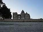 | |||
| The Whaum, 22 The Scores | 56°20′34″N 2°47′52″W | Category C(S) | 40823 | | |||
| 2 Gillespie Terrace, The Scores | 56°20′34″N 2°48′03″W | Category C(S) | 40825 | | |||
| St. Andrews Episcopal Church, Queen's Terrace | 56°20′14″N 2°47′46″W | Category B | 40845 | | |||
| 25 North Castle Street | 56°20′27″N 2°47′26″W | Category C(S) | 40850 | | |||
| 27 North Castle Street | 56°20′27″N 2°47′26″W | Category C(S) | 40851 | | |||
| 11, 13 College Street | 56°20′27″N 2°47′42″W | Category A | 40868 | | |||
| 3, 5 Church Street | 56°20′25″N 2°47′42″W | Category C(S) | 40875 | | |||
| Southgait Hall (Originally Royal Hotel). South Street | 56°20′20″N 2°47′49″W | Category B | 40702 | | |||
| 166, 168 South Street, Including Garden Walls Of Lang Rig | 56°20′18″N 2°48′01″W | Category B | 40720 | | |||
| West Port. (Southgait Port) | 56°20′19″N 2°48′03″W | Category A | 40723 | 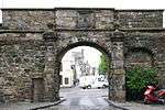 | |||
| 3, 5 Market Street And 10 South Castle Street | 56°20′25″N 2°47′29″W | Category B | 40725 | | |||
| 19 Market Street | 56°20′25″N 2°47′32″W | Category C(S) | 40726 | | |||
| 23 North Street | 56°20′27″N 2°47′24″W | Category B | 40760 | | |||
| 25 North Street | 56°20′26″N 2°47′25″W | Category C(S) | 40761 | | |||
| 29 North Street | 56°20′27″N 2°47′26″W | Category C(S) | 40763 | | |||
| 77 North Street Old Students' Union | 56°20′29″N 2°47′42″W | Category B | 40773 | | |||
| 54 North Street | 56°20′27″N 2°47′34″W | Category C(S) | 40787 | | |||
| 136, 138 North Street | 56°20′29″N 2°47′52″W | Category C(S) | 40801 | | |||
| Guest Hall (Within Grounds Of Bishopshall, Pends Road) | 56°12′15″N 2°46′06″W | Category B | 40593 | | |||
| 19 South Street | 56°20′23″N 2°47′27″W | Category B | 40607 | | |||
| 45 South Street | 56°20′23″N 2°47′33″W | Category C(S) | 40615 | | |||
| 47 South Street | 56°20′23″N 2°47′33″W | Category B | 40616 | | |||
| 59, 61 South Street | 56°20′23″N 2°47′35″W | Category B | 40620 | | |||
| 73-81 South Street | 56°20′23″N 2°47′38″W | Category B | 40625 | | |||
| 91 South Street And 1 Crail's Lane | 56°20′23″N 2°47′40″W | Category B | 40628 | | |||
| 105, 107 South Street And 29, 31 Church Street | 56°20′22″N 2°47′42″W | Category C(S) | 40632 | | |||
| 147, 149 South Street | 56°20′21″N 2°47′52″W | Category B | 40643 | | |||
| 157 South Street | 56°20′21″N 2°47′53″W | Category C(S) | 40645 | | |||
| 10 South Street | 56°20′22″N 2°47′25″W | Category B | 40664 | | |||
| St Leonard's College, Including Garden Walls | 56°20′21″N 2°47′24″W | Category B | 40668 | | |||
| 34 South Street | 56°20′22″N 2°47′29″W | Category B | 40674 | | |||
| 46 South Street, Dovecot | 56°20′18″N 2°47′32″W | Category B | 40679 | | |||
| Bute Medical Building | 56°20′17″N 2°47′38″W | Category C(S) | 40692 | | |||
| 108, 110 South Street | 56°20′21″N 2°47′48″W | Category B | 40698 | | |||
| The Scores, Hamilton Hall | 56°20′35″N 2°48′06″W | Category B | 46109 | | |||
| North Street, University Of St Andrews, Younger Hall | 56°20′29″N 2°47′32″W | Category B | 48318 | 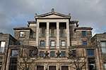 | |||
| Hepburn Gardens, University Playing Field, St Andrews University Rugby Football Club Stand | 56°20′10″N 2°48′53″W | Category C(S) | 50919 | | |||
| 50 And 52 Hepburn Gardens Including Boundary Walls | 56°20′10″N 2°48′36″W | Category C(S) | 50922 | | |||
| 4-6 Church Square | 56°20′24″N 2°47′45″W | Category C(S) | 40884 | | |||
| Boots' Building, 1 Logie's Lane | 56°20′25″N 2°47′46″W | Category B | 40886 | | |||
| 11 Crail's Lane | 56°20′24″N 2°47′40″W | Category C(S) | 40891 | | |||
| Rose Park, City Road | 56°20′25″N 2°48′10″W | Category C(S) | 40906 | | |||
| 22 City Road | 56°20′27″N 2°48′10″W | Category B | 40907 | | |||
| 59 Argyle Street | 56°20′19″N 2°48′15″W | Category C(S) | 40910 | | |||
| 31, 33, 35 And 37 Kinnessburn Road (Former 1-3 Fleming Place) Including Ancillary Structure And Boundary Walls | 56°20′11″N 2°47′58″W | Category C(S) | 40913 | | |||
| Kennedy Gardens, Rathmore (Formerly Rathelpie Villa) Including Little Rathmore, Upper Rathmore, North Flat, South Flat And Boundary Walls | 56°20′20″N 2°48′27″W | Category C(S) | 40919 | | |||
| Kennedy Gardens And Donaldson Gardens, University Hall, Old Wing Including Boundary Walls And Gatepiers | 56°20′17″N 2°48′41″W | Category B | 40921 | | |||
| 3 Ellice Place | 56°20′31″N 2°47′59″W | Category C(S) | 40804 | | |||
| 19 Pilmour Links And Grannie Clark's Wynd With Boundary Walls And Gatepier | 56°20′33″N 2°48′18″W | Category B | 40810 | | |||
| 12 Greenside Place | 56°20′16″N 2°47′29″W | Category C(S) | 40833 | | |||
| 14 South Castle Street | 56°20′26″N 2°47′28″W | Category C(S) | 40848 | | |||
| 31 North Castle Street | 56°20′27″N 2°47′26″W | Category C(S) | 40853 | | |||
| 5 Union Street | 56°20′26″N 2°47′38″W | Category B | 40862 | | |||
| 7 Union Street | 56°20′26″N 2°47′38″W | Category B | 40863 | | |||
| Madras College Main Building | 56°20′16″N 2°47′52″W | Category A | 40703 | | |||
| Britannia Hotel, 170 South Street | 56°20′19″N 2°48′01″W | Category C(S) | 40721 | | |||
| 77, 79 Market Street And 1, 3 College Street | 56°20′26″N 2°47′42″W | Category C(S) | 40732 | | |||
| British Linen Bank, 81 Market Street | 56°20′26″N 2°47′43″W | Category B | 40733 | | |||
| Cross Keys Hotel, Market Street | 56°20′27″N 2°47′45″W | Category C(S) | 40735 | | |||
| 62-64 Market Street | 56°20′25″N 2°47′39″W | Category C(S) | 40740 | | |||
| 19, 21 North Street | 56°20′26″N 2°47′23″W | Category B | 40759 | | |||
| 18, 20 North Street | 56°20′26″N 2°47′26″W | Category B | 40777 | | |||
| 36, 36A North Street | 56°20′26″N 2°47′30″W | Category B | 40782 | | |||
| 52 North Street, Greyfriars' Hotel | 56°20′27″N 2°47′32″W | Category C(S) | 40785 | | |||
| 52A North Street | 56°20′27″N 2°47′33″W | Category C(S) | 40786 | | |||
| 60 North Street | 56°20′27″N 2°47′35″W | Category C(S) | 40789 | | |||
| 122, 124 North Street | 56°20′29″N 2°47′50″W | Category B | 40800 | | |||
| 1 South Street The Roundel, Including Garden Walls | 56°20′24″N 2°47′22″W | Category A | 40600 | | |||
| 63 South Street | 56°20′23″N 2°47′35″W | Category B | 40621 | | |||
| 83-85 South Street | 56°20′23″N 2°47′39″W | Category B | 40626 | | |||
| Holy Trinity Church (Town Kirk), South Street | 56°20′23″N 2°47′44″W | Category A | 40633 | 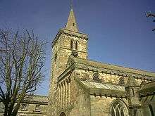 | |||
| 159 South Street | 56°20′21″N 2°47′54″W | Category C(S) | 40646 | | |||
| 173 South Street | 56°20′21″N 2°47′56″W | Category C(S) | 40649 | | |||
| 177-179 South Street | 56°20′21″N 2°47′57″W | Category C(S) | 40651 | | |||
| 181-187 South Street | 56°20′21″N 2°47′58″W | Category C(S) | 40652 | | |||
| 14 South Street Including Garden Walls | 56°20′23″N 2°47′26″W | Category B | 40665 | | |||
| St Leonard's School, St. Leonard's Lane Including Garden Walls | 56°20′21″N 2°47′27″W | Category C(S) | 40669 | | |||
| St Leonard's, Oliphant Memorial Gates | 56°20′18″N 2°47′19″W | Category B | 40670 | | |||
| 36 And 38A-E (Formerly 36-40 South Street, "The Great Eastern') | 56°20′22″N 2°47′30″W | Category B | 40675 | | |||
| 52 South Street, With Garden Walls Of Lang Rig, Including Those Now Belonging To Abbey Close And Red Roofs | 56°20′22″N 2°47′33″W | Category B | 40680 | | |||
| 60 South Street, With Garden Walls Of Lang Rig | 56°20′22″N 2°47′35″W | Category B | 40684 | | |||
| St. Mary's College, West Range, Principal's House And Precinct, Including West Boundary Wall | 56°20′21″N 2°47′41″W | Category A | 40686 | 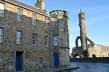 | |||
| University Library 1908 Extension | 56°20′19″N 2°47′37″W | Category B | 40689 | | |||
| Sundial, St. Mary's College | 56°20′19″N 2°47′39″W | Category B | 40690 | | |||
| St Andrews Cathedral | 56°20′24″N 2°47′15″W | Category A | 40585 | 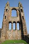 | |||
| 3 Pilmour Links | 56°20′32″N 2°48′10″W | Category C(S) | 46270 | | |||
| 6 Pilmour Links With Boundary Walls, Gate And Railings | 56°20′33″N 2°48′11″W | Category C(S) | 46271 | | |||
| Kinnessburn Road And Langlands Road, Boy's Brigade Hall Including Gates And Boundary Railings | 56°20′09″N 2°47′34″W | Category B | 49363 | | |||
| 6-8 Church Street | 56°20′24″N 2°47′43″W | Category C(S) | 40882 | | |||
| 13 Crail's Lane | 56°20′24″N 2°47′40″W | Category C(S) | 40892 | | |||
| 16 Crail's Lane | 56°20′24″N 2°47′41″W | Category C(S) | 40893 | | |||
| 11 Greyfriars Garden | 56°20′28″N 2°47′55″W | Category B | 40896 | | |||
| 34 Argyle Street | 56°20′18″N 2°48′11″W | Category C(S) | 40911 | | |||
| 54 Argyle Street, End Rigg | 56°20′18″N 2°48′14″W | Category C(S) | 40912 | | |||
| 4 Hepburn Gardens, Rathelpie Cottage | 56°20′16″N 2°48′23″W | Category C(S) | 40923 | | |||
| St Andrews War Memorial, North Street | 56°20′26″N 2°47′19″W | Category B | 40937 | 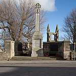 | |||
| 48 South Street | 56°20′22″N 2°47′33″W | Category B | 40939 | | |||
| 1, 2 Ellice Place | 56°20′31″N 2°48′00″W | Category C(S) | 40803 | | |||
| 18 The Links, The Swilken | 56°20′34″N 2°48′21″W | Category B | 40811 | | |||
| Balfour House | 56°20′12″N 2°47′03″W | Category C(S) | 40831 | | |||
| 22 Greenside Place | 56°20′15″N 2°47′31″W | Category C(S) | 40835 | | |||
| Dauphin Hill House, Abbey Walk And 4 Greenside Place | 56°20′17″N 2°47′28″W | Category B | 40836 | | |||
| 3 Queen's Gardens | 56°20′19″N 2°47′43″W | Category B | 40841 | | |||
| Gate To South Part University Botanic Gardens, Queen's Terrace | 56°20′14″N 2°47′36″W | Category C(S) | 40844 | | |||
| 11 South Castle Street (Joan's House) | 56°20′25″N 2°47′27″W | Category B | 40846 | | |||
| 8 College Street | 56°20′27″N 2°47′43″W | Category C(S) | 40872 | | |||
| 11, 13 Church Street | 56°20′24″N 2°47′42″W | Category C(S) | 40876 | | |||
| Madras College Schoolhouse East | 56°20′20″N 2°47′51″W | Category B | 40704 | 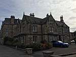 | |||
| Baptist Church, South Street | 56°20′19″N 2°47′55″W | Category C(S) | 40707 | | |||
| 172 South Street | 56°20′19″N 2°48′02″W | Category B | 40722 | | |||
| 56-60 Market Street | 56°20′25″N 2°47′39″W | Category C(S) | 40739 | | |||
| 74-76 Market Street And 1 Church Street | 56°20′25″N 2°47′42″W | Category C(S) | 40744 | | |||
| 1-4 Lockhart Place, Market Street | 56°20′25″N 2°48′03″W | Category B | 40751 | | |||
| Hope Park Church, Market Street | 56°20′26″N 2°48′06″W | Category B | 40752 | 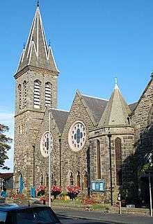 | |||
| All Saints Rectory, North Street | 56°20′27″N 2°47′29″W | Category B | 40765 | .jpg) | |||
| Old Castle Tavern, 22 North Street And 23 South Castle Street | 56°20′26″N 2°47′26″W | Category C(S) | 40778 | | |||
| 56, 58 North Street, Reden Hotel | 56°20′27″N 2°47′34″W | Category C(S) | 40788 | | |||
| 68 North Street | 56°20′27″N 2°47′37″W | Category C(S) | 40792 | | |||
| Kirkheugh Cottage, Shorehead | 56°20′22″N 2°47′05″W | Category B | 40598 | | |||
| 29 South Street | 56°20′23″N 2°47′29″W | Category C(S) | 40610 | | |||
| 49, (51) South Street | 56°20′23″N 2°47′34″W | Category B | 40617 | | |||
| 95 South Street | 56°20′23″N 2°47′40″W | Category C(S) | 40629 | | |||
| 97-99 South Street | 56°20′23″N 2°47′41″W | Category C(S) | 40630 | | |||
| 127 South Street, Post Office | 56°20′22″N 2°47′49″W | Category C(S) | 40636 | | |||
| 141, 143 South Street | 56°20′21″N 2°47′51″W | Category B | 40641 | | |||
| 145 South Street | 56°20′21″N 2°47′52″W | Category C(S) | 40642 | | |||
| 2 South Street, "Priorsgate' Including Garden Walls And Outbuilding | 56°20′23″N 2°47′22″W | Category B | 40661 | | |||
| 4 South Street, Queen Mary's House Including Garden Walls And Grotto | 56°20′22″N 2°47′24″W | Category A | 40662 | | |||
| 6, 8 South Street | 56°20′23″N 2°47′24″W | Category C(S) | 40663 | | |||
| 112 South Street (Second House In Close) | 56°20′20″N 2°47′48″W | Category B | 40699 | | |||
| Cathedral Graveyard | 56°20′23″N 2°47′12″W | Category A | 40587 | 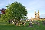 | |||
| The Pend | 56°20′23″N 2°47′21″W | Category A | 40590 | | |||
| 60 Argyle Street, The Garage (Former Cartshed And Byre) Including Boundary Wall | 56°20′17″N 2°48′15″W | Category C(S) | 46258 | | |||
| 15 And 16 The Links, Waldon House, With Boundary Walls And Railings | 56°20′34″N 2°48′13″W | Category C(S) | 46275 | |
Key
The scheme for classifying buildings in Scotland is:
- Category A: "buildings of national or international importance, either architectural or historic; or fine, little-altered examples of some particular period, style or building type."[3]
- Category B: "buildings of regional or more than local importance; or major examples of some particular period, style or building type, which may have been altered."[3]
- Category C: "buildings of local importance; lesser examples of any period, style, or building type, as originally constructed or moderately altered; and simple traditional buildings which group well with other listed buildings."[3]
In March 2016 there were 47,288 listed buildings in Scotland. Of these, 8% were Category A, and 50% were Category B, with the remaining 42% being Category C.[4]
gollark: Initial search UI.
gollark: Exciting news: minoteaur development.
gollark: I'm getting many CPU usage warnings on IRC.
gollark: It's compiling.
gollark: You can happily cast basically anything to anything, often with no complaints, and most things have to be ints or void pointers because there are no generics (I do not count the "generics" which are just type-level switches).
See also
Notes
- Sometimes known as OSGB36, the grid reference (where provided) is based on the British national grid reference system used by the Ordnance Survey.
• "Guide to National Grid". Ordnance Survey. Retrieved 2007-12-12.
• "Get-a-map". Ordnance Survey. Retrieved 2007-12-17. - Historic Environment Scotland assign a unique alphanumeric identifier to each designated site in Scotland, for listed buildings this always begins with "LB", for example "LB12345".
References
- All entries, addresses and coordinates are based on data from Historic Scotland. This data falls under the Open Government Licence
- "Law Mill, Lade Braes, St Andrews | Buildings at Risk Register". www.buildingsatrisk.org.uk.
- "Law Mill, Lade Braes, St Andrews | Buildings at Risk Register". www.buildingsatrisk.org.uk.
- "What is Listing?". Historic Environment Scotland. Retrieved 29 May 2018.
- Scotland's Historic Environment Audit 2016 (PDF). Historic Environment Scotland and the Built Environment Forum Scotland. pp. 15–16. Retrieved 29 May 2018.
This article is issued from Wikipedia. The text is licensed under Creative Commons - Attribution - Sharealike. Additional terms may apply for the media files.