List of listed buildings in Saltcoats, North Ayrshire
List
| Name | Location | Date Listed | Grid Ref. [note 1] | Geo-coordinates | Notes | LB Number [note 2] | Image |
|---|---|---|---|---|---|---|---|
| Chapelwell Street, New Trinity Church, (Former Erskine, Church Of Scotland) With Hall, Boundary Walls, Gatepiers And Railings | 55°38′04″N 4°47′18″W | Category C(S) | 44718 |  | |||
| 6 Hamilton Street | 55°38′01″N 4°47′25″W | Category C(S) | 40505 | | |||
| 28 Hamilton Street | 55°38′03″N 4°47′27″W | Category C(S) | 40515 | | |||
| 46 Hamilton Street | 55°38′05″N 4°47′30″W | Category C(S) | 40523 | | |||
| 56 Hamilton Street | 55°38′06″N 4°47′30″W | Category C(S) | 40527 | | |||
| 58 Hamilton Street | 55°38′07″N 4°47′29″W | Category B | 40528 | | |||
| 66 Hamilton Street | 55°38′07″N 4°47′31″W | Category C(S) | 40532 | | |||
| St Cuthbert's Parish Church | 55°38′16″N 4°47′31″W | Category B | 40488 | | |||
| 1 Parkend Avenue (Kyleshill House) | 55°38′03″N 4°46′53″W | Category B | 40493 | | |||
| Saltcoats Station Station Road And Glencairn Road | 55°38′02″N 4°47′03″W | Category B | 40500 | 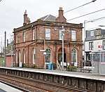 | |||
| 14 Hamilton Street | 55°38′02″N 4°47′25″W | Category C(S) | 40509 | | |||
| 40 Hamilton Street | 55°38′05″N 4°47′28″W | Category C(S) | 40520 | | |||
| 14 Nineyard Street | 55°38′00″N 4°47′01″W | Category C(S) | 40494 | | |||
| 19 Raise Street | 55°38′06″N 4°47′03″W | Category C(S) | 40499 | | |||
| 10 Hamilton Street | 55°38′01″N 4°47′25″W | Category C(S) | 40507 | | |||
| 32 Hamilton Street | 55°38′04″N 4°47′27″W | Category B | 40517 | | |||
| E U Congregational Church, Hamilton Street | 55°38′04″N 4°47′24″W | Category C(S) | 40534 | | |||
| Town Hall Countess Street | 55°38′00″N 4°47′08″W | Category B | 40489 | | |||
| 26, 28 Countess Street | 55°38′00″N 4°47′06″W | Category C(S) | 40491 | | |||
| Harbour | 55°37′52″N 4°47′13″W | Category B | 40496 | | |||
| 20, 22 Hamilton Street | 55°38′03″N 4°47′26″W | Category C(S) | 40512 | | |||
| 30 Hamilton Street | 55°38′04″N 4°47′27″W | Category C(S) | 40516 | | |||
| 60 Hamilton Street | 55°38′07″N 4°47′30″W | Category B | 40529 | | |||
| 68 Hamilton Street | 55°38′08″N 4°47′31″W | Category C(S) | 40533 | | |||
| 8 Hamilton Street | 55°38′01″N 4°47′24″W | Category C(S) | 40506 | | |||
| 12 Hamilton Street | 55°38′02″N 4°47′25″W | Category C(S) | 40508 | | |||
| 16 Hamilton Street | 55°38′02″N 4°47′26″W | Category C(S) | 40510 | | |||
| 24 Hamilton Street | 55°38′03″N 4°47′26″W | Category C(S) | 40513 | | |||
| 26 Hamilton Street | 55°38′03″N 4°47′26″W | Category C(S) | 40514 | | |||
| 30 Countess Street | 55°38′01″N 4°47′06″W | Category C(S) | 40492 | | |||
| 15 Raise Street | 55°38′05″N 4°47′03″W | Category C(S) | 40497 | | |||
| 17 Raise Street | 55°38′05″N 4°47′03″W | Category C(S) | 40498 | | |||
| Landsborough And Trinity Church Dockhead Street | 55°38′00″N 4°47′16″W | Category C(S) | 40501 | | |||
| 18 Hamilton Street | 55°38′02″N 4°47′26″W | Category C(S) | 40511 | | |||
| 34 Hamilton Street | 55°38′04″N 4°47′27″W | Category C(S) | 40518 | | |||
| 52, 52A Hamilton Street | 55°38′05″N 4°47′30″W | Category C(S) | 40525 | | |||
| 62 Hamilton Street | 55°38′07″N 4°47′30″W | Category B | 40530 | | |||
| 64 Hamilton Street | 55°38′07″N 4°47′30″W | Category C(S) | 40531 | | |||
| 36, 38 Hamilton Street | 55°38′04″N 4°47′27″W | Category C(S) | 40519 | | |||
| 54 Hamilton Street | 55°38′06″N 4°47′30″W | Category C(S) | 40526 | | |||
| 23 Manse Street | 55°38′06″N 4°47′20″W | Category C(S) | 40535 | | |||
| Museum. Old Ardrossan Parish Church (Including Old Graveyard) | 55°38′04″N 4°47′21″W | Category B | 40487 | | |||
| 1 And 3 Countess Street (Savoy Cafe And M Kelly Fruiterer) | 55°37′58″N 4°47′06″W | Category C(S) | 40490 | | |||
| Engine House In Field Close To Railway | 55°38′05″N 4°46′15″W | Category B | 40495 | | |||
| 87, 89 Dockhead Street | 55°38′00″N 4°47′18″W | Category B | 40502 | | |||
| 6 Chapelwell Street With 1, 3 Hamilton Street | 55°38′01″N 4°47′21″W | Category B | 40503 | | |||
| 4 Hamilton Street | 55°38′01″N 4°47′24″W | Category C(S) | 40504 | | |||
| 42 Hamilton Street | 55°38′05″N 4°47′28″W | Category C(S) | 40521 | | |||
| 44 Hamilton Street | 55°38′05″N 4°47′30″W | Category C(S) | 40522 | | |||
| 48, 50 Hamilton Street | 55°38′05″N 4°47′30″W | Category C(S) | 40524 | |
Key
The scheme for classifying buildings in Scotland is:
- Category A: "buildings of national or international importance, either architectural or historic; or fine, little-altered examples of some particular period, style or building type."[1]
- Category B: "buildings of regional or more than local importance; or major examples of some particular period, style or building type, which may have been altered."[1]
- Category C: "buildings of local importance; lesser examples of any period, style, or building type, as originally constructed or moderately altered; and simple traditional buildings which group well with other listed buildings."[1]
In March 2016 there were 47,288 listed buildings in Scotland. Of these, 8% were Category A, and 50% were Category B, with the remaining 42% being Category C.[2]
gollark: This statement is false or possibly true.
gollark: Ah, yes, frequency doubled Nd:YAG I think.
gollark: The pleasant 532nm green of frequency doubled something or other.
gollark: Orbital environment lasers are standing by.
gollark: More than 16% of the time anyway.
Notes
- Sometimes known as OSGB36, the grid reference (where provided) is based on the British national grid reference system used by the Ordnance Survey.
• "Guide to National Grid". Ordnance Survey. Retrieved 2007-12-12.
• "Get-a-map". Ordnance Survey. Retrieved 2007-12-17. - Historic Environment Scotland assign a unique alphanumeric identifier to each designated site in Scotland, for listed buildings this always begins with "LB", for example "LB12345".
References
- All entries, addresses and coordinates are based on data from Historic Scotland. This data falls under the Open Government Licence
- "What is Listing?". Historic Environment Scotland. Retrieved 29 May 2018.
- Scotland's Historic Environment Audit 2016 (PDF). Historic Environment Scotland and the Built Environment Forum Scotland. pp. 15–16. Retrieved 29 May 2018.
This article is issued from Wikipedia. The text is licensed under Creative Commons - Attribution - Sharealike. Additional terms may apply for the media files.