List of listed buildings in Leslie, Fife
List
| Name | Location | Date Listed | Grid Ref. [note 1] | Geo-coordinates | Notes | LB Number [note 2] | Image |
|---|---|---|---|---|---|---|---|
| 37-51 (Odd Nos) Glenwood Road | 56°11′49″N 3°12′54″W | Category C(S) | 37281 |  | |||
| 1-12 (Inc Nos) Greenside | 56°12′16″N 3°12′10″W | Category B | 37283 | | |||
| 9 High Street | 56°12′14″N 3°12′14″W | Category C(S) | 37295 | | |||
| 155 High Street With Boundary Walls | 56°12′10″N 3°12′36″W | Category C(S) | 37301 | | |||
| 242 And 248 High Street With Boundary Wall, Railings And Outbuilding (Former House) To Rear | 56°12′09″N 3°12′34″W | Category B | 37316 | | |||
| 264 High Street With Boundary Wall | 56°12′08″N 3°12′38″W | Category C(S) | 37320 | | |||
| 314 And 318 High Street | 56°12′06″N 3°12′44″W | Category C(S) | 37322 | | |||
| High Street, St Mary's Rc Church And Church Hall With Boundary Wall, Steps And Piers | 56°12′10″N 3°12′37″W | Category B | 37328 | | |||
| High Street, Trinity Parish Church With Boundary Walls, Piers And Railings | 56°12′01″N 3°12′56″W | Category B | 37330 | | |||
| 1-23 (Odd Nos) Prinlaws Road | 56°11′58″N 3°13′07″W | Category C(S) | 37340 | | |||
| Balgeddie House Hotel | 56°12′41″N 3°11′46″W | Category C(S) | 9690 | | |||
| Leslie House Policies, Duke's Lodge | 56°12′16″N 3°11′57″W | Category C(S) | 9694 | | |||
| Prinlaws Stalk | 56°11′47″N 3°13′26″W | Category C(S) | 37342 | | |||
| 1-7 (Odd Nos) Valley Drive | 56°11′55″N 3°13′08″W | Category C(S) | 37343 | | |||
| Greenside, Christ's Kirk On The Green, Kirkyard, Rothes And Douglas Vaults | 56°12′20″N 3°12′03″W | Category B | 37292 | | |||
| 203 High Street | 56°12′07″N 3°12′44″W | Category C(S) | 37303 | | |||
| 80 High Street | 56°12′12″N 3°12′18″W | Category C(S) | 37306 | | |||
| 82-88 (Even Nos) High Street | 56°12′12″N 3°12′19″W | Category B | 37307 | | |||
| 92 High Street Building To Rear | 56°12′11″N 3°12′19″W | Category B | 37309 | | |||
| 104 High Street Elmbank House With Boundary Wall | 56°12′11″N 3°12′20″W | Category C(S) | 37310 | | |||
| 144 High Street With Boundary Wall | 56°12′10″N 3°12′25″W | Category C(S) | 37313 | | |||
| 222 High Street | 56°12′10″N 3°12′31″W | Category C(S) | 37315 | | |||
| High Street, Bingartree House With Gatepiers And Boundary Walls | 56°12′02″N 3°12′52″W | Category B | 37324 | | |||
| High Street Old Co-Operative Society Shop | 56°12′02″N 3°12′54″W | Category C(S) | 37326 | | |||
| Leslie House Policies, High Street, West Gate, With Boundary Walls | 56°12′15″N 3°12′09″W | Category B | 37331 | | |||
| Leslie House Policies, High Street, West Lodge | 56°12′14″N 3°12′09″W | Category B | 37332 | | |||
| Mansfield, Lingarth With Gatepiers And Boundary Walls | 56°12′10″N 3°12′56″W | Category B | 37333 | | |||
| Strathendry Castle With Outbuildings, Gatepiers, Gates And Boundary Walls | 56°12′13″N 3°15′01″W | Category B | 13625 | | |||
| Valley Drive, Rescobie Hotel With Terrace Walls, Sundial, Gatepiers And Boundary Walls | 56°11′58″N 3°12′58″W | Category C(S) | 37345 | | |||
| 14 And 15 Greenside | 56°12′19″N 3°12′08″W | Category B | 37285 | | |||
| Greenside, Bull Stone | 56°12′18″N 3°12′07″W | Category C(S) | 37289 | | |||
| Greenside, Greenside House With Stables, Outbuildings And Boundary Walls | 56°12′19″N 3°12′02″W | Category B | 37290 | | |||
| 11 High Street | 56°12′14″N 3°12′15″W | Category C(S) | 37296 | | |||
| 22 Iona Park, Gilven House With Gatepiers, Boundary Walls And Railings | 56°12′25″N 3°10′34″W | Category C(S) | 9692 | | |||
| Leslie Mains, Mains Lodge With Boundary Wall And Gatepiers | 56°12′18″N 3°11′37″W | Category C(S) | 6801 | | |||
| 2 Valley Drive With Boundary Wall | 56°12′00″N 3°13′00″W | Category C(S) | 37344 | | |||
| 13 Greenside | 56°12′18″N 3°12′09″W | Category B | 37284 | | |||
| 17 Greenside | 56°12′19″N 3°12′08″W | Category C(S) | 37287 | | |||
| 20 And 21 Greenside | 56°12′19″N 3°12′07″W | Category C(S) | 37288 | | |||
| Greenside, Christ's Kirk On The Green, Old Parish Church With Lychgate, Boundary Walls, Graveyard And Monuments | 56°12′19″N 3°12′04″W | Category B | 37291 | 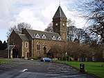 | |||
| 15 And 17 High Street | 56°12′14″N 3°12′15″W | Category C(S) | 37297 | | |||
| 50 And 52 High Street | 56°12′13″N 3°12′14″W | Category B | 37305 | | |||
| 92 High Street | 56°12′12″N 3°12′19″W | Category C(S) | 37308 | | |||
| Mansfield, Wood Gyle With Gatepiers And Boundary Walls | 56°12′10″N 3°12′57″W | Category B | 37335 | | |||
| Norman Place, Fettykil House With Walled Garden, Terrace And Boundary Walls | 56°12′02″N 3°12′40″W | Category B | 37337 | | |||
| Norman Place, Fettykil Lodge With Boundary Walls | 56°12′04″N 3°12′37″W | Category B | 37338 | | |||
| Leslie House With Conservatory, Terraced Garden And Boundary Walls | 56°12′12″N 3°11′42″W | Category A | 9693 | 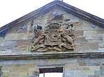 | |||
| Leslie House Policies, Forester's Lodge, Lodge Rise With Gatepiers And Boundary Walls | 56°12′20″N 3°11′02″W | Category C(S) | 9695 | | |||
| 4 Leslie Mains | 56°12′17″N 3°11′31″W | Category C(S) | 6799 | | |||
| Lothrie Burn Bridge | 56°12′12″N 3°11′29″W | Category C(S) | 6802 | | |||
| Strathendry South Lodge Boundary Wall And Gatepiers | 56°12′02″N 3°14′22″W | Category C(S) | 6805 | | |||
| Greenside, War Memorial | 56°12′16″N 3°12′09″W | Category B | 37293 | | |||
| 101 High Street | 56°12′11″N 3°12′28″W | Category C(S) | 37300 | | |||
| 258 High Street | 56°12′08″N 3°12′37″W | Category C(S) | 37318 | | |||
| 322 And 324 High Street And 5 Seath Court | 56°12′05″N 3°12′45″W | Category C(S) | 37323 | | |||
| High Street, Royal Bank Of Scotland | 56°12′08″N 3°12′40″W | Category C(S) | 37327 | | |||
| Mansfield And Croft Road, Maryfield With Boundary Walls | 56°12′12″N 3°13′00″W | Category B | 37334 | | |||
| 7 High Street | 56°12′14″N 3°12′14″W | Category C(S) | 37294 | | |||
| 91 High Street, Former Bank Of Scotland Including Boundary Walls | 56°12′12″N 3°12′27″W | Category B | 37299 | | |||
| 195 And 197 High Street | 56°12′07″N 3°12′42″W | Category C(S) | 37302 | | |||
| 256 High Street | 56°12′08″N 3°12′37″W | Category C(S) | 37317 | | |||
| 260 High Street | 56°12′08″N 3°12′38″W | Category C(S) | 37319 | | |||
| Strathendry, North Lodge | 56°12′14″N 3°14′35″W | Category C(S) | 6804 | | |||
| Fettykil Mills, Smith Anderson Scotts Mill | 56°11′57″N 3°12′40″W | Category C(S) | 37280 | | |||
| Glenwood Road, Fluthers House With Gatepiers And Boundary Walls | 56°12′00″N 3°12′48″W | Category C(S) | 37282 | | |||
| 16 Greenside | 56°12′19″N 3°12′08″W | Category B | 37286 | | |||
| 170 High Street With Boundary Wall And Outbuildings (Former Houses) To Rear | 56°12′10″N 3°12′25″W | Category B | 37314 | | |||
| 270-274 (Even Nos) High Street | 56°12′07″N 3°12′40″W | Category C(S) | 37321 | | |||
| High Street, Town Hall | 56°12′14″N 3°12′16″W | Category C(S) | 37329 | | |||
| Strathendry Dovecot | 56°12′16″N 3°14′57″W | Category B | 13626 | | |||
| Leslie House Policies, Gates And Gatepies, Duke's Lodge | 56°12′16″N 3°11′57″W | Category B | 10776 | | |||
| 5 Leslie Mains, Keepers House | 56°12′16″N 3°11′31″W | Category B | 6800 | | |||
| Strathendry House With Boundary Walls, Bee Boles And Railings | 56°12′12″N 3°14′53″W | Category B | 6803 | | |||
| Fettykil Mills, Smith Anderson Stalk | 56°12′06″N 3°12′29″W | Category B | 37279 | | |||
| 71 High Street | 56°12′12″N 3°12′23″W | Category B | 37298 | | |||
| 205 And 207 High Street, The Auld Hoose | 56°12′07″N 3°12′44″W | Category C(S) | 37304 | | |||
| 130 High Street With Outbuildings (Former Houses) | 56°12′11″N 3°12′23″W | Category B | 37311 | | |||
| High Street Old Anti-Burgher Kirk To The Rear Of 122-126 And 128 High Street | 56°12′10″N 3°12′22″W | Category C(S) | 37312 | | |||
| High Street, Greenside Hotel With Archway | 56°12′15″N 3°12′12″W | Category C(S) | 37325 | | |||
| 10-12 (Inclusive Nos) Murray Place | 56°12′10″N 3°12′45″W | Category C(S) | 37336 | | |||
| North Street, Baptist Church With Boundary Walls, Piers And Railings | 56°12′10″N 3°12′43″W | Category B | 37339 | | |||
| Prinlaws Road Trinity Church Hall With Piers | 56°12′01″N 3°13′03″W | Category C(S) | 37341 | | |||
| Ballingall Farmhouse | 56°12′47″N 3°12′41″W | Category C(S) | 9691 | |
Key
The scheme for classifying buildings in Scotland is:
- Category A: "buildings of national or international importance, either architectural or historic; or fine, little-altered examples of some particular period, style or building type."[1]
- Category B: "buildings of regional or more than local importance; or major examples of some particular period, style or building type, which may have been altered."[1]
- Category C: "buildings of local importance; lesser examples of any period, style, or building type, as originally constructed or moderately altered; and simple traditional buildings which group well with other listed buildings."[1]
In March 2016 there were 47,288 listed buildings in Scotland. Of these, 8% were Category A, and 50% were Category B, with the remaining 42% being Category C.[2]
gollark: If you serialize all your data in some application-specific binary format, that should be smaller than a bunch of ASCII.
gollark: You could maybe make a better encoding for it.
gollark: The last time I did compression I just used some random LZW library off the interwebs.
gollark: That way they don't need to be recorded.
gollark: There's a simple solution: limit the size of the world.If your turtle encounters blocks let's say more than 100 blocks from world spawn, have it destroy them.
See also
Notes
- Sometimes known as OSGB36, the grid reference (where provided) is based on the British national grid reference system used by the Ordnance Survey.
• "Guide to National Grid". Ordnance Survey. Retrieved 2007-12-12.
• "Get-a-map". Ordnance Survey. Retrieved 2007-12-17. - Historic Environment Scotland assign a unique alphanumeric identifier to each designated site in Scotland, for listed buildings this always begins with "LB", for example "LB12345".
References
- All entries, addresses and coordinates are based on data from Historic Scotland. This data falls under the Open Government Licence
- "What is Listing?". Historic Environment Scotland. Retrieved 29 May 2018.
- Scotland's Historic Environment Audit 2016 (PDF). Historic Environment Scotland and the Built Environment Forum Scotland. pp. 15–16. Retrieved 29 May 2018.
This article is issued from Wikipedia. The text is licensed under Creative Commons - Attribution - Sharealike. Additional terms may apply for the media files.