List of listed buildings in Kirkcaldy, Fife
List
| Name | Location | Date Listed | Grid Ref. [note 1] | Geo-coordinates | Notes | LB Number [note 2] | Image |
|---|---|---|---|---|---|---|---|
| Loughborough Road, Cemetery Lodge With Boundary Walls | 56°07′38″N 3°07′38″W | Category C(S) | 45535 |  | |||
| Pathhead Court, Pathhead Evangelical Union Congregational Church And Church Hall With Boundary Walls | 56°07′13″N 3°08′58″W | Category C(S) | 45543 | | |||
| Ravenscraig Park Boundary Walls, Railings And Gates | 56°07′15″N 3°08′22″W | Category B | 45545 | | |||
| 2-6 (Even Nos) St Clair Street, 1 Dysart Road And Sinclair Tavern | 56°07′16″N 3°08′30″W | Category C(S) | 45549 | | |||
| 250 St Clair Street, The Fife Arms | 56°07′42″N 3°08′14″W | Category C(S) | 45551 | | |||
| 32 And 34 St Mary's Road With Boundary Walls | 56°07′02″N 3°09′14″W | Category C(S) | 45554 | | |||
| Viewforth Street, Viewforth Day Centre With Boundary Walls And Gatepiers | 56°07′37″N 3°08′04″W | Category C(S) | 45563 | | |||
| Abbotshall Road, Abbotshall Parish Church Graveyard With Mort-House, Boundary Walls, Gatepiers And Gates | 56°06′35″N 3°10′06″W | Category B | 45481 | | |||
| Abbotshall Road, Abbotshall Parish Church Hall And Beadle's House | 56°06′33″N 3°10′10″W | Category C(S) | 45482 | | |||
| Anderson Street, Pathhead Baptist Church With Hall And Boundary Walls | 56°07′25″N 3°08′26″W | Category C(S) | 45485 | | |||
| Beveridge Park, Southerton Lodge | 56°06′27″N 3°10′39″W | Category B | 45495 | | |||
| 17-23 (Odd Nos) Church Street With Boundary Walls | 56°07′23″N 3°08′27″W | Category C(S) | 45497 | | |||
| Den Road, Forbo-Nairn Ltd | 56°07′21″N 3°09′00″W | Category B | 45499 | 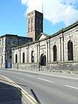 | |||
| Dysart, 2-14 (Even Nos) Fitzroy Street And High Street | 56°07′31″N 3°07′21″W | Category C(S) | 45505 | | |||
| Dysart, 41-55 (Odd Nos) Normand Road, Berwick Place And 34-46 (Even Nos) Alexander Street | 56°07′46″N 3°07′20″W | Category C(S) | 45509 | | |||
| Dysart, Townhead, Royal Hotel | 56°07′36″N 3°07′27″W | Category C(S) | 45513 | | |||
| Dysart, 8, 10 And 12 Victoria Street | 56°07′33″N 3°07′15″W | Category C(S) | 45514 | | |||
| Dysart, Westport And Townhead, War Memorial With Boundary Walls | 56°07′33″N 3°07′30″W | Category C(S) | 45515 | | |||
| 71 And 73 Loughborough Road | 56°07′32″N 3°08′08″W | Category C(S) | 45532 | | |||
| 475-479 (Odd Nos) High Street And Cottage To Rear With Boundary Walls | 56°06′59″N 3°09′08″W | Category C(S) | 44049 | | |||
| 212-216 (Even Nos) High Street | 56°06′42″N 3°09′26″W | Category C(S) | 44062 | | |||
| 69-81 (Odd Nos) Milton Road And Munro Street With Boundary Walls | 56°06′16″N 3°09′59″W | Category B | 44073 | | |||
| Ramsay Road, Abbotshall Infant School With Boundary Walls, Gatepiers, Gates, Railings And Drinking Fountain | 56°06′04″N 3°09′54″W | Category C(S) | 44090 | | |||
| 12 And 14 Wemyssfield With Boundary Walls And Gatepiers | 56°06′40″N 3°09′48″W | Category C(S) | 44106 | | |||
| 23 Whytehouse Avenue With Greenhouse And Boundary Walls | 56°06′30″N 3°09′49″W | Category C(S) | 44109 | | |||
| 1 East Fergus Place And South Fergus Place With Gazebo And Boundary Walls And Railings | 56°06′34″N 3°09′50″W | Category B | 44007 | | |||
| 67-87 (Odd Nos) High Street And 1-9 (Odd Nos) Whytecauseway, Whytehouse Mansions | 56°06′31″N 3°09′37″W | Category B | 44013 | | |||
| 4-18 (Even Nos) Doctor's Row Off Rosslyn Street | 56°08′01″N 3°07′58″W | Category C(S) | 43892 | | |||
| 38 Townsend Place With Boundary Walls | 56°06′50″N 3°09′28″W | Category C(S) | 36365 | | |||
| 22 Raith Gardens | 56°06′35″N 3°10′31″W | Category C(S) | 36394 | | |||
| Pathhead, 6 The Path, Offices Of East Bridge Flour Mills With Former Horsemill, Boundary Walls, Railings And East Burn Bridge | 56°07′06″N 3°09′03″W | Category B | 36398 | | |||
| Dysart, West Port, St Serf's Church Of Scotland With Boundary Walls, Gatepiers, Gates And Railings | 56°07′32″N 3°07′30″W | Category B | 36427 | | |||
| Dysart, 10 West Port And 2 Townhead | 56°07′34″N 3°07′30″W | Category C(S) | 36430 | | |||
| 40 Kirk Wynd, Hendry Hall | 56°06′44″N 3°09′31″W | Category B | 36320 | | |||
| 51-59 (Odd Nos) High Street | 56°06′28″N 3°09′38″W | Category C(S) | 36326 | | |||
| 111-115 (Odd Nos) High Street | 56°06′35″N 3°09′35″W | Category C(S) | 36327 | | |||
| 148, 150, 154 And 156 High Street, Commercial Bank Buildings | 56°06′38″N 3°09′31″W | Category B | 36333 | | |||
| 160-164 (Even Nos) High Street, Central Chambers | 56°06′38″N 3°09′30″W | Category B | 36337 | | |||
| 201-205 (Odd Nos) High Street | 56°06′41″N 3°09′30″W | Category C(S) | 36340 | | |||
| 443-449 (Odd Nos) High Street And Malcolm's Wynd, Sailor's Walk With Boundary Walls | 56°06′57″N 3°09′08″W | Category A | 36358 | _Sailors'_Walk%2C_Kirkcaldy.jpg) | |||
| Nether Street, Sinclairtown Feuars Graveyard Including Boundary Walls | 56°07′13″N 3°08′35″W | Category C(S) | 45542 | | |||
| 108 St Clair Street And 1-3 (Odd Nos) Loughborough Road With Boundary Walls | 56°07′29″N 3°08′27″W | Category B | 45550 | | |||
| Victoria Road, Fife College, Priory Campus With Boundary Walls, Terraces And Steps | 56°07′06″N 3°09′09″W | Category B | 45558 | | |||
| Victoria Road, Victoria Power Station | 56°07′09″N 3°09′20″W | Category B | 45560 | | |||
| 56 And 58 Windmill Road With Boundary Walls | 56°07′44″N 3°07′39″W | Category C(S) | 45565 | | |||
| 5 Balwearie Road And 1 Balwearie Crescent | 56°06′11″N 3°10′10″W | Category C(S) | 45488 | | |||
| 69 And 71 Balwearie Road With Boundary Walls | 56°06′05″N 3°10′33″W | Category C(S) | 45489 | | |||
| 41-49 (Odd Nos) Church Street | 56°07′24″N 3°08′24″W | Category C(S) | 45498 | | |||
| Dysart, 11 And 13 Fitzroy Square | 56°07′31″N 3°07′22″W | Category C(S) | 45504 | | |||
| Dysart, Normand Road, Dysart Primary School With Boundary Walls, Gatepiers, Gates And Railings | 56°07′45″N 3°07′18″W | Category C(S) | 45510 | | |||
| Dysart, Normand Road United Free Church With Boundary Walls, Gatepiers, Gates And Railings | 56°07′42″N 3°07′23″W | Category C(S) | 45512 | | |||
| Dysart, West Quality Street, Masonic Hall | 56°07′31″N 3°07′25″W | Category C(S) | 45516 | | |||
| Glebe Park And Maryhall Street, School House With Boundary Walls | 56°06′59″N 3°09′26″W | Category C(S) | 45527 | | |||
| 409-417 (Odd Nos) High Street | 56°06′54″N 3°09′12″W | Category C(S) | 44043 | | |||
| 252-262 (Even Nos) High Street And Redburn Wynd Mgm Cinema | 56°06′44″N 3°09′21″W | Category B | 44063 | | |||
| Bennochy Road And St Brycedale Avenue, Adam Smith Theatre With Boundary Walls And Outbuilding | 56°06′43″N 3°09′50″W | Category B | 44003 | | |||
| 1 Beveridge Road, The Bungalow With Boundary Walls | 56°06′33″N 3°09′59″W | Category C(S) | 44004 | | |||
| 47 Townsend Place With Boundary Walls | 56°06′52″N 3°09′25″W | Category C(S) | 36369 | | |||
| 7-15 (Odd Nos) Mitchell Street With Boundary Walls | 56°06′53″N 3°09′22″W | Category C(S) | 36370 | | |||
| 2 East Fergus Place With Boundary Walls And Gates | 56°06′36″N 3°09′49″W | Category B | 36376 | | |||
| Forth Park Drive, Bennochy House (Polish Ex-Servicemen's Club), With Outbuildings, Boundary Walls, Gatepiers And Gates | 56°07′09″N 3°10′20″W | Category C(S) | 36384 | | |||
| 54 Bennochy Road, Westdean Including Garden Enclosing Walls, Gatepiers And Gates | 56°07′05″N 3°10′30″W | Category B | 36385 | | |||
| 44 Nicol Street With Boundary Walls | 56°06′24″N 3°09′52″W | Category B | 36389 | | |||
| Abbotshall Road, Abbotshall Parish Church (Church Of Scotland) | 56°06′34″N 3°10′09″W | Category B | 36391 | 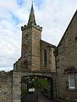 | |||
| Nether Street, Pathhead Medical Centre, Path House With Gatepiers And Boundary Wall | 56°07′10″N 3°08′52″W | Category A | 36399 |  | |||
| Commercial Street And Bogies Wynd, Feuars Arms | 56°07′15″N 3°08′46″W | Category A | 36401 | | |||
| Dysart, 7 Pan Ha', The Girnel With Boundary Walls | 56°07′27″N 3°07′16″W | Category B | 36409 | | |||
| Dysart, 8 Pan Ha', The Covenant House | 56°07′27″N 3°07′15″W | Category B | 36410 | | |||
| Dysart, 10 Pan Ha', The Pilot's House With Boundary Walls | 56°07′27″N 3°07′14″W | Category B | 36412 | | |||
| Dysart, 44 East Quality Street With Former Coach House | 56°07′36″N 3°07′21″W | Category B | 36437 | | |||
| Victoria Road, Victoria Viaduct | 56°07′12″N 3°09′07″W | Category B | 36446 | | |||
| Hunter Street, Telephone Kiosk At Former Post Office | 56°06′38″N 3°09′42″W | Category B | 36447 | | |||
| 130 St Clair Street | 56°07′31″N 3°08′27″W | Category B | 36449 | | |||
| Kirk Wynd, Kirkcaldy Old Kirk (Former Kirkcaldy Parish Church), Including Graveyard Boundary Wall And Steps | 56°06′45″N 3°09′31″W | Category B | 36317 | | |||
| 34 And 36 Kirk Wynd With Boundary Walls | 56°06′44″N 3°09′30″W | Category B | 36321 | | |||
| 6 Kirk Wynd, Tsb Bank | 56°06′43″N 3°09′29″W | Category B | 36322 | | |||
| 170 High Street And Tolbooth Street | 56°06′39″N 3°09′29″W | Category B | 36334 | | |||
| 191 High Street | 56°06′41″N 3°09′30″W | Category B | 36338 | | |||
| 263-271 (Odd Nos) High Street And 6 Oswald's Wynd | 56°06′45″N 3°09′23″W | Category B | 36347 | | |||
| 275 And 277 High Street | 56°06′46″N 3°09′23″W | Category B | 36348 | | |||
| 305A-315 (Odd Nos) High Street With Oven, Elder's Brae | 56°06′47″N 3°09′18″W | Category B | 36349 | | |||
| 295A And 297 High Street And Victoria House With Pottie's Close Outbuilding And Boundary Walls | 56°06′47″N 3°09′20″W | Category B | 36350 | | |||
| 333-337 (Odd Nos) High Street With Boundary Walls | 56°06′49″N 3°09′17″W | Category B | 36353 | | |||
| 439 High Street | 56°06′56″N 3°09′10″W | Category B | 36357 | | |||
| 2 Townsend Place And Kirk Wynd | 56°06′46″N 3°09′35″W | Category B | 36361 | | |||
| Loughborough Road, Sinclairtown Library And Clinic | 56°07′30″N 3°08′09″W | Category C(S) | 45536 | | |||
| Loughborough Road, Viewforth High School Annexe With Former Stable And Washhouse, Boundary Walls, Gatepiers And Terraces | 56°07′31″N 3°08′05″W | Category B | 45538 | | |||
| St Clair Street, Methodist Church | 56°07′30″N 3°08′30″W | Category C(S) | 45553 | | |||
| Thornton Road, National Tyres | 56°08′58″N 3°08′25″W | Category C(S) | 45555 | | |||
| 121 Victoria Road, Victoria House With Boundary Walls, Gatepiers And Gates | 56°06′59″N 3°09′37″W | Category C(S) | 45557 | | |||
| Victoria Road And Victoria Gardens, St Andrews Church (Church Of Scotland) | 56°06′54″N 3°09′46″W | Category B | 45562 | | |||
| Bennochy Road, Forth Park Hospital Including Former Coach House, Stables, Cottage And Boundary Walls | 56°07′04″N 3°10′12″W | Category B | 45491 | | |||
| Bennochy Road And Balsusney Road, Bennochy Cemetery Including Lodge, Gravestones, Boundary Walls, Gatepiers And Gates | 56°06′53″N 3°09′56″W | Category C(S) | 45492 | | |||
| Dunnikier Way, Fife Council, Dunnikier House Policies, Former Walled Garden And Gatepiers | 56°08′10″N 3°09′34″W | Category C(S) | 45502 | | |||
| Dysart, Hot Pot Wynd, Harbour House | 56°07′24″N 3°07′27″W | Category B | 45507 | | |||
| 78 Lady Nairn Avenue | 56°07′27″N 3°07′53″W | Category C(S) | 45530 | | |||
| 317 And 319 High Street | 56°06′48″N 3°09′18″W | Category C(S) | 44448 | | |||
| 405 And 407 High Street | 56°06′54″N 3°09′12″W | Category C(S) | 44042 | | |||
| 429 High Street, Harbour House, With Boundary Walls And Railings | 56°06′56″N 3°09′12″W | Category B | 44044 | | |||
| 465 And 467 High Street And Malcolm's House With Boundary Walls | 56°06′58″N 3°09′07″W | Category C(S) | 44047 | | |||
| 176 High Street And Tolbooth Street | 56°06′40″N 3°09′29″W | Category C(S) | 44057 | | |||
| 192-196 (Even Nos) High Street | 56°06′40″N 3°09′27″W | Category B | 44061 | | |||
| High Street, Wemyss Buildings | 56°06′24″N 3°09′39″W | Category C(S) | 44065 | | |||
| High Street And Whytehouse Avenue, West End Congregational Church | 56°06′29″N 3°09′38″W | Category B | 44066 | | |||
| 85 And 87 Milton Road, Maryfield, With Boundary Walls, Gatepiers And Lamp Bracket | 56°06′15″N 3°10′02″W | Category B | 44079 | | |||
| 32-38 (Even Nos) Milton Road With Boundary Walls | 56°06′18″N 3°09′45″W | Category C(S) | 44080 | | |||
| 42 Milton Road, West Primary School With Outbuildings, Gatepiers, Boundary Walls And Lamp Bracket | 56°06′16″N 3°09′48″W | Category B | 44081 | | |||
| 13 Charlotte St | 56°06′30″N 3°09′31″W | Category B | 44095 | | |||
| 50 Townsend Place With Boundary Walls And Railings | 56°06′50″N 3°09′24″W | Category C(S) | 44103 | | |||
| Bennochy Road, Kirkcaldy Museum, Art Gallery And Public Library With Pavilion | 56°06′45″N 3°09′58″W | Category B | 44000 | | |||
| Bennochy Road, Museum Lodge | 56°06′45″N 3°09′58″W | Category C(S) | 44001 | | |||
| 7 East Fergus Place, Fergus House With Boundary Walls | 56°06′36″N 3°09′54″W | Category C(S) | 44009 | | |||
| 26 East Fergus Place With Boundary Walls | 56°06′38″N 3°09′56″W | Category C(S) | 44011 | | |||
| 89-95 (Odd Nos) High Street And 2 Whytecauseway, Burton's | 56°06′33″N 3°09′36″W | Category B | 44014 | | |||
| 117-121 (Odd Nos) High Street | 56°06′35″N 3°09′35″W | Category C(S) | 44015 | | |||
| 123-127 (Odd Nos) High Street And Hill Street | 56°06′36″N 3°09′35″W | Category C(S) | 44016 | | |||
| St Brycedale Avenue And Kirk Wynd, St Brycedale's Church And Church Hall With Boundary Walls, Gatepiers And Gates | 56°06′45″N 3°09′38″W | Category B | 36373 | | |||
| Victoria Road, Former Scottish Linoleum Works, South Factory | 56°07′21″N 3°09′00″W | Category A | 36400 | | |||
| Dysart, Carmelite Monastery, Former Dysart House, With St Serf's Cave, Terraced Garden And Boundary Walls | 56°07′28″N 3°07′26″W | Category B | 36416 | | |||
| Dysart, 58 And 60 High Street | 56°07′34″N 3°07′15″W | Category B | 36420 | | |||
| Dysart, 14 Fitzroy Square, St David's With Outbuilding And Boundary Walls | 56°07′31″N 3°07′22″W | Category A | 36425 | | |||
| Dysart, 69 East Quality Street | 56°07′38″N 3°07′21″W | Category B | 36440 | | |||
| Dunnikier Way, Dunnikier House Hotel | 56°08′10″N 3°09′44″W | Category B | 36442 | | |||
| Kirk Wynd, Kirkcaldy Parish Church, Churchyard With Boundary Walls, Gatepiers, Gates And Steps | 56°06′46″N 3°09′31″W | Category B | 36319 | | |||
| 37 Kirk Wynd With Boundary Walls | 56°06′44″N 3°09′35″W | Category B | 36323 | | |||
| 44-50 (Even Nos) High Street | 56°06′29″N 3°09′35″W | Category C(S) | 36325 | | |||
| 158 High Street | 56°06′38″N 3°09′29″W | Category C(S) | 36336 | | |||
| 427 And 431 High Street | 56°06′55″N 3°09′11″W | Category C(S) | 36356 | | |||
| 9 And 11 Townsend Place With Boundary Walls | 56°06′48″N 3°09′36″W | Category B | 36362 | | |||
| 1-3 Mitchell Street | 56°06′52″N 3°09′23″W | Category C(S) | 45540 | | |||
| 254 St Clair Street | 56°07′43″N 3°08′13″W | Category C(S) | 45552 | | |||
| 6 And 8 Anderson Street | 56°07′24″N 3°08′25″W | Category C(S) | 45483 | | |||
| 187 Balsusney Road | 56°06′57″N 3°09′51″W | Category C(S) | 45486 | | |||
| Beveridge Park, Main Gate And South East Gate | 56°06′27″N 3°10′16″W | Category B | 45493 | | |||
| 133 Dunnikier Road, Victoria House, Fife Council Property & Development Services, Including Boundary Walls | 56°07′16″N 3°09′40″W | Category C(S) | 45500 | | |||
| 21 Glebe Park With Boundary Walls And Gatepiers | 56°06′59″N 3°09′25″W | Category C(S) | 45524 | | |||
| High Street, Olympia Arcade Halls West, To Rear Of Wemyss Buildings (Former Abbotshall Linen Works) | 56°06′24″N 3°09′40″W | Category C(S) | 44446 | | |||
| 7 Nicol Street With Boundary Walls | 56°06′24″N 3°09′45″W | Category C(S) | 44085 | | |||
| St Brycedale Avenue, Fife College, St Brycedale Campus With Boundary Walls And Railings | 56°06′46″N 3°09′44″W | Category B | 44092 | | |||
| 1 South Fergus Place And West Fergus Place With Gatepiers And Boundary Walls | 56°06′31″N 3°09′54″W | Category C(S) | 44093 | | |||
| 21 Tolbooth Street | 56°06′38″N 3°09′25″W | Category C(S) | 44098 | | |||
| 35-41 (Odd Nos) Townsend Place With Boundary Walls | 56°06′51″N 3°09′27″W | Category C(S) | 44099 | | |||
| 49 And 51 Townsend Place | 56°06′52″N 3°09′24″W | Category C(S) | 44101 | | |||
| Whytecauseway, Sheriff Court Buildings With Boundary Walls | 56°06′34″N 3°09′48″W | Category B | 44108 | 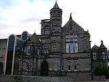 | |||
| 18 And 20 Beveridge Road With Boundary Walls | 56°06′32″N 3°10′02″W | Category C(S) | 44005 | | |||
| 9 East Fergus Place, The Cedars, With Boundary Walls | 56°06′36″N 3°09′55″W | Category C(S) | 44010 | | |||
| 36 Townsend Place With Boundary Walls | 56°06′49″N 3°09′28″W | Category C(S) | 36364 | | |||
| 17 Tolbooth Street | 56°06′39″N 3°09′26″W | Category B | 36371 | | |||
| 16 Wemyssfield With Boundary Walls | 56°06′41″N 3°09′49″W | Category B | 36374 | | |||
| Bethelfield Place And Nicol Street, Linktown Church (Church Of Scotland) And Hall With Boundary Walls And Gatepiers | 56°06′24″N 3°09′43″W | Category B | 36388 | | |||
| Dysart Harbour | 56°07′22″N 3°07′28″W | Category B | 36406 | 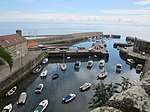 | |||
| Dysart, 9 Pan Ha', The Tide-Waiter's House With Boundary Walls | 56°07′27″N 3°07′15″W | Category B | 36411 | | |||
| Dysart, 40 And 42 High Street With Boundary Walls | 56°07′32″N 3°07′17″W | Category B | 36417 | | |||
| Dysart, High Street And Victoria Street, Tolbooth And Town Hall | 56°07′34″N 3°07′16″W | Category A | 36418 | 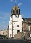 | |||
| Dysart, Rectory Lane And West Quality Street, Old Rectory Inn With Boundary Walls, Gatepiers And Gates | 56°07′31″N 3°07′25″W | Category B | 36426 | | |||
| Dysart, Townhead, Dysart Barony, With Graveyard And Boundary Walls | 56°07′38″N 3°07′27″W | Category B | 36431 | | |||
| Windmill Road, Old Windmill Tower | 56°07′42″N 3°07′42″W | Category B | 36441 | | |||
| 133 And 135 High Street With Boundary Walls | 56°06′36″N 3°09′34″W | Category B | 36330 | | |||
| 211-217 (Odd Nos) High Street | 56°06′42″N 3°09′29″W | Category B | 36341 | | |||
| 339-343 (Odd Nos) High Street With Boundary Walls | 56°06′49″N 3°09′16″W | Category A | 36354 | | |||
| Loughborough Road, Viewforth High School | 56°07′32″N 3°08′00″W | Category C(S) | 45537 | | |||
| Mid Street, Pathhead Feuars' Graveyard With Boundary Walls, Gatepiers And Gates | 56°07′12″N 3°08′59″W | Category B | 45539 | | |||
| Rosslyn Street, Gallatown Nursery School With Boundary Walls Gatepiers And Railings | 56°07′54″N 3°08′02″W | Category C(S) | 45547 | | |||
| Viceroy Street, J Thomson & Son | 56°07′10″N 3°10′00″W | Category C(S) | 45556 | | |||
| Victoria Road And Dunnikier Road, Victoria Mansions | 56°07′06″N 3°09′26″W | Category C(S) | 45561 | | |||
| Viewforth Street And Viewforth Terrace, Viewforth (Church Of Scotland) Church With Gatepiers And Boundary Walls | 56°07′44″N 3°08′09″W | Category C(S) | 45564 | | |||
| Dysart, High Street, The Cross Jubilee Lamp | 56°07′34″N 3°07′16″W | Category C(S) | 45506 | | |||
| 15 Dysart Road | 56°07′15″N 3°08′27″W | Category C(S) | 45517 | | |||
| 87 Loughborough Road With Boundary Walls And Railings | 56°07′34″N 3°07′58″W | Category C(S) | 45533 | | |||
| 461 And 463 High Street, The 'Lang Toun' Bar, And Malcolm's Wynd With Boundary Walls | 56°06′57″N 3°09′08″W | Category B | 44046 | | |||
| High Street, Fife College, Priory Campus, Nairn Building With Boundary Walls | 56°07′00″N 3°09′06″W | Category B | 44050 | | |||
| 152 High Street, New Club With Boundary Walls | 56°06′37″N 3°09′29″W | Category B | 44055 | | |||
| Kirkcaldy Dock And Harbour | 56°06′53″N 3°09′02″W | Category B | 44067 | | |||
| Links Street, Former Raith Church With Boundary Walls And Cast-Iron Stanchion | 56°06′15″N 3°09′39″W | Category C(S) | 44072 | | |||
| 83 Milton Road, Forrester Memorial Manse With Boundary Walls | 56°06′16″N 3°10′00″W | Category C(S) | 44078 | | |||
| 191 Nicol Street With Boundary Walls | 56°06′27″N 3°09′58″W | Category C(S) | 44086 | | |||
| 15 Tolbooth Street | 56°06′39″N 3°09′26″W | Category C(S) | 44096 | | |||
| 48 Townsend Place With Boundary Walls | 56°06′50″N 3°09′25″W | Category C(S) | 44102 | | |||
| 6 Wemyssfield, Wemyssfield House With Boundary Walls | 56°06′39″N 3°09′46″W | Category B | 44105 | | |||
| Bennochy Road And Abbotshall Road, War Memorial And Gardens With Sundial, Gatepiers And Quadrant Walls | 56°06′43″N 3°09′57″W | Category B | 44002 | 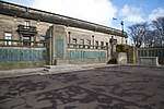 | |||
| 131 High Street | 56°06′36″N 3°09′34″W | Category C(S) | 44017 | | |||
| 40 Townsend Place And 31 Oswalds Wynd | 56°06′50″N 3°09′27″W | Category C(S) | 36366 | | |||
| 52 Townsend Place With Boundary Walls And Railings | 56°06′51″N 3°09′24″W | Category B | 36367 | | |||
| East Fergus Place, Osborne House With Boundary Walls And Gatepier | 56°06′39″N 3°09′55″W | Category B | 36378 | | |||
| 52 Bennochy Road, Sauchendene, With Boundary Walls And Gatepiers | 56°07′04″N 3°10′26″W | Category B | 36382 | | |||
| Raith Walled Garden, Old Gate (Adjoining 2 Raith Gardens) And Boundary Walls | 56°06′35″N 3°10′24″W | Category B | 36393 | | |||
| Church Street And Harriet Street, Pathhead Parish Church (Church Of Scotland) With Boundary Walls | 56°07′21″N 3°08′29″W | Category B | 36403 | | |||
| Ravenscraig Park, Dovecot | 56°07′12″N 3°08′18″W | Category A | 36405 | | |||
| Dysart, 11 Pan Ha', The Shoremaster's House | 56°07′28″N 3°07′14″W | Category B | 36413 | | |||
| Dysart, 54 And 56 High Street | 56°07′34″N 3°07′15″W | Category B | 36419 | | |||
| 137-141 (Odd Nos) High Street | 56°06′37″N 3°09′33″W | Category C(S) | 36332 | | |||
| 395-399 (Odd Nos) High Street | 56°06′53″N 3°09′13″W | Category B | 36355 | | |||
| Thornton Road, Kincraig | 56°08′51″N 3°08′26″W | Category B | 36360 | | |||
| 281 - 285 (Odd Nos) High Street | 56°06′46″N 3°09′21″W | Category C(S) | 48418 | | |||
| 5 Mitchell Street | 56°06′52″N 3°09′23″W | Category C(S) | 45541 | | |||
| 14 Boglily Road With Boundary Walls, Gatepiers And Gates | 56°06′28″N 3°10′23″W | Category B | 45496 | | |||
| 34 High Street | 56°06′27″N 3°09′35″W | Category C(S) | 44051 | | |||
| 132 High Street | 56°06′36″N 3°09′31″W | Category B | 44054 | | |||
| 286-290 (Even Nos) High Street | 56°06′46″N 3°09′18″W | Category C(S) | 44064 | | |||
| 44 Milton Road, Janitor's House | 56°06′16″N 3°09′51″W | Category C(S) | 44082 | | |||
| 15 Wemyssfield, Stairard With Boundary Walls And Gatepiers | 56°06′39″N 3°09′51″W | Category B | 44104 | | |||
| Coal Wynd, Former Mission Institute/Tax Office With Gates, Gatepiers And Railings | 56°06′52″N 3°09′18″W | Category C(S) | 44006 | | |||
| East Fergus Place, St Margaret's, With Boundary Walls | 56°06′38″N 3°09′52″W | Category B | 44012 | | |||
| 23 And 25 Tolbooth Street | 56°06′38″N 3°09′24″W | Category B | 36372 | | |||
| 31 Bennochy Road, Morningside Residential Home With Conservatory, Boundary Walls And Gatepiers | 56°07′00″N 3°10′08″W | Category B | 36380 | | |||
| 46 Nicol Street, Newton House With Boundary Walls And Gatepiers | 56°06′24″N 3°09′53″W | Category B | 36390 | | |||
| Ravenscraig Park, Ravenscraig Castle | 56°07′11″N 3°08′33″W | Category A | 36404 | | |||
| Dysart, 1 And 2 Shore Road, The Anchorage With Boundary Walls | 56°07′28″N 3°07′15″W | Category A | 36414 | | |||
| Dysart, Shore Road, St Serf's Kirk, Tower And Graveyard Including Boundary Walls | 56°07′27″N 3°07′19″W | Category A | 36415 | 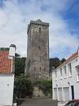 | |||
| Dysart, 5 Mcdouall Stuart Place With Boundary Walls | 56°07′30″N 3°07′18″W | Category B | 36423 | | |||
| Dysart, 42 East Quality Street | 56°07′36″N 3°07′21″W | Category B | 36436 | | |||
| 151-153 (Odd Nos) High Street | 56°06′38″N 3°09′33″W | Category B | 36331 | | |||
| 193-199 (Odd Nos) High Street | 56°06′41″N 3°09′30″W | Category B | 36339 | | |||
| 221 High Street And Kirk Wynd, Swan Memorial Building | 56°06′43″N 3°09′28″W | Category C(S) | 36343 | | |||
| 228-232 High Street | 56°06′43″N 3°09′25″W | Category C(S) | 36346 | | |||
| Ravenscraig Street, Craignairn House With Boundary Walls And Gatepiers | 56°07′23″N 3°08′23″W | Category B | 36359 | | |||
| 84 Loughborough Road, Ravensheugh With Gatepiers, Gates And Boundary Walls | 56°07′33″N 3°07′52″W | Category B | 45534 | | |||
| Prime Gilt Box Street, North Primary School And Psychological Services, With Outbuilding, Boundary Walls And Railings | 56°07′15″N 3°09′44″W | Category C(S) | 45544 | | |||
| Ravenscraig Park, Lookout Tower | 56°07′08″N 3°08′10″W | Category B | 45546 | | |||
| Victoria Road, Victoria Hotel | 56°07′01″N 3°09′37″W | Category B | 45559 | | |||
| Dunnikier Road And Victoria Road, St Marie's Roman Catholic Church With Boundary Walls | 56°07′06″N 3°09′23″W | Category B | 45501 | | |||
| Dysart, Mcdouall Stuart Place And Rectory Lane, Mcdouall Stuart Museum With Boundary Walls | 56°07′30″N 3°07′17″W | Category B | 45508 | | |||
| Glebe Park Centre, Former East School With Boundary Walls | 56°07′00″N 3°09′27″W | Category B | 45525 | | |||
| Hayfield Road, West Lodge With Boundary Walls | 56°07′34″N 3°09′44″W | Category C(S) | 45528 | | |||
| Lawson Street And Park Road, Hawklymuir Factory | 56°07′50″N 3°08′16″W | Category C(S) | 45531 | | |||
| St Brycedale Road And St Brycedale Avenue, Police Buildings With Gatepiers And Boundary Walls | 56°06′43″N 3°09′44″W | Category B | 44447 | | |||
| 469-473 (Odd Nos) High Street, Harbour Bar And Outbuilding With Boundary Walls | 56°06′58″N 3°09′07″W | Category C(S) | 44048 | | |||
| 182 High Street | 56°06′40″N 3°09′28″W | Category C(S) | 44059 | | |||
| 74 And 76 Milton Road, West Holme And Fairview, With Boundary Walls And Gatepiers | 56°06′14″N 3°10′01″W | Category B | 44084 | | |||
| 20 The Esplanade | 56°06′40″N 3°09′22″W | Category C(S) | 44094 | | |||
| 19 Tolbooth Street | 56°06′39″N 3°09′25″W | Category C(S) | 44097 | | |||
| 43 And 45 Townsend Place With Boundary Walls | 56°06′51″N 3°09′25″W | Category C(S) | 44100 | | |||
| 30 Whytehouse Avenue With Boundary Walls, Gatepiers And Gates | 56°06′32″N 3°09′47″W | Category C(S) | 44110 | | |||
| 299-305 (Odd Nos) High Street | 56°06′47″N 3°09′19″W | Category B | 44019 | | |||
| 4 East Fergus Place With Balcony And Boundary Walls | 56°06′36″N 3°09′50″W | Category B | 36377 | | |||
| Wemyssfield, Town House With Provost's Lamps And Boundary Walls | 56°06′35″N 3°09′45″W | Category B | 36387 | | |||
| Bridge Street, The Foyer, West Bridge Mill (Forth And Clyde Roperie) | 56°05′54″N 3°09′53″W | Category B | 36397 | | |||
| Dysart, 1 Pan Ha', Bay House Including Boundary Walls, Gatepiers And Gates | 56°07′26″N 3°07′20″W | Category A | 36407 | | |||
| Dysart, West Port, St Serf's Churchyard, Dovecot | 56°07′32″N 3°07′31″W | Category B | 36428 | | |||
| Dysart, 49 East Quality Street | 56°07′37″N 3°07′23″W | Category B | 36435 | | |||
| Dysart, 46 East Quality Street | 56°07′37″N 3°07′21″W | Category B | 36438 | | |||
| Hayfield Road, Former Gateway To Dunnikier House With Gates | 56°07′34″N 3°09′43″W | Category B | 36443 | | |||
| 2 Wishart Place And Dysart Road, Strathearn Hotel With Boundary Walls And Gatepiers | 56°07′26″N 3°07′52″W | Category B | 36444 | | |||
| Victoria Road, Braehead House With Terrace, Boundary Walls, Gatepiers, Gates And Railings | 56°07′11″N 3°09′01″W | Category B | 36445 | | |||
| Whytecauseway, Telephone Kiosk At Townhouse | 56°06′34″N 3°09′44″W | Category B | 36448 | | |||
| 114 High Street Bank Of Scotland | 56°06′35″N 3°09′32″W | Category B | 36328 | | |||
| 180 High Street | 56°06′40″N 3°09′28″W | Category C(S) | 36335 | | |||
| 218-222 (Even Nos) High Street Adam Smith House | 56°06′42″N 3°09′26″W | Category B | 36344 | | |||
| 321 And 323 High Street | 56°06′48″N 3°09′18″W | Category C(S) | 36352 | | |||
| 5 Smeaton Road, Glenaber Engineers, Polychrome Buildings Including Boundary Walls | 56°07′21″N 3°09′03″W | Category B | 45548 | | |||
| 1 And 3 Balwearie Road | 56°06′11″N 3°10′09″W | Category C(S) | 45487 | | |||
| 24 Bennochy Road, Marchmont Residential Home With Boundary Walls | 56°07′00″N 3°10′04″W | Category B | 45490 | | |||
| Beveridge Park Main Gate Lodge With Lions | 56°06′26″N 3°10′17″W | Category B | 45494 | | |||
| Dysart, Normand Road, The Bird House Including Boundary Walls, Gatepiers, Gates And Railings | 56°07′39″N 3°07′21″W | Category C(S) | 45511 | | |||
| 42 High Street And 1 Glasswork Street, Kirkcaldy Peoples Club And Institute | 56°06′28″N 3°09′34″W | Category C(S) | 44052 | | |||
| 178 High Street | 56°06′40″N 3°09′29″W | Category C(S) | 44058 | | |||
| 184 High Street | 56°06′40″N 3°09′28″W | Category C(S) | 44060 | | |||
| 149 Links Street | 56°07′37″N 3°08′04″W | Category C(S) | 44070 | | |||
| Links Street Clock | 56°06′04″N 3°09′43″W | Category C(S) | 44071 | | |||
| 72 Milton Road, Abbotsford, With Boundary Walls | 56°06′14″N 3°09′59″W | Category C(S) | 44083 | | |||
| 21 Pratt Street, Invertiel Guest House With Boundary Walls Gatepiers And Gates | 56°05′59″N 3°10′00″W | Category C(S) | 44089 | | |||
| Ramsay Road, Abbotshall School Off-Campus Unit With Boundary Walls And Drinking Fountain | 56°06′03″N 3°09′51″W | Category C(S) | 44091 | | |||
| Whytecauseway, Baptist Church | 56°06′35″N 3°09′40″W | Category C(S) | 44107 | | |||
| 3 East Fergus Place With Outbuilding And Boundary Walls | 56°06′35″N 3°09′50″W | Category C(S) | 44008 | | |||
| 287-295 (Odd Nos) High Street With Boundary Walls | 56°06′46″N 3°09′21″W | Category C(S) | 44018 | | |||
| 54 And 56 Townsend Place With Boundary Walls And Railings | 56°06′51″N 3°09′23″W | Category B | 36368 | | |||
| Hunter Street, Hunter Hospital With John Hunter Memorial, Gazebo, Gatepiers And Boundary Walls | 56°06′42″N 3°09′38″W | Category B | 36375 | | |||
| 8 Bennochy Avenue | 56°06′59″N 3°10′13″W | Category B | 36379 | | |||
| 50 Bennochy Road Including Boundary Walls | 56°07′04″N 3°10′25″W | Category B | 36381 | | |||
| 26 Bennochy Road, Beechwood, Including Former Stables And Boundary Walls | 56°07′00″N 3°10′05″W | Category B | 36383 | | |||
| Abbotshall Road, Raith Lodge And Gateway | 56°06′29″N 3°10′16″W | Category B | 36392 | | |||
| 40 Milton Road With Gatepiers, Gates And Boundary Walls | 56°06′16″N 3°09′46″W | Category B | 36395 | | |||
| Linktown Railway Viaduct | 56°05′54″N 3°10′09″W | Category B | 36396 | | |||
| Commercial Street, Pathhead Halls, Fife College Arts And Leisure Centre | 56°07′18″N 3°08′38″W | Category B | 36402 | 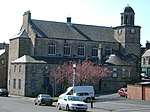 | |||
| Dysart, Pan Ha', The Salmon Fisher's House With Boundary Walls | 56°07′27″N 3°07′17″W | Category B | 36408 | | |||
| Dysart, 1 And 3 Mcdouall Stuart Place With Boundary Walls | 56°07′30″N 3°07′18″W | Category B | 36422 | | |||
| Dysart, West Port And Quality Street, Orchardcroft With Outbuilding, Boundary Walls, Gatepiers And Gates | 56°07′34″N 3°07′25″W | Category B | 36433 | | |||
| Dysart, 43-47 East Quality Street, The Towers With Forecourt Wall | 56°07′36″N 3°07′23″W | Category A | 36434 | | |||
| Dysart, 65 East Quality Street | 56°07′37″N 3°07′22″W | Category B | 36439 | | |||
| 29 St Clair Street | 56°07′21″N 3°08′34″W | Category B | 36451 | | |||
| Hunter Street And Wemyssfield, Post Office Including Pedestrian Gateway, Gatepier And Boundary Walls | 56°06′38″N 3°09′44″W | Category B | 36452 | | |||
| Dunnikier Road, Fire Station With Boundary Wall | 56°07′00″N 3°09′16″W | Category B | 36318 | | |||
| 36-40 (Even Nos) High Street | 56°06′28″N 3°09′35″W | Category C(S) | 36324 | | |||
| 224-226 (Even Nos) High Street With Boundary Walls | 56°06′42″N 3°09′25″W | Category B | 36345 | | |||
| 32 And 34 Townsend Place With Boundary Walls | 56°06′49″N 3°09′29″W | Category C(S) | 36363 | |
Key
The scheme for classifying buildings in Scotland is:
- Category A: "buildings of national or international importance, either architectural or historic; or fine, little-altered examples of some particular period, style or building type."[1]
- Category B: "buildings of regional or more than local importance; or major examples of some particular period, style or building type, which may have been altered."[1]
- Category C: "buildings of local importance; lesser examples of any period, style, or building type, as originally constructed or moderately altered; and simple traditional buildings which group well with other listed buildings."[1]
In March 2016 there were 47,288 listed buildings in Scotland. Of these, 8% were Category A, and 50% were Category B, with the remaining 42% being Category C.[2]
gollark: * apeirogon
gollark: Idea: time sphere.
gollark: Anyway, I think it's because you can consider the problem of designing an error correction code similarly to packing spheres, because each sphere of radius n represents all the possible values n bit errors away from a value being transmitted and you want them to not overlap.
gollark: Like cows.
gollark: Bees are spheres. QED.
See also
Notes
- Sometimes known as OSGB36, the grid reference (where provided) is based on the British national grid reference system used by the Ordnance Survey.
• "Guide to National Grid". Ordnance Survey. Retrieved 2007-12-12.
• "Get-a-map". Ordnance Survey. Retrieved 2007-12-17. - Historic Environment Scotland assign a unique alphanumeric identifier to each designated site in Scotland, for listed buildings this always begins with "LB", for example "LB12345".
References
- All entries, addresses and coordinates are based on data from Historic Scotland. This data falls under the Open Government Licence
- "What is Listing?". Historic Environment Scotland. Retrieved 29 May 2018.
- Scotland's Historic Environment Audit 2016 (PDF). Historic Environment Scotland and the Built Environment Forum Scotland. pp. 15–16. Retrieved 29 May 2018.
This article is issued from Wikipedia. The text is licensed under Creative Commons - Attribution - Sharealike. Additional terms may apply for the media files.