List of listed buildings in Kilrenny, Fife
List
| Name | Location | Date Listed | Grid Ref. [note 1] | Geo-coordinates | Notes | LB Number [note 2] | Image |
|---|---|---|---|---|---|---|---|
| Sea View (A D Wylie) Haddfoot Wynd Anstruther Easter | 56°13′20″N 2°41′51″W | Category B | 36166 |  | |||
| 25 East Green, Anstruther Easter | 56°13′20″N 2°41′46″W | Category C(S) | 36175 | | |||
| 16 East Green, Anstruther Easter | 56°13′19″N 2°41′48″W | Category C(S) | 36178 | | |||
| Clydesdale Bank Building, Crail Road And St Andrews Road Anstruther Easter (Including Walls And Railings) | 56°13′24″N 2°42′12″W | Category C(S) | 36186 | | |||
| Anstruther Wester Esplanade | 56°13′19″N 2°42′14″W | Category B | 36195 | | |||
| The Old Manse 5 The Esplanade Anstruther Wester | 56°13′19″N 2°42′13″W | Category B | 36199 | | |||
| 13 The Esplanade Anstruther Wester | 56°13′19″N 2°42′14″W | Category B | 36201 | | |||
| 15 The Esplanade Anstruther Wester | 56°13′19″N 2°42′15″W | Category B | 36202 | | |||
| 17-23 High Street (Including Area Railings) Anstruther Wester | 56°13′19″N 2°42′15″W | Category B | 36205 | | |||
| Pittenweem Road Watson Place Nos 1 To 18 (Inclusive Nos) | 56°13′17″N 2°42′27″W | Category B | 36211 | | |||
| 20, 22, 24 And 26 High Street Anstruther Wester | 56°13′19″N 2°42′21″W | Category C(S) | 36219 | | |||
| 30-38 High Street Anstruther Wester | 56°13′19″N 2°42′23″W | Category C(S) | 36221 | | |||
| The Manse Doocot, Backdykes Anstruther Easter | 56°13′24″N 2°41′52″W | Category B | 36073 | | |||
| Burgh Offices And Hall, Backdykes And Ladywalk, Anstruther Easter | 56°13′25″N 2°41′53″W | Category B | 36074 | | |||
| Old Wall, West Side Wightman's Wynd, High Street Anstruther Easter | 56°13′22″N 2°42′10″W | Category B | 36084 | | |||
| 51 High Street Anstruther Easter | 56°13′24″N 2°42′06″W | Category B | 36088 | | |||
| Town Council Burgh Depot, Garage Workshop And Store (Part Occupied J Cornfoot) Burial Brae Cunzie Street And School Green, Anstruther Easter | 56°13′25″N 2°42′04″W | Category B | 36110 | | |||
| 23-25 Cunzie Street Peebles Building Anstruther Easter | 56°13′23″N 2°42′02″W | Category B | 36113 | | |||
| Anstruther Easter, 21-27 Rodger Street | 56°13′23″N 2°42′07″W | Category C(S) | 36120 | | |||
| 10 Rodger Street Anstruther Easter | 56°13′24″N 2°42′08″W | Category C(S) | 36123 | | |||
| 20 & 22 Rodger Street, Anstruther Easter | 56°13′23″N 2°42′07″W | Category C(S) | 36126 | | |||
| 6 Castle Street Anstruther Easter | 56°13′22″N 2°42′09″W | Category B | 36133 | | |||
| Sea Wall Castle Street Anstruther Easter | 56°13′21″N 2°42′08″W | Category C(S) | 36136 | | |||
| 1, 2 And 3 Shore Street, Anstruther Easter | 56°13′23″N 2°42′05″W | Category C(S) | 36139 | | |||
| Post Office Shore Street Anstruther Easter | 56°13′22″N 2°41′59″W | Category C(S) | 36149 | | |||
| 31, 32 And 33 Shore Street Anstruther Easter (Including Rear Buildings And Garden Walls) | 56°13′21″N 2°41′55″W | Category C(S) | 36157 | | |||
| Mr John Smith's House, Main Street, Kilrenny | 56°14′02″N 2°41′12″W | Category C(S) | 35981 | | |||
| Schoolhouse And Hall (Former School Main Street Kilrenny, Including Garden Walls | 56°14′04″N 2°41′15″W | Category B | 35987 | | |||
| Kirkwynd Bridge Over Gellie Burn, Kilrenny | 56°14′06″N 2°41′15″W | Category C(S) | 35990 | | |||
| Ve-Mara Cottage, Routine Row, Kilrenny | 56°14′05″N 2°41′15″W | Category C(S) | 35991 | | |||
| No 1 Routine Row Kilrenny | 56°14′05″N 2°41′17″W | Category C(S) | 35996 | | |||
| Brownlea Cottage Trades Street Kilrenny | 56°14′02″N 2°41′20″W | Category C(S) | 35999 | | |||
| Rennyhill - Garden Walls Enclosing Old And New Houses And Dovecot | 56°14′06″N 2°41′22″W | Category B | 36001 | | |||
| Rennyhill Dovecot | 56°14′07″N 2°41′20″W | Category B | 36002 | | |||
| Innergellie, East Gatepiers And Lodge | 56°14′11″N 2°40′55″W | Category B | 36009 | | |||
| 19 John Street Cellardyke | 56°13′23″N 2°41′20″W | Category C(S) | 36014 | | |||
| 77, 79 George Street, Cellardyke | 56°13′30″N 2°41′04″W | Category C(S) | 36025 | | |||
| 6 Shore Street, Cellardyke | 56°13′32″N 2°41′03″W | Category C(S) | 36036 | | |||
| 31 Shore Street, Cellardyke | 56°13′35″N 2°40′58″W | Category C(S) | 36050 | | |||
| 32, 33 And 34 Shore Street, Cellardyke | 56°13′35″N 2°40′57″W | Category C(S) | 36051 | | |||
| 27 Shore Street, Cellardyke | 56°13′34″N 2°40′58″W | Category C(S) | 36053 | | |||
| 1 Dove Street Cellardyke (Including Garden Walls) | 56°13′32″N 2°41′05″W | Category C(S) | 36058 | | |||
| Caiplie Farmhouse, Cottage And Steading | 56°14′14″N 2°39′44″W | Category B | 8977 | | |||
| Cellardyke, Rodger Street, Nos 1A, 1-9 (Inclusive), 11-35 (Odd Nos), Including Ancillary Buildings And Boundary Walls | 56°13′27″N 2°41′32″W | Category B | 49883 | | |||
| Cellardyke, Rodger Street, Nos 10, 14-38 (Even Nos), Including Boundary Walls And Ancillary Buildings | 56°13′28″N 2°41′30″W | Category B | 49884 | | |||
| 11 And 13 East Green, Anstruther Easter | 56°13′20″N 2°41′49″W | Category B | 36171 | | |||
| 15 East Green, Anstruther Easter | 56°13′20″N 2°41′48″W | Category C(S) | 36172 | | |||
| 21 And 23 East Green Anstruther Easter | 56°13′20″N 2°41′47″W | Category C(S) | 36174 | | |||
| Cruachan, 1 Crail Road And Anstruther Easter | 56°13′24″N 2°42′10″W | Category B | 36185 | | |||
| Dreel Bridge | 56°13′21″N 2°42′16″W | Category C(S) | 36190 | | |||
| Buckie Hoose, 2 High Street Anstruther Wester | 56°13′20″N 2°42′16″W | Category B | 36212 | | |||
| 8 High Street Anstruther Wester | 56°13′20″N 2°42′18″W | Category B | 36215 | | |||
| 18 High Street Anstruther Wester | 56°13′20″N 2°42′20″W | Category B | 36218 | | |||
| 1, 3, 5 High St Anstruther Easter | 56°13′22″N 2°42′14″W | Category B | 36077 | | |||
| Chalmers' Birthplace, Old Post Office Close High Street Anstruther Easter | 56°13′22″N 2°42′08″W | Category B | 36086 | | |||
| 59 And 61 High Street And 11 Cunzie Street, Anstruther Easter (Masonic Temple) | 56°13′24″N 2°42′04″W | Category C(S) | 36092 | | |||
| 32 High Street Anstruther Easter | 56°13′23″N 2°42′09″W | Category B | 36103 | | |||
| 5 And 7 Rodger St, Anstruther Easter | 56°13′24″N 2°42′09″W | Category C(S) | 36115 | | |||
| 16 Rodger Street Royal Hotel Anstruther Easter | 56°13′24″N 2°42′07″W | Category C(S) | 36125 | | |||
| 2 Castle Street Anstruther Easter | 56°13′22″N 2°42′07″W | Category B | 36130 | | |||
| 7 Castle Street And Corner Of Wightman's Wynd Anstruther Easter | 56°13′22″N 2°42′09″W | Category B | 36134 | | |||
| Anstruther Harbour Anstruther Easter | 56°13′17″N 2°41′52″W | Category B | 36137 | 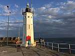 | |||
| 13 Shore Street Anstruther Easter | 56°13′22″N 2°41′59″W | Category C(S) | 36147 | | |||
| 23 And 24 Shore Street Anstruther Easter (Including Garden Walls) | 56°13′22″N 2°41′57″W | Category C(S) | 36153 | | |||
| 25 And 27 Shore Street Anstruther Easter (Including Garden Walls Of 25-27) | 56°13′22″N 2°41′57″W | Category B | 36154 | | |||
| 29 And 30 Shore Street Anstruther Easter (Including Rear Buildings And Garden Walls) | 56°13′21″N 2°41′56″W | Category B | 36156 | | |||
| 37, 38, 39 Shore Street Anstruther Easter (Including Garden Walls) | 56°13′21″N 2°41′54″W | Category C(S) | 36160 | | |||
| Kilrenny Churchyard Lumsdaine Burial Enclosure | 56°14′04″N 2°41′13″W | Category B | 35976 | | |||
| Kilrenny Churchyard - Walls And Monuments | 56°14′04″N 2°41′11″W | Category B | 35979 | | |||
| Mr Gardner's Cottage Main Street, Kilrenny Including Outhouses | 56°14′02″N 2°41′12″W | Category C(S) | 35980 | | |||
| Ivy Cottage (2 Houses) Main Street Kilrenny | 56°14′02″N 2°41′15″W | Category C(S) | 35984 | | |||
| Burnside Cottage, Routine Row Kilrenny | 56°14′05″N 2°41′15″W | Category C(S) | 35992 | | |||
| Innergellie, Stables | 56°14′14″N 2°41′19″W | Category B | 36007 | | |||
| Cellardyke, Tolbooth Road, Market Cross Affixed To Town Hall | 56°13′23″N 2°41′23″W | Category B | 36012 | | |||
| 69-75 George Street Cellardyke | 56°13′29″N 2°41′05″W | Category B | 36024 | | |||
| 52 George Street, Cellardyke | 56°13′30″N 2°41′05″W | Category C(S) | 36027 | | |||
| 3, 4 And 5 Toft Terrace, George Street, Cellardyke | 56°13′30″N 2°41′05″W | Category B | 36029 | | |||
| 23 Shore Street, Cellardyke | 56°13′33″N 2°40′58″W | Category C(S) | 36052 | | |||
| 2 Dove Street, Cellardyke | 56°13′32″N 2°41′04″W | Category C(S) | 36059 | | |||
| Cellardyke, 3 Dove Street | 56°13′32″N 2°41′04″W | Category B | 36060 | | |||
| Gear Loft And Fish Premises (Of Shop At 50 George Street) East Forth Street Cellardyke | 56°13′30″N 2°41′07″W | Category C(S) | 36063 | | |||
| The Ship Tavern 49 Shore Street And 1 Haddfoot Wynd Anstruther Easter | 56°13′20″N 2°41′51″W | Category C(S) | 36165 | | |||
| 18, 20 East Green Anstruther Easter | 56°13′19″N 2°41′47″W | Category C(S) | 36179 | | |||
| 24 East Green Anstruther Easter | 56°13′19″N 2°41′46″W | Category C(S) | 36181 | | |||
| 2 The Esplanade (Including Garages) Anstruther Wester | 56°13′20″N 2°42′12″W | Category B | 36203 | | |||
| 31 High Street Anstruther Wester | 56°13′19″N 2°42′17″W | Category B | 36207 | | |||
| 39 High Street Anstruther Wester | 56°13′19″N 2°42′18″W | Category C(S) | 36208 | | |||
| Johnstone Lodge, Former Coach House And Stables Of (Converted To House 1970-1) Backdykes And Haddfoot Wynd Anstruther Easter | 56°13′21″N 2°41′52″W | Category B | 36076 | | |||
| Mr Doig's Property Wightman's Wynd High Street Anstruther Easter | 56°13′22″N 2°42′09″W | Category C(S) | 36083 | | |||
| Tolbooth Wynd (East Side) High Street Anstruther Easter | 56°13′24″N 2°42′05″W | Category B | 36089 | | |||
| Old Corn Mill, Warehouse To North-East Of, Anstruther Easter | 56°13′21″N 2°42′18″W | Category C(S) | 36094 | | |||
| House (R Kell) Chalmers' Buildings High Street Anstruther Easter | 56°13′22″N 2°42′17″W | Category C(S) | 36096 | | |||
| 42 And 44 High Street, Anstruther Easter | 56°13′24″N 2°42′07″W | Category C(S) | 36104 | | |||
| 46 And 48 High Street Anstruther Easter | 56°13′24″N 2°42′07″W | Category C(S) | 36105 | | |||
| 54 And 56 High Street, Anstruther Easter | 56°13′25″N 2°42′06″W | Category C(S) | 36107 | | |||
| Anstruther Town Hall | 56°13′25″N 2°42′03″W | Category B | 36109 | | |||
| 15 Cunzie Street Anstruther Easter | 56°13′24″N 2°42′03″W | Category C(S) | 36112 | | |||
| 17 And 19 Rodger Street, Anstruther Easter | 56°13′23″N 2°42′08″W | Category C(S) | 36119 | | |||
| 12 And 14 Rodger Street And 40 High Street, Anstruther Easter | 56°13′24″N 2°42′08″W | Category B | 36124 | | |||
| Market Cross Shore Street Anstruther Easter | 56°13′22″N 2°42′02″W | Category B | 36138 | | |||
| 4 Shore Street Anstruther Easter | 56°13′23″N 2°42′05″W | Category B | 36140 | | |||
| 34 Shore Street Anstruther Easter (Including Rear Buildings And Garden Walls) | 56°13′21″N 2°41′55″W | Category C(S) | 36158 | | |||
| 41, 42, 43 And 44 Shore Street Anstruther Easter (Including Rear Buildings And Garden Walls) | 56°13′20″N 2°41′53″W | Category B | 36161 | 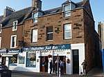 | |||
| 45, 46 Shore St Anstruther | 56°13′20″N 2°41′52″W | Category C(S) | 36162 | | |||
| Westbourne, Main Street, Kilrenny | 56°14′03″N 2°41′19″W | Category C(S) | 35988 | | |||
| Invermay House Routine Row Kilrenny | 56°14′04″N 2°41′17″W | Category C(S) | 35997 | | |||
| Rennyhill House (0Ld) | 56°14′04″N 2°41′24″W | Category B | 36000 | | |||
| Whiteside House, Kilrenny | 56°14′05″N 2°41′03″W | Category C(S) | 36010 | | |||
| 25 And 27 John Street, Cellardyke | 56°13′23″N 2°41′19″W | Category B | 36016 | | |||
| Cellardyke, 29-33 John Street | 56°13′23″N 2°41′18″W | Category B | 36017 | | |||
| The Harbour (Skinfast Haven) Cellardyke | 56°13′31″N 2°41′00″W | Category B | 36034 | | |||
| 16 Shore Street Cellardyke | 56°13′33″N 2°41′00″W | Category C(S) | 36043 | | |||
| 22 And 24 Shore Street, Cellardyke | 56°13′34″N 2°40′59″W | Category C(S) | 36046 | | |||
| 1 Harbour Head, Cellardyke | 56°13′33″N 2°40′58″W | Category B | 36055 | | |||
| Seaview House East End Cellardyke | 56°13′39″N 2°40′53″W | Category B | 36065 | | |||
| Anstruther Easter Parish Church (St Adrian's) | 56°13′27″N 2°42′02″W | Category A | 36066 | 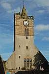 | |||
| Murray And Wilson's Premises School Green Anstruther Easter | 56°13′25″N 2°41′59″W | Category C(S) | 36069 | | |||
| 8 Haddfoot Wynd Anstruther Easter (Including Garden Wall) | 56°13′20″N 2°41′51″W | Category B | 36167 | | |||
| Warehouse And Workshop (Smith & Hutton) Harbour Head, Anstruther Easter | 56°13′19″N 2°41′46″W | Category B | 36170 | | |||
| 14 East Green, Anstruther Easter | 56°13′19″N 2°41′48″W | Category C(S) | 36177 | | |||
| 26 East Green Warehouse, Anstruther Easter | 56°13′19″N 2°41′46″W | Category B | 36182 | | |||
| Anstruther Wester Town Hall, Session House And Church Hall | 56°13′20″N 2°42′15″W | Category C(S) | 36193 | | |||
| 1-8 Elizabeth Place, Anstruther Wester | 56°13′20″N 2°42′16″W | Category C(S) | 36194 | | |||
| The White House 1 The Esplanade Anstruther Wester | 56°13′19″N 2°42′11″W | Category A | 36197 | | |||
| Fernbank 25 And 27 High Street Anstruther Wester | 56°13′19″N 2°42′16″W | Category B | 36206 | | |||
| 43 High Street Anstruther Wester | 56°13′19″N 2°42′19″W | Category B | 36209 | | |||
| The Hermitage Backdykes Including Garden Walls And Outbuildings Anstruther Easter | 56°13′24″N 2°41′55″W | Category B | 36071 | | |||
| 19 And 21 High St Anstruther Easter | 56°13′23″N 2°42′12″W | Category B | 36079 | | |||
| House (Kerr) Wightman's Wynd And Old Post Office Close High Street, Anstruther Easter | 56°13′23″N 2°42′09″W | Category B | 36082 | | |||
| 31 High Street Anstruther Easter Including Wing To Wightman's Wynd | 56°13′23″N 2°42′09″W | Category C(S) | 36085 | | |||
| 55 High Street Anstruther Easter | 56°13′24″N 2°42′05″W | Category C(S) | 36091 | | |||
| 50 And 52 High Street Anstruther Easter | 56°13′24″N 2°42′06″W | Category B | 36106 | | |||
| Belmont House, Cunzie Street Anstruther Easter | 56°13′25″N 2°42′04″W | Category B | 36111 | | |||
| 13 Rodger Street And 34 High Street, Anstruther Easter | 56°13′23″N 2°42′09″W | Category C(S) | 36117 | | |||
| Dreel Lodge Castle Street And Wightman's Wynd Anstruther Easter | 56°13′21″N 2°42′10″W | Category C(S) | 36135 | | |||
| 5 And 6 Shore Street Anstruther Easter | 56°13′23″N 2°42′03″W | Category B | 36141 | | |||
| 10 And 11 Shore Street Anstruther Easter | 56°13′22″N 2°42′01″W | Category C(S) | 36145 | | |||
| Masonic Arms 12 Shore Street Anstruther Easter | 56°13′22″N 2°42′00″W | Category B | 36146 | | |||
| 48 Shore Street Anstruther Easter | 56°13′20″N 2°41′51″W | Category B | 36164 | | |||
| Kilrenny Parish Church | 56°14′04″N 2°41′12″W | Category B | 35975 | | |||
| Kilrenny Churchyard-Scott Of Balcomie Mausoleum | 56°14′04″N 2°41′14″W | Category B | 35978 | | |||
| Innergellie, Walled Gardens | 56°14′11″N 2°41′16″W | Category B | 36006 | | |||
| Innergellie Dovecot | 56°14′07″N 2°41′18″W | Category B | 36008 | | |||
| Outhouses, Toft Terrace, George Street Cellardyke | 56°13′31″N 2°41′06″W | Category C(S) | 36032 | | |||
| Bay View 33 East Forth Street, Cellardyke | 56°13′30″N 2°41′07″W | Category C(S) | 36062 | | |||
| Manse, School Green Including Garden Walls Anstruther Easter | 56°13′25″N 2°41′57″W | Category C(S) | 36070 | | |||
| Cellardyke, East End, Kilrenny War Memorial Including Railings | 56°13′41″N 2°40′55″W | Category B | 51250 | | |||
| 22 East Green Anstruther Easter | 56°13′19″N 2°41′47″W | Category C(S) | 36180 | | |||
| East Green, Engineers Shop And Warehouse, Anstruther Easter | 56°13′19″N 2°41′46″W | Category C(S) | 36183 | | |||
| 28 East Green, Anstruther Easter | 56°13′19″N 2°41′45″W | Category C(S) | 36184 | | |||
| Cunzie House And Outbuildings (Now Garage) Crail Road, Anstruther Easter | 56°13′28″N 2°42′06″W | Category B | 36188 | | |||
| Anstruther Wester Parish Church (Now St Adrian's Church Hall) | 56°13′20″N 2°42′14″W | Category A | 36191 | 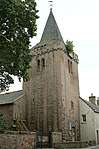 | |||
| Rose Court 11 The Esplanade Anstruther Wester | 56°13′19″N 2°42′14″W | Category B | 36200 | | |||
| 6 High Street Anstruther Wester | 56°13′20″N 2°42′17″W | Category B | 36214 | | |||
| 10 And 12 High Street Anstruther Wester | 56°13′20″N 2°42′18″W | Category B | 36216 | | |||
| 28 High Street Anstruther Wester | 56°13′19″N 2°42′22″W | Category B | 36220 | | |||
| Johnstone Lodge Backdykes Anstruther Easter Including Garden-Walls And Gate-Piers | 56°13′23″N 2°41′52″W | Category B | 36075 | | |||
| Smugglers' Inn High Street, Anstruther Easter | 56°13′22″N 2°42′13″W | Category B | 36078 | | |||
| 23 And 25 High St Anstruther Easter | 56°13′23″N 2°42′11″W | Category B | 36080 | | |||
| 35 High Street Anstruther Easter | 56°13′23″N 2°42′09″W | Category C(S) | 36087 | | |||
| Old Corn Mill On Dreel Burn, Off High Street Anstruther Easter | 56°13′21″N 2°42′18″W | Category B | 36093 | | |||
| Old Mill House Chalmers' Buildings, High Street Anstruther Easter | 56°13′22″N 2°42′18″W | Category C(S) | 36095 | | |||
| 15 Rodger Street Anstruther Easter | 56°13′23″N 2°42′08″W | Category C(S) | 36118 | | |||
| Strathburn Cottage And Miss Lindsay's Cottage, Main Street, Kilrenny | 56°14′03″N 2°41′14″W | Category C(S) | 35982 | | |||
| Killin Cottage Routine Row Kilrenny | 56°14′05″N 2°41′16″W | Category C(S) | 35994 | | |||
| Cairnhill House Trades Street Kilrenny | 56°14′03″N 2°41′19″W | Category C(S) | 35998 | | |||
| Kilrenny Mains (Rennyhill) Farm | 56°14′06″N 2°41′27″W | Category C(S) | 36003 | | |||
| Rennyhill Bridge Over Gellie Burn | 56°14′06″N 2°41′19″W | Category B | 36004 | | |||
| 55 George Street Cellardyke | 56°13′28″N 2°41′07″W | Category C(S) | 36020 | | |||
| 57-61 George Street Cellardyke | 56°13′28″N 2°41′07″W | Category B | 36021 | | |||
| 81, 83 George Street And Harbour House Cellardyke | 56°13′30″N 2°41′03″W | Category B | 36026 | | |||
| 1 Toft Terrace George Street Cellardyke | 56°13′30″N 2°41′05″W | Category C(S) | 36028 | | |||
| 2 Harbour Head, Cellardyke | 56°13′33″N 2°40′58″W | Category C(S) | 36056 | | |||
| Guerdon Cottage School Green Anstruther Easter | 56°13′25″N 2°41′59″W | Category C(S) | 36068 | | |||
| Barnsmuir Farmhouse And Steading | 56°14′51″N 2°39′12″W | Category B | 8975 | | |||
| Caiplie Dovecot | 56°14′26″N 2°40′00″W | Category B | 8976 | | |||
| West Pitkierie Dovecot | 56°14′25″N 2°43′10″W | Category A | 8979 | 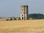 | |||
| 19A B And C East Green Anstruther Easter | 56°13′20″N 2°41′47″W | Category B | 36173 | | |||
| 27 And 29 East Green, Anstruther Easter | 56°13′20″N 2°41′46″W | Category C(S) | 36176 | | |||
| House (Mrs Henderson) Crail Road And St Andrews Road Anstruther Easter | 56°13′26″N 2°42′11″W | Category B | 36187 | | |||
| Dolphin Cottage The Esplanade Anstruther Wester | 56°13′20″N 2°42′14″W | Category B | 36204 | | |||
| The Dreel Tavern 14 And 16 High Street Anstruther Wester | 56°13′20″N 2°42′19″W | Category B | 36217 | | |||
| The Manse, Backdykes Anstruther Easter (Including Garden Walls) | 56°13′24″N 2°41′53″W | Category A | 36072 |  | |||
| House (Mr Watt) High Terrace, High Street, Anstruther Easter | 56°13′23″N 2°42′15″W | Category C(S) | 36098 | | |||
| Holmlea, High Street, Anstruther Easter | 56°13′23″N 2°42′14″W | Category C(S) | 36100 | | |||
| 6, 8 High Street Anstruther Easter | 56°13′23″N 2°42′14″W | Category C(S) | 36101 | | |||
| 60 High Street Anstruther Easter | 56°13′25″N 2°42′05″W | Category C(S) | 36108 | | |||
| 9 And 11 Rodger Street, Anstruther Easter | 56°13′24″N 2°42′09″W | Category C(S) | 36116 | | |||
| Savings Bank Rodger Street Anstruther Easter | 56°13′22″N 2°42′07″W | Category B | 36121 | | |||
| Royal Bank Of Scotland 26 & 28 Rodger Street Anstruther Easter | 56°13′23″N 2°42′06″W | Category C(S) | 36127 | | |||
| 1 Castle Street Anstruther Easter | 56°13′22″N 2°42′07″W | Category B | 36129 | | |||
| 3 Castle Street Anstruther Easter | 56°13′22″N 2°42′08″W | Category B | 36131 | | |||
| The Murray Library 7 Shore Street Anstruther Easter | 56°13′23″N 2°42′03″W | Category C(S) | 36142 | | |||
| 13 Shore Street House To Rear Of (Now Warehouse Of No 13) Anstruther Easter | 56°13′22″N 2°41′59″W | Category C(S) | 36148 | | |||
| 35 And 36 Shore Street Anstruther Easter (Including Rear And Garden Walls) | 56°13′21″N 2°41′54″W | Category C(S) | 36159 | | |||
| Rose Cottage (Moir) Main Street Kilrenny | 56°14′02″N 2°41′17″W | Category C(S) | 35985 | | |||
| Corthie Cottage Main Street Kilrenny | 56°14′01″N 2°41′19″W | Category C(S) | 35986 | | |||
| Kirkwynd Cottage And Mrs Braid's Cottage, Kirkwynd Kilrenny | 56°14′05″N 2°41′14″W | Category C(S) | 35989 | | |||
| Woodburn Cottage Routine Row Kilrenny | 56°14′05″N 2°41′16″W | Category C(S) | 35993 | | |||
| Gelliebank Cottage Routine Row Kilrenny | 56°14′05″N 2°41′17″W | Category C(S) | 35995 | | |||
| 15 And 17 John Street, Cellardyke | 56°13′23″N 2°41′20″W | Category B | 36013 | | |||
| 21 And 23 John Street, Cellardyke | 56°13′23″N 2°41′19″W | Category C(S) | 36015 | | |||
| Cellardyke, 15-19 George Street | 56°13′26″N 2°41′10″W | Category B | 36019 | | |||
| 67 George Street Cellardyke | 56°13′29″N 2°41′05″W | Category C(S) | 36023 | | |||
| 8 Toft Terrace, George Street, Cellardyke (Including Wall To East Forth Street) | 56°13′30″N 2°41′07″W | Category C(S) | 36031 | | |||
| 54 George Street, Cellardyke | 56°13′30″N 2°41′05″W | Category C(S) | 36033 | | |||
| 19 Shore Street Cellardyke | 56°13′33″N 2°40′59″W | Category C(S) | 36045 | | |||
| 26 Shore Street, Cellardyke | 56°13′34″N 2°40′59″W | Category C(S) | 36047 | | |||
| 3 & 4 Harbour Head, Including Outhouses Cellardyke | 56°13′33″N 2°40′56″W | Category C(S) | 36057 | | |||
| Store (Isobel Bremner) East Forth Street Cellardyke | 56°13′30″N 2°41′08″W | Category C(S) | 36064 | | |||
| Cornceres House | 56°14′16″N 2°40′46″W | Category C(S) | 8978 | | |||
| House (Miss Graham) Haddfoot Wynd Anstruther Easter | 56°13′20″N 2°41′50″W | Category C(S) | 36168 | | |||
| Scottish Fisheries Museum Trust Ltd Harbour Head And 50 East Shore Anstruther Easter | 56°13′19″N 2°41′49″W | Category A | 36169 |  | |||
| Mayview, Crail Road And Ladywalk | 56°13′32″N 2°41′50″W | Category B | 36189 | | |||
| Anstruther Wester Parish Churchyard And Gravestones | 56°13′20″N 2°42′13″W | Category C(S) | 36192 | | |||
| Sea Wall From Esplanade To Anstruther Golf Club (Including Watch Tower) Anstruther Wester | 56°13′13″N 2°42′19″W | Category B | 36196 | | |||
| 4 High Street Anstruther Wester | 56°13′20″N 2°42′17″W | Category C(S) | 36213 | | |||
| 27 High Street Anstruther Easter | 56°13′23″N 2°42′10″W | Category B | 36081 | | |||
| Chalmers' House Chalmers' Buildings High Street, Anstruther Easter | 56°13′23″N 2°42′16″W | Category C(S) | 36097 | | |||
| House (Mr Peattie) High Terrace, High Street, Anstruther Easter | 56°13′23″N 2°42′16″W | Category C(S) | 36099 | | |||
| 6 & 8 Rodger Street Anstruther Easter | 56°13′24″N 2°42′08″W | Category C(S) | 36122 | | |||
| 17 Shore Street, Anstruther Easter | 56°13′22″N 2°41′58″W | Category C(S) | 36150 | | |||
| 18-20 Shore Street North Boundary Wall Only | 56°13′23″N 2°41′56″W | Category C(S) | 36151 | | |||
| 21 And 22 Shore Street Anstruther Easter (Including Garden Walls) | 56°13′22″N 2°41′57″W | Category C(S) | 36152 | | |||
| Salutation Bar 28 Shore Street Anstruther Easter (Including Garden Walls) | 56°13′21″N 2°41′56″W | Category C(S) | 36155 | | |||
| 47 Shore Street (With Haddfoot Close) Anstruther Easter | 56°13′20″N 2°41′52″W | Category B | 36163 | | |||
| Kilrenny Churchyard-Beaton Burial Enclosure | 56°14′04″N 2°41′11″W | Category B | 35977 | | |||
| Kilrenny Manse | 56°14′03″N 2°40′58″W | Category B | 36011 | | |||
| 6 Toft Terrace, George Street, Cellardyke | 56°13′30″N 2°41′06″W | Category C(S) | 36030 | | |||
| 8 Shore Street, Cellardyke | 56°13′32″N 2°41′02″W | Category C(S) | 36038 | | |||
| 13 Shore Street Cellardyke | 56°13′33″N 2°41′01″W | Category C(S) | 36041 | | |||
| 18 Shore Street Cellardyke | 56°13′33″N 2°41′00″W | Category C(S) | 36044 | | |||
| Tower (Mr Dick, Clifton East Forth Street) East Forth Street Cellardyke | 56°13′33″N 2°41′03″W | Category B | 36061 | | |||
| St Adrian's Churchyard Walls And Monuments | 56°13′25″N 2°42′01″W | Category B | 36067 | | |||
| 3 The Esplanade Anstruther Wester | 56°13′19″N 2°42′12″W | Category B | 36198 | | |||
| Crichton House High Street And Crichton Street Anstruther Wester | 56°13′19″N 2°42′21″W | Category C(S) | 36210 | | |||
| 53 High Street Anstruther Easter | 56°13′24″N 2°42′05″W | Category C(S) | 36090 | | |||
| 24 High Street And "Dunearne" Anstruther Easter | 56°13′24″N 2°42′10″W | Category B | 36102 | | |||
| Guthrie's House 11 Card's Wynd Anstruther Easter | 56°13′22″N 2°41′58″W | Category B | 36114 | | |||
| 34 Rodger Street Anstruther Easter | 56°13′23″N 2°42′05″W | Category B | 36128 | | |||
| 4 Castle Street (Pantiles) Anstruther Easter | 56°13′22″N 2°42′08″W | Category C(S) | 36132 | | |||
| 8 Shore Street Anstruther Easter | 56°13′23″N 2°42′02″W | Category B | 36143 | | |||
| 9 Shore Street And 34 Cunzie Street, Anstruther Easter | 56°13′22″N 2°42′01″W | Category B | 36144 | | |||
| Dunglass (Mr Scott) Main Street, Kilrenny | 56°14′03″N 2°41′14″W | Category B | 35983 | | |||
| Innergellie House | 56°14′11″N 2°41′15″W | Category A | 36005 | 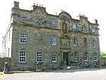 | |||
| 56 John Street Cellardyke | 56°13′26″N 2°41′14″W | Category B | 36018 | | |||
| 63 George Street Cellardyke | 56°13′29″N 2°41′06″W | Category C(S) | 36022 | | |||
| 7 Shore Street, Cellardyke | 56°13′32″N 2°41′03″W | Category C(S) | 36037 | | |||
| 9 And 10 Shore Street And 5, 7, 9 Dove Street, Cellardyke | 56°13′32″N 2°41′02″W | Category C(S) | 36039 | | |||
| 11 Shore Street Cellardyke | 56°13′32″N 2°41′02″W | Category C(S) | 36040 | | |||
| 14 & 15 Shore Street Cellardyke | 56°13′33″N 2°41′00″W | Category C(S) | 36042 | | |||
| 28 Shore Street Cellardyke | 56°13′34″N 2°40′58″W | Category C(S) | 36048 | | |||
| 30 Shore Street, Cellardyke | 56°13′34″N 2°40′58″W | Category B | 36049 | | |||
| 29 Shore Street, Cellardyke | 56°13′34″N 2°40′57″W | Category C(S) | 36054 | | |||
| School Road, Cellardyke Primary School | 56°13′27″N 2°41′27″W | Category C(S) | 49408 | |
Key
The scheme for classifying buildings in Scotland is:
- Category A: "buildings of national or international importance, either architectural or historic; or fine, little-altered examples of some particular period, style or building type."[1]
- Category B: "buildings of regional or more than local importance; or major examples of some particular period, style or building type, which may have been altered."[1]
- Category C: "buildings of local importance; lesser examples of any period, style, or building type, as originally constructed or moderately altered; and simple traditional buildings which group well with other listed buildings."[1]
In March 2016 there were 47,288 listed buildings in Scotland. Of these, 8% were Category A, and 50% were Category B, with the remaining 42% being Category C.[2]
gollark: `libcurses` just helps generate the escape sequences which control the terminal.
gollark: Those who pronounce SQL as sequel must be... *corrected*.
gollark: Which comes in two colors.
gollark: The... animal thingy.
gollark: No, squirrel.
See also
Notes
- Sometimes known as OSGB36, the grid reference (where provided) is based on the British national grid reference system used by the Ordnance Survey.
• "Guide to National Grid". Ordnance Survey. Retrieved 2007-12-12.
• "Get-a-map". Ordnance Survey. Retrieved 2007-12-17. - Historic Environment Scotland assign a unique alphanumeric identifier to each designated site in Scotland, for listed buildings this always begins with "LB", for example "LB12345".
References
- All entries, addresses and coordinates are based on data from Historic Scotland. This data falls under the Open Government Licence
- "What is Listing?". Historic Environment Scotland. Retrieved 29 May 2018.
- Scotland's Historic Environment Audit 2016 (PDF). Historic Environment Scotland and the Built Environment Forum Scotland. pp. 15–16. Retrieved 29 May 2018.
This article is issued from Wikipedia. The text is licensed under Creative Commons - Attribution - Sharealike. Additional terms may apply for the media files.