List of listed buildings in Forfar, Angus
List
| Name | Location | Date Listed | Grid Ref. [note 1] | Geo-coordinates | Notes | LB Number [note 2] | Image |
|---|---|---|---|---|---|---|---|
| 29 West High Street | 56°38′37″N 2°53′24″W | Category C(S) | 31512 |  | |||
| 35 West High Street | 56°38′36″N 2°53′25″W | Category C(S) | 31514 | | |||
| Doig's Showroom Little Causeway | 56°38′37″N 2°53′19″W | Category C(S) | 31520 | 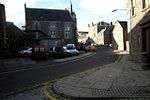 | |||
| 3 Little Causeway | 56°38′37″N 2°53′21″W | Category B | 31522 | | |||
| 5 Little Causeway | 56°38′36″N 2°53′23″W | Category C(S) | 31524 | | |||
| 23-33 Castle Street Royal Hotel | 56°38′41″N 2°53′22″W | Category C(S) | 31547 | | |||
| 10-14 Castle Street 'The Strangers' Inn' | 56°38′41″N 2°53′17″W | Category C(S) | 31552 | | |||
| 16-22 Castle Street | 56°38′41″N 2°53′17″W | Category C(S) | 31553 | | |||
| Garden Walls, Annfield House, Off Manor Street | 56°38′43″N 2°53′26″W | Category B | 31559 | | |||
| Chapel Park Primary School (Former Academy) Academy Street And High Street, Main Building | 56°38′41″N 2°53′00″W | Category B | 31562 | | |||
| 21, 23 Academy Street | 56°38′37″N 2°53′03″W | Category C(S) | 31565 | | |||
| 2 Sparrowcroft | 56°38′36″N 2°53′13″W | Category C(S) | 31572 | | |||
| Ravenswood (Original House Only) New Road | 56°38′31″N 2°53′23″W | Category C(S) | 31579 | | |||
| 22-26 Dundee Loan | 56°38′29″N 2°53′38″W | Category C(S) | 31586 | | |||
| 2-10 Western Sunnyside | 56°38′26″N 2°53′37″W | Category C(S) | 31593 | | |||
| Lowson Memorial Parish Church Jamieson Street | 56°38′48″N 2°52′27″W | Category A | 31604 | 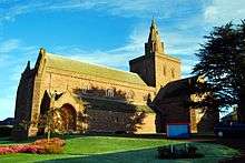 | |||
| Sheriff Court House, County Buildings, Market Street And Brechin Road | 56°39′00″N 2°53′14″W | Category B | 31609 | | |||
| 2 East High Street | 56°38′39″N 2°53′17″W | Category B | 31484 | | |||
| 4-8 East High Street | 56°38′39″N 2°53′16″W | Category C(S) | 31485 | | |||
| 50 High Street 3, 5, 7, 9 Albion Place | 56°38′39″N 2°53′10″W | Category C(S) | 31491 | | |||
| 74-82 East High Street | 56°38′40″N 2°53′06″W | Category B | 31494 | | |||
| Queen's Hotel 12, 14 Cross | 56°38′38″N 2°53′19″W | Category C(S) | 31500 | | |||
| 4-10 West High Street | 56°38′39″N 2°53′23″W | Category C(S) | 31501 | | |||
| 11, 13 West High Street And 27 Little Causeway | 56°38′38″N 2°53′22″W | Category B | 31508 | | |||
| Lour - Steading And Stables | 56°36′19″N 2°51′08″W | Category B | 11371 | | |||
| Inchgarth Farmhouse | 56°38′48″N 2°54′48″W | Category B | 11390 | | |||
| 37, 39 West High Street | 56°38′36″N 2°53′26″W | Category C(S) | 31515 | | |||
| 4 Little Causeway | 56°38′37″N 2°53′22″W | Category B | 31523 | | |||
| 19-21 Osnaburg Street | 56°38′38″N 2°53′16″W | Category C(S) | 31538 | | |||
| 23 Manor Street Manor Place, Including Fountain Garden Walls And Steps | 56°38′43″N 2°53′30″W | Category B | 31560 | | |||
| Chapelpark Primary School (Former Academy) Academy Street, Western Block | 56°38′39″N 2°53′04″W | Category B | 31563 | 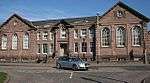 | |||
| 27-35 Dundee Loan | 56°38′28″N 2°53′37″W | Category C(S) | 31582 | | |||
| 18 Dundee Loan | 56°38′29″N 2°53′38″W | Category C(S) | 31585 | | |||
| 42-44 Dundee Loan | 56°38′27″N 2°53′37″W | Category C(S) | 31591 | | |||
| 11, 13 Eastern Sunnyside | 56°38′26″N 2°53′32″W | Category C(S) | 31601 | | |||
| Lowson Memorial Parish Church Hall Jamieson Street | 56°38′47″N 2°52′25″W | Category B | 31605 | | |||
| 1-3 East High Street And 2 Castle Street | 56°38′40″N 2°53′17″W | Category C(S) | 31481 | | |||
| St. John's Episcopal Church 71 East High Street | 56°38′42″N 2°53′07″W | Category B | 31483 | 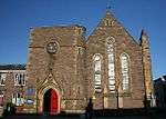 | |||
| 100, 102 East High Street | 56°38′41″N 2°53′03″W | Category B | 31495 | | |||
| 8-11 Cross | 56°38′39″N 2°53′19″W | Category C(S) | 31499 | | |||
| 12-16 West High Street | 56°38′39″N 2°53′21″W | Category C(S) | 31502 | | |||
| Lour - Temple | 56°36′17″N 2°51′41″W | Category B | 13749 | | |||
| Burnside Road Bridge Over Knowehead Burn | 56°38′01″N 2°50′46″W | Category C(S) | 11393 | | |||
| Burnside Road Bridge Over Auchterforfar Burn | 56°38′25″N 2°50′39″W | Category C(S) | 11394 | | |||
| South Street, Former Linen Works, Office Building With Italianate Tower | 56°38′40″N 2°52′41″W | Category C(S) | 51659 | | |||
| 23-27 West High Street | 56°38′37″N 2°53′24″W | Category C(S) | 31511 | | |||
| 7 (8) Little Causeway | 56°38′36″N 2°53′23″W | Category B | 31525 | | |||
| 11 Little Causeway | 56°38′36″N 2°53′24″W | Category C(S) | 31527 | | |||
| 2, 4 Osnaburg Street | 56°38′39″N 2°53′17″W | Category C(S) | 31540 | | |||
| 7, 9 Castle Street The County Hotel | 56°38′40″N 2°53′21″W | Category B | 31544 | | |||
| 13, 15 Castle Street | 56°38′40″N 2°53′20″W | Category C(S) | 31545 | | |||
| 3 Sparrowcroft | 56°38′36″N 2°53′12″W | Category C(S) | 31573 | | |||
| 4 Sparrowcroft | 56°38′36″N 2°53′11″W | Category C(S) | 31574 | | |||
| 14 Dundee Loan | 56°38′29″N 2°53′38″W | Category C(S) | 31584 | | |||
| 36 Dundee Loan | 56°38′28″N 2°53′38″W | Category C(S) | 31588 | | |||
| 58-62 Dundee Loan | 56°38′26″N 2°53′37″W | Category C(S) | 31592 | | |||
| 1 Eastern Sunnyside And 41 Dundee Loan | 56°38′26″N 2°53′35″W | Category C(S) | 31596 | | |||
| 9 Eastern Sunnyside | 56°38′26″N 2°53′33″W | Category C(S) | 31600 | | |||
| 15, 17 Eastern Sunnyside | 56°38′26″N 2°53′32″W | Category C(S) | 31602 | | |||
| Monument To Sir Robert Peel, Newmont Hill | 56°38′32″N 2°52′52″W | Category B | 31607 | | |||
| War Memorial, Balmashanner Hill | 56°37′57″N 2°53′09″W | Category C(S) | 31608 | 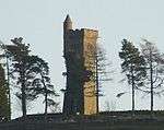 | |||
| 50 High Street (County Assessor's) | 56°38′40″N 2°53′10″W | Category B | 31492 | | |||
| British Linen Bank, Cross | 56°38′39″N 2°53′17″W | Category B | 31497 | | |||
| Meffan Institute, 20 West High Street | 56°38′39″N 2°53′22″W | Category C(S) | 31503 | | |||
| Lour - Sundial | 56°36′17″N 2°51′07″W | Category B | 11373 | | |||
| Orchardbank House Including Boundary Walls And Pedestrian Gate | 56°38′25″N 2°54′51″W | Category B | 11391 | | |||
| Craignathro Farm Cottages | 56°37′30″N 2°52′50″W | Category C(S) | 11395 | | |||
| Reid Park Bar 39 West High Street And 19 Little Causeway | 56°38′36″N 2°53′26″W | Category B | 31516 | | |||
| 20 Little Causeway | 56°38′36″N 2°53′25″W | Category C(S) | 31530 | | |||
| 24 Little Causeway | 56°38′37″N 2°53′24″W | Category C(S) | 31534 | | |||
| 3-9 Osnaburg Street | 56°38′39″N 2°53′17″W | Category C(S) | 31535 | | |||
| 13-17 Osnaburg Street | 56°38′38″N 2°53′16″W | Category C(S) | 31537 | | |||
| 35-39 Castle Street | 56°38′42″N 2°53′20″W | Category C(S) | 31548 | | |||
| Clydesdale Bank Buildings Castle Street | 56°38′44″N 2°53′22″W | Category C(S) | 31549 | | |||
| 75 Castle Street Eastern House Including Garden Walls | 56°38′44″N 2°53′24″W | Category C(S) | 31550 | | |||
| 28-36 Castle Street | 56°38′42″N 2°53′18″W | Category B | 31555 | | |||
| 10 Manor Street Old Parish Kirk Manse, Now Manor Guest House | 56°38′45″N 2°53′24″W | Category C(S) | 31558 | | |||
| 1 Sparrowcroft | 56°38′36″N 2°53′13″W | Category C(S) | 31571 | | |||
| 10 Dundee Loan | 56°38′30″N 2°53′38″W | Category C(S) | 31583 | | |||
| 38 Dundee Loan | 56°38′27″N 2°53′38″W | Category C(S) | 31589 | | |||
| 40 Dundee Loan | 56°38′27″N 2°53′38″W | Category C(S) | 31590 | | |||
| 5 Eastern Sunnyside | 56°38′26″N 2°53′34″W | Category C(S) | 31598 | | |||
| Bankhead Farm And Cottage | 56°39′02″N 2°53′43″W | Category B | 31612 | | |||
| Castle Street, 2 K6 Telephone Kiosks | 56°38′41″N 2°53′19″W | Category B | 31613 | | |||
| Forfar Parish Churchyard East High Street | 56°38′38″N 2°53′12″W | Category C(S) | 31480 | | |||
| 16, 18 East High Street | 56°38′39″N 2°53′15″W | Category C(S) | 31488 | | |||
| George Milne's 50 East High Street And 1 Albion Place | 56°38′39″N 2°53′10″W | Category B | 31490 | | |||
| 1-5 West High Street | 56°38′38″N 2°53′21″W | Category C(S) | 31506 | | |||
| Balmashanner Farmhouse | 56°37′44″N 2°52′47″W | Category B | 13751 | | |||
| Prior House | 56°39′14″N 2°50′53″W | Category B | 11387 | | |||
| East Mains Farmhouse | 56°36′23″N 2°49′28″W | Category C(S) | 11396 | | |||
| 49, 51 West High Street | 56°38′35″N 2°53′27″W | Category C(S) | 31518 | | |||
| 53 West High Street | 56°38′35″N 2°53′27″W | Category C(S) | 31519 | | |||
| 9, 10 Little Causeway | 56°38′36″N 2°53′23″W | Category C(S) | 31526 | | |||
| 23 Little Causeway | 56°38′37″N 2°53′24″W | Category C(S) | 31533 | | |||
| 11 Osnaburg Street | 56°38′39″N 2°53′16″W | Category C(S) | 31536 | | |||
| Municipal Buildings Castle Street | 56°38′41″N 2°53′19″W | Category A | 31542 | 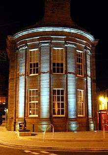 | |||
| 1-5 Castle Street And 2 West High Street ('Pool's Corner') | 56°38′39″N 2°53′20″W | Category B | 31543 | | |||
| 17-21 Castle Street | 56°38′40″N 2°53′20″W | Category C(S) | 31546 | | |||
| St. James's Road School (Old South School) | 56°38′28″N 2°53′14″W | Category B | 31567 | | |||
| Farr Lodge, St. James's Road | 56°38′35″N 2°53′11″W | Category C(S) | 31570 | | |||
| 5 Sparrowcroft | 56°38′36″N 2°53′11″W | Category C(S) | 31575 | | |||
| County Offices, Market Street (Original Section Only) | 56°39′00″N 2°53′12″W | Category C(S) | 31610 | | |||
| 50 High Street, Southern Building On East Side Of Albion Place | 56°38′40″N 2°53′10″W | Category B | 31493 | | |||
| 7, 9 West High Street | 56°38′38″N 2°53′21″W | Category C(S) | 31507 | | |||
| Auchterforfar Bridge Over Auchterforfar Burn | 56°38′12″N 2°50′53″W | Category C(S) | 11388 | | |||
| 45, 47 West High Street And Little Causeway | 56°38′36″N 2°53′27″W | Category C(S) | 31517 | | |||
| 14 (Formerly 17, 18) Little Causeway | 56°38′36″N 2°53′25″W | Category C(S) | 31528 | | |||
| 15 Little Causeway And 2 New Road | 56°38′35″N 2°53′21″W | Category C(S) | 31529 | | |||
| 23 Osnaburg Street, Osnaburg Bar With J.B. Dawes And Unionist Committee Rooms Building On Chapel Street | 56°38′38″N 2°53′16″W | Category B | 31539 | | |||
| Congregational Chapel 6 Osnaburg Street | 56°38′38″N 2°53′17″W | Category C(S) | 31541 | 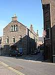 | |||
| 76 Castle Street Western House Including Garden Walls | 56°38′44″N 2°53′25″W | Category B | 31551 | | |||
| 24, 26 Castle Street | 56°38′42″N 2°53′18″W | Category C(S) | 31554 | | |||
| Burgh Cross, Castlehill | 56°38′40″N 2°53′18″W | Category B | 31556 | | |||
| 13 Couttie's Wynd Including Garden Walls | 56°38′39″N 2°53′06″W | Category B | 31566 | | |||
| St. James's Church Of Scotland. St. James's Road | 56°38′37″N 2°53′05″W | Category B | 31568 | 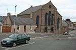 | |||
| 6 And Former 7 Sparrowcroft | 56°38′36″N 2°53′10″W | Category C(S) | 31576 | | |||
| 8 Sparrowcroft | 56°38′36″N 2°53′09″W | Category C(S) | 31577 | | |||
| 9 Sparrowcroft | 56°38′36″N 2°53′08″W | Category C(S) | 31578 | | |||
| Wash House, Western Sunnyside | 56°38′26″N 2°53′37″W | Category C(S) | 31595 | | |||
| Briar, Glamis Road | 56°38′23″N 2°54′00″W | Category B | 31603 | | |||
| Forfar Parish Church East High Street | 56°38′39″N 2°53′12″W | Category B | 31479 | 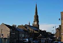 | |||
| 10 East High Street With Close To 12 | 56°38′39″N 2°53′16″W | Category C(S) | 31486 | | |||
| 20-26 East High Street | 56°38′39″N 2°53′15″W | Category C(S) | 31489 | | |||
| Forfar Town And County Hall, Cross | 56°38′40″N 2°53′19″W | Category B | 31496 | | |||
| 44-48 West High Street | 56°38′38″N 2°53′25″W | Category C(S) | 31505 | | |||
| Restenneth Priory | 56°39′12″N 2°50′46″W | Category A | 11386 | | |||
| "Boley Bridge" Over Greenmire Burn | 56°36′27″N 2°48′57″W | Category B | 11397 | | |||
| 95 Glamis Road, Langlands, Including Offices, Boundary Walls, Gatepiers And Gates | 56°38′23″N 2°54′04″W | Category B | 46515 | | |||
| Ingleside (Old Secession Manse) East High Street | 56°38′47″N 2°52′44″W | Category B | 47326 | | |||
| 19-21 West High Street | 56°38′37″N 2°53′24″W | Category C(S) | 31510 | | |||
| 21 Little Causeway | 56°38′37″N 2°53′25″W | Category C(S) | 31531 | | |||
| 2, 4, 6 Manor Street | 56°38′45″N 2°53′23″W | Category C(S) | 31557 | | |||
| 7-11 Dundee Loan | 56°38′29″N 2°53′37″W | Category C(S) | 31580 | | |||
| 13-25 Dundee Loan | 56°38′29″N 2°53′36″W | Category C(S) | 31581 | | |||
| 7 Eastern Sunnyside | 56°38′26″N 2°53′33″W | Category C(S) | 31599 | | |||
| 17, 19 East High Street | 56°38′40″N 2°53′15″W | Category B | 31482 | | |||
| Royal Bank Of Scotland, 6, 7 Cross | 56°38′39″N 2°53′18″W | Category C(S) | 31498 | | |||
| 15, 17 West High Street And 25, 26 Little Causeway | 56°38′37″N 2°53′23″W | Category C(S) | 31509 | | |||
| Lour - Garden House | 56°36′19″N 2°51′03″W | Category B | 11372 | | |||
| Railway Bridge Kas/200, By A926, At Turfbeg | 56°39′13″N 2°54′29″W | Category B | 45983 | | |||
| 3 New Road With Boundary Walls | 56°38′35″N 2°53′24″W | Category C(S) | 44181 | | |||
| 31, 33 West High Street | 56°38′37″N 2°53′25″W | Category C(S) | 31513 | | |||
| 1 Little Causeway | 56°38′37″N 2°53′20″W | Category C(S) | 31521 | | |||
| 22 Little Causeway | 56°38′37″N 2°53′24″W | Category C(S) | 31532 | | |||
| Manor Street, Manor Works, East Block | 56°38′41″N 2°53′34″W | Category B | 31561 | | |||
| 19 Academy Street | 56°38′38″N 2°53′03″W | Category C(S) | 31564 | | |||
| 2, 4 St. James's Road | 56°38′37″N 2°53′07″W | Category C(S) | 31569 | | |||
| 28-34 Dundee Loan | 56°38′28″N 2°53′38″W | Category C(S) | 31587 | | |||
| 3 Eastern Sunnyside | 56°38′26″N 2°53′35″W | Category C(S) | 31597 | | |||
| Lowson Memorial Parish Church, Manse, Jamieson Street And Lilybank Crescent | 56°38′46″N 2°52′26″W | Category C(S) | 31606 | | |||
| Bankhead House | 56°39′01″N 2°53′44″W | Category B | 31611 | | |||
| 14 East High Street | 56°38′39″N 2°53′16″W | Category C(S) | 31487 | | |||
| 22-26 West High Street | 56°38′38″N 2°53′23″W | Category C(S) | 31504 | | |||
| Lour - Doocot | 56°36′18″N 2°51′16″W | Category B | 11374 | | |||
| Campbeltown Old Tollhouse | 56°39′12″N 2°54′44″W | Category C(S) | 11389 | | |||
| Lour House Including Garden Walls | 56°36′17″N 2°51′05″W | Category B | 11398 | | |||
| Wellbrae Primary School, Wellbraehead | 56°38′49″N 2°53′04″W | Category C(S) | 50236 | |
Key
The scheme for classifying buildings in Scotland is:
- Category A: "buildings of national or international importance, either architectural or historic; or fine, little-altered examples of some particular period, style or building type."[1]
- Category B: "buildings of regional or more than local importance; or major examples of some particular period, style or building type, which may have been altered."[1]
- Category C: "buildings of local importance; lesser examples of any period, style, or building type, as originally constructed or moderately altered; and simple traditional buildings which group well with other listed buildings."[1]
In March 2016 there were 47,288 listed buildings in Scotland. Of these, 8% were Category A, and 50% were Category B, with the remaining 42% being Category C.[2]
gollark: Alternatively, you could probably cover it in tin foil first, or something like that.
gollark: Surely a competent designer would have made them report it to whoever puts them on if they're removed?
gollark: So yes, the Macron Runtime.
gollark: Also, I disagree with this Macron Runtime spec.
gollark: Oh, is this the Macron Runtime spec?
See also
Notes
- Sometimes known as OSGB36, the grid reference (where provided) is based on the British national grid reference system used by the Ordnance Survey.
• "Guide to National Grid". Ordnance Survey. Retrieved 2007-12-12.
• "Get-a-map". Ordnance Survey. Retrieved 2007-12-17. - Historic Environment Scotland assign a unique alphanumeric identifier to each designated site in Scotland, for listed buildings this always begins with "LB", for example "LB12345".
References
- All entries, addresses and coordinates are based on data from Historic Scotland. This data falls under the Open Government Licence
- "What is Listing?". Historic Environment Scotland. Retrieved 29 May 2018.
- Scotland's Historic Environment Audit 2016 (PDF). Historic Environment Scotland and the Built Environment Forum Scotland. pp. 15–16. Retrieved 29 May 2018.
This article is issued from Wikipedia. The text is licensed under Creative Commons - Attribution - Sharealike. Additional terms may apply for the media files.