List of listed buildings in Edinburgh/20
List
| Name | Location | Date Listed | Grid Ref. [note 1] | Geo-coordinates | Notes | LB Number [note 2] | Image |
|---|---|---|---|---|---|---|---|
| 89 Duke Street, Former Leith Academy Secondary School, Lochend Anexe, With Janitor's House, Play Shelter, Railings And Gateway | 55°58′06″N 3°10′00″W | Category B | 26754 |  | |||
| Commercial Street And Citadel Street, Citadel Youth Club (Former North Leith Station) | 55°58′38″N 3°10′34″W | Category B | 26774 | | |||
| 1-13 (Odd Nos) Bernard Street, 30-34 (Even Nos) Constitution Street, Waterloo Buildings | 55°58′31″N 3°10′01″W | Category B | 26783 | | |||
| Chapel Street, Former Buccleuch Parish Church | 55°56′37″N 3°11′08″W | Category C(S) | 26785 | | |||
| 23, 23A Bath Street | 55°57′13″N 3°06′44″W | Category C(S) | 26793 | | |||
| Addistoun House With Garden Walls, Archway, Terrace, Walled Garden, Garden House And Wallhead | 55°54′37″N 3°21′10″W | Category B | 26710 | | |||
| 3 Bath Street Royal Hotel | 55°57′10″N 3°06′50″W | Category C(S) | 26715 | | |||
| Addistoun Lodge | 55°54′39″N 3°21′09″W | Category C(S) | 26723 | | |||
| Almondhill Farmhouse | 55°57′33″N 3°23′46″W | Category C(S) | 26736 | | |||
| 22-24 (Even Nos) Bonnington Grove With Boundary Wall; Eh6 4Bl | 55°58′22″N 3°11′25″W | Category B | 26696 | | |||
| 1 Abercorn Public Park Memorial | 55°57′03″N 3°06′22″W | Category C(S) | 26698 | | |||
| Dalmeny Village, K6 Telephone Kiosk | 55°58′54″N 3°22′27″W | Category B | 6629 | | |||
| Baberton House, Sundial | 55°54′32″N 3°17′43″W | Category B | 6130 | | |||
| Westfield Steading And Cottages | 55°58′32″N 3°26′05″W | Category C(S) | 5524 | | |||
| Dalmeny Village, 10 Main Street | 55°58′54″N 3°22′25″W | Category C(S) | 5539 | | |||
| Easter Dalmeny Farmhouse | 55°59′02″N 3°21′52″W | Category C(S) | 5544 | | |||
| Dalmeny House, Walled Garden With Greenhouses | 55°59′13″N 3°20′37″W | Category B | 5550 | | |||
| Dalmeny House, East Craigie Farmhouse, Including Shell House | 55°58′20″N 3°18′55″W | Category B | 5564 | | |||
| Dalmeny Village, 20 Main Street, Dalmeny Kirk, St Cuthbert's, Church Of Scotland, Including Churchyard | 55°58′58″N 3°22′21″W | Category A | 5570 | | |||
| Dalmeny House, Chapel Gate Lodge | 55°59′04″N 3°21′31″W | Category B | 5503 | | |||
| Newgardens, Bee Bole Wall | 55°59′14″N 3°22′35″W | Category B | 5522 | | |||
| 1 And 3 Crewe Road North, Gec Marconi Avionics Radar Systems Division, Laboratory Block, Including Gateways And Gatehouse | 55°58′08″N 3°14′15″W | Category B | 45791 | | |||
| 24A Pennywell Road, The Old Kirk Of Edinburgh | 55°58′13″N 3°15′00″W | Category C(S) | 45798 | | |||
| 17 Broughton Place And 16-18A (Even Nos) Hart Street | 55°57′31″N 3°11′19″W | Category B | 45925 | | |||
| 103 Broughton Street, Stafford Centre, Including Boundary Walls | 55°57′32″N 3°11′24″W | Category C(S) | 45933 | | |||
| 22 Claremont Crescent And 91 East Claremont Street | 55°57′51″N 3°11′27″W | Category A | 45936 | | |||
| 29 Forth Street And 12 Union Street | 55°57′28″N 3°11′10″W | Category B | 45949 | | |||
| 35-41 (Odd Nos) Barony Street | 55°57′28″N 3°11′31″W | Category C(S) | 46116 | | |||
| 41 And 43 Cluny Gardens | 55°55′31″N 3°12′09″W | Category B | 46293 | | |||
| 11, 13 And 15 Lennox Row | 55°58′39″N 3°12′28″W | Category C(S) | 46737 | | |||
| Lennox Row, Bridge Over Railway | 55°58′41″N 3°12′15″W | Category B | 46738 | | |||
| 27 Primrose Bank Road, With Boundary Wall And Gatepiers | 55°58′44″N 3°12′38″W | Category C(S) | 46740 | | |||
| 8 Russell Place, With Boundary Wall | 55°58′36″N 3°12′16″W | Category C(S) | 46747 | | |||
| 14 York Road, York Lodge, With Conservatory, Boundary Wall And Gatepiers | 55°58′38″N 3°12′10″W | Category C(S) | 46760 | | |||
| 22-30 (Even Nos) Glen Street, Former Sisters' House, School And Hall | 55°56′36″N 3°12′06″W | Category C(S) | 47027 | | |||
| 9-11 (Inclusive Nos) Glengyle Terrace, Including Railings | 55°56′28″N 3°12′08″W | Category C(S) | 47031 | | |||
| 20 George Square | 55°56′37″N 3°11′26″W | Category A | 47584 | 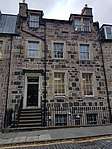 | |||
| 63-65 (Odd Nos) Shandwick Place | 55°56′57″N 3°12′35″W | Category C(S) | 47730 | | |||
| 3-9 (Odd Nos) Torphichen Place, Police Station | 55°56′48″N 3°12′50″W | Category C(S) | 47732 | | |||
| 13 East Terrace, Laburnum House | 55°59′22″N 3°23′38″W | Category B | 47774 | | |||
| 1 And 2 High Street And 3 Bellstane | 55°59′27″N 3°23′51″W | Category C(S) | 47779 | | |||
| 26-44 (Even Nos) Home Street, 1 And 3 Lochrin Terrace And 2-6 (Even Nos) Lochrin Place Including Cameo Cinema | 55°56′35″N 3°12′15″W | Category B | 47783 | | |||
| 51-61 (Odd Nos) Forrest Road | 55°56′44″N 3°11′30″W | Category C(S) | 47866 | | |||
| 23 Spittal Street | 55°56′48″N 3°12′10″W | Category C(S) | 47899 | | |||
| Victoria Terrace, With Pavement, Railings Lamps And Steps Leading From Victoria Street To Upper Bow | 55°56′55″N 3°11′39″W | Category A | 47901 | 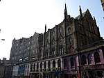 | |||
| 84 -88 (Even Nos) West Bow | 55°56′54″N 3°11′40″W | Category C(S) | 47904 | | |||
| Hamilton Place, 45-50 (Inclusive Nos) Patriothall, Former St Cuthbert's Co-Operative Society Stable Yard, Including Gatepiers | 55°57′31″N 3°12′25″W | Category B | 48104 | | |||
| Edinburgh Castle, Scottish National War Memorial | 55°56′54″N 3°11′59″W | Category A | 48229 | 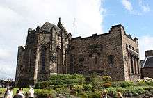 | |||
| 11 Kinellan Road, St Leonards Including Summerhouse | 55°56′55″N 3°15′03″W | Category B | 48891 | | |||
| 1-9 And 9A (Odd Nos) Murrayfield Avenue Including Boundary Walls | 55°56′48″N 3°14′11″W | Category C(S) | 48894 | | |||
| 64 Roseburn Street, Roseburn Primary School, Including Janitor's House, Boundary Walls, Gates, Gatepiers And Railings | 55°56′37″N 3°14′12″W | Category B | 48911 | | |||
| 61 Northfield Broadway, Royal High Primary School, With Boundary Wall, Railings, Janitor's House And Playshed | 55°57′14″N 3°08′25″W | Category B | 49042 | | |||
| North Bridge, South African War Memorial | 55°57′06″N 3°11′17″W | Category A | 49067 |  | |||
| Jeffrey Street, Wall, Vaults, Railings And Pier | 55°57′05″N 3°11′07″W | Category C(S) | 49085 | | |||
| 17 And 19 Union Street Including Railings And Boundary Wall | 55°57′30″N 3°11′10″W | Category B | 49154 | | |||
| 4-8 (Even Nos) Nelson Street, Including Railings And Lamp | 55°57′25″N 3°11′48″W | Category A | 49491 | | |||
| 1 Deanhaugh Street, Pizza Express Building | 55°57′30″N 3°12′32″W | Category B | 49541 | | |||
| 5 And 6 Bonaly Steading, Bonaly Road With Gate Pier | 55°54′07″N 3°15′34″W | Category C(S) | 49546 | | |||
| Dell Road Cemetery, War Memorial | 55°54′30″N 3°15′21″W | Category C(S) | 49561 | | |||
| Dreghorn Loan, Laverockdale Bridge | 55°54′08″N 3°15′01″W | Category C(S) | 49563 | | |||
| 33 And 34 Spylaw Street | 55°54′28″N 3°15′28″W | Category C(S) | 49569 | | |||
| 3 And 5 Woodhall Road, Fairhaven And Kingcraig, With Boundary Walls | 55°54′25″N 3°15′21″W | Category C(S) | 49573 | | |||
| Fettes College, Cricket Pavilion | 55°57′55″N 3°13′29″W | Category B | 49627 | | |||
| 8 Carlton Terrace Including Railings And Boundary Walls | 55°57′23″N 3°10′25″W | Category A | 49750 | | |||
| 17 Carlton Terrace Including Railings And Boundary Walls | 55°57′24″N 3°10′29″W | Category A | 49759 | 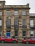 | |||
| 121 Montgomery Street, Calton Centre, Formerly Kirk Memorial Evangelical Union Church Including Boundary Walls And Railings | 55°57′32″N 3°10′22″W | Category C(S) | 49763 | | |||
| 2 Regent Terrace Including Railings And Boundary Walls | 55°57′15″N 3°10′41″W | Category A | 49765 | 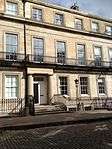 | |||
| 8 Regent Terrace Including Railings And Boundary Walls | 55°57′16″N 3°10′39″W | Category A | 49771 | | |||
| 9 Regent Terrace Including Railings And Boundary Walls | 55°57′16″N 3°10′39″W | Category A | 49772 | | |||
| 10 Regent Terrace Including Railings And Boundary Walls | 55°57′17″N 3°10′38″W | Category A | 49773 | 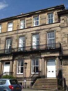 | |||
| 12 Regent Terrace, Including Railings And Boundary Walls | 55°57′17″N 3°10′37″W | Category A | 49775 |  | |||
| 16 Regent Terrace, Including Railings And Boundary Walls | 55°57′17″N 3°10′35″W | Category A | 49779 | 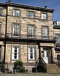 | |||
| 21 Regent Terrace Including Railings And Boundary Walls | 55°57′18″N 3°10′33″W | Category A | 49784 | 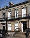 | |||
| 31 Regent Terrace Including Railings And Boundary Walls | 55°57′20″N 3°10′29″W | Category A | 49796 | | |||
| 3 Royal Terrace Including Railings And Boundary Walls | 55°57′24″N 3°10′51″W | Category A | 49801 | | |||
| 5 Royal Terrace Including Railings And Boundary Walls | 55°57′24″N 3°10′50″W | Category A | 49803 | | |||
| 13 Royal Terrace Including Railings And Boundary Walls | 55°57′24″N 3°10′45″W | Category A | 49810 | | |||
| 16-22 (Inclusive Nos) Royal Terrace, Royal Terrace Hotel, Including Railings And Boundary Walls | 55°57′24″N 3°10′43″W | Category A | 49813 | 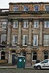 | |||
| 39 Royal Terrace Including Railings And Boundary Walls | 55°57′24″N 3°10′32″W | Category A | 49831 | | |||
| The Pleasance, University Of Edinburgh, Former Quaker Burial Ground | 55°56′51″N 3°10′54″W | Category B | 50195 | | |||
| Nether Liberton, 1 Clapper Lane, Clapperfield | 55°55′26″N 3°09′51″W | Category B | 50794 | | |||
| 15 Montpelier | 55°56′14″N 3°12′35″W | Category C(S) | 50853 | | |||
| 1, 2 And 3 Upper Bow | 55°56′56″N 3°11′39″W | Category C(S) | 51068 | | |||
| Holyroodhouse, Stables | 55°57′08″N 3°10′26″W | Category B | 51178 | 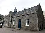 | |||
| Parliament Square, Advocates' Library, Including Wall And Railings | 55°56′56″N 3°11′30″W | Category A | 51179 | | |||
| 96 Inverleith Place | 55°57′54″N 3°13′17″W | Category C(S) | 51319 | | |||
| Craigentinny Road, St Christopher's Church And Hall Including Boundary Walls | 55°57′38″N 3°08′07″W | Category C(S) | 51657 | | |||
| 16 Glenlockhart Road, Glenwood Including Garage, Boundary Walls, Gatepiers And Gates | 55°55′12″N 3°14′12″W | Category B | 51774 | | |||
| 402 Ferry Road (Castleview) And 15 Wardie Avenue (Castlehaven), Including Boundary Walls | 55°58′15″N 3°12′56″W | Category C(S) | 45649 | | |||
| Drummond Place Gardens, Railings And Gate | 55°57′31″N 3°11′43″W | Category B | 45478 | | |||
| Great King Street, K6 Telephone Kiosk | 55°57′28″N 3°11′59″W | Category B | 45480 | | |||
| Heriot Row, At India Street, Police Box | 55°57′17″N 3°12′19″W | Category B | 45484 | | |||
| Baberton House, Walled Garden | 55°54′30″N 3°17′48″W | Category C(S) | 45415 | | |||
| Craigiehall | 55°57′52″N 3°20′11″W | Category A | 45432 | | |||
| 10 Cramond Bridge, Cramond Bridge Farmhouse | 55°57′55″N 3°19′07″W | Category C(S) | 45435 | | |||
| Seafield Street, Eastern General Hospital, Administration Block | 55°58′00″N 3°08′51″W | Category B | 44949 | | |||
| Seafield Street, Eastern General Hospital, Matron's House | 55°58′03″N 3°08′50″W | Category C(S) | 44950 | | |||
| 144 St John's Road And St Ninian's Road, St Ninian's Church Including Boundary Walls, Gatepiers And Gates | 55°56′36″N 3°17′06″W | Category C(S) | 44758 | | |||
| 235 Corstorphine Road Including Boundary Walls And Outbuildings | 55°56′29″N 3°16′21″W | Category B | 44762 | | |||
| Restalrig Road South, St Ninian's Rc School, Including Railings And Boundary Walls | 55°57′39″N 3°09′02″W | Category C(S) | 44629 | | |||
| 47 Regent Street | 55°57′14″N 3°06′38″W | Category C(S) | 44583 | | |||
| Newcraighall, 85, 87 Whitehill Street, Miners Welfare Society | 55°56′07″N 3°05′12″W | Category C(S) | 44605 | | |||
| 4, 4A And 5 Ventnor Terrace, Including Boundary Walls | 55°55′55″N 3°10′15″W | Category C(S) | 44436 | | |||
| 18 West Mayfield, Former Manse To Mayfield Salisbury Church, Including Boundary Walls, Gatepier And Pedestrian Gate | 55°55′59″N 3°10′36″W | Category B | 44439 | | |||
| 2 Burgess Terrace, Including Boundary Walls | 55°56′02″N 3°10′03″W | Category C(S) | 44205 | | |||
| 19 Craigmillar Park, Including Gatepiers And Boundary Walls | 55°55′46″N 3°10′10″W | Category C(S) | 44208 | | |||
| 9 Gordon Terrace, Netherbrae, Including Gatepiers, Boundary Walls And Garage | 55°55′27″N 3°10′05″W | Category B | 44218 | | |||
| 11 Gordon Terrace, South Park, Including Gatepiers And Boundary Walls | 55°55′23″N 3°10′05″W | Category B | 44220 | | |||
| Mayfield Road And West Mains Road, University Of Edinburgh, King's Buildings, Joseph Black Chemistry Building | 55°55′25″N 3°10′34″W | Category B | 44228 | | |||
| 3 Mayfield Terrace, Including Boundary Walls | 55°56′07″N 3°10′21″W | Category C(S) | 44232 | | |||
| 5 And 7 Mayfield Terrace, Including Boundary Walls And Pedestrian Gates | 55°56′06″N 3°10′20″W | Category C(S) | 44233 | | |||
| 3 And 3A Queens Crescent, Including Boundary Walls | 55°56′02″N 3°10′20″W | Category C(S) | 44252 | | |||
| 19B Queens Crescent, Waverley Lodge, Including Boundary Walls And Carriage Gate | 55°56′04″N 3°10′05″W | Category C(S) | 44253 | | |||
| 16 Queens Crescent, Including Boundary Walls | 55°56′03″N 3°10′11″W | Category C(S) | 44254 | | |||
| 102 Whitehouse Road, Including Outbuilding And Boundary Wall | 55°58′15″N 3°18′28″W | Category C(S) | 43942 | | |||
| 79 Lauriston Place, Simpson's Hotel, Including Boundary Wall And Railings | 55°56′40″N 3°12′03″W | Category C(S) | 44033 | | |||
| Balgreen Road, The Wheatsheaf Including Gatepiers And Boundary Walls | 55°56′03″N 3°14′45″W | Category B | 44034 | 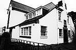 | |||
| 22 Cammo Crescent, Including Gatepiers And Boundary Wall | 55°57′39″N 3°18′37″W | Category C(S) | 43934 | | |||
| 61 Gamekeeper's Road, Winton Hall, Including Boundary Wall And Gatepiers | 55°58′09″N 3°18′24″W | Category C(S) | 43938 | | |||
| 3 And 4 Great Michael Close | 55°58′50″N 3°11′37″W | Category C(S) | 43697 | | |||
| 62 Newhaven Main Street | 55°58′50″N 3°11′51″W | Category B | 43709 | | |||
| 1-19 (Odd Nos) New Lane, Newhaven | 55°58′47″N 3°11′26″W | Category B | 43710 | | |||
| 12 Park Road, Newhaven, Including Gatepiers And Boundary Walls | 55°58′47″N 3°11′41″W | Category B | 43720 | | |||
| 1 Wester Close | 55°58′50″N 3°11′42″W | Category C(S) | 43727 | | |||
| 7 And 8 Wester Close | 55°58′50″N 3°11′43″W | Category C(S) | 43730 | | |||
| 6 And 8 Hill Street | 55°57′12″N 3°12′07″W | Category A | 43299 | | |||
| 18 And 20 Hill Street | 55°57′12″N 3°12′09″W | Category A | 43303 | | |||
| 24 And 25 Princes Street | 55°57′11″N 3°11′28″W | Category B | 43315 | | |||
| 74-75 Princes Street | 55°57′08″N 3°11′46″W | Category B | 43318 | | |||
| 159, 161 And 161A Rose Street | 55°57′05″N 3°12′18″W | Category B | 43334 |  | |||
| 178-182 (Even Nos) Rose Street | 55°57′05″N 3°12′15″W | Category B | 43341 | | |||
| Thistle Street, 3 And 4 Thistle Court With Lamp Brackets, Boundary Walls, Gates And Railings | 55°57′16″N 3°11′46″W | Category A | 43351 |  | |||
| 5-15 (Odd Nos) Thistle Street | 55°57′17″N 3°11′46″W | Category C(S) | 43354 | | |||
| 27 Thistle Street, Napier House | 55°57′15″N 3°11′55″W | Category C(S) | 43355 | | |||
| 51-55 (Odd Nos) Thistle Street | 55°57′15″N 3°11′59″W | Category B | 43360 | | |||
| 37 Young Street Lane North | 55°57′12″N 3°12′18″W | Category C(S) | 43370 | | |||
| 85 Kirkbrae | 55°54′49″N 3°09′36″W | Category C(S) | 43245 | | |||
| Gilmerton, The Drum, Gardeners' Cottages | 55°54′29″N 3°07′21″W | Category C(S) | 43252 | | |||
| 35 And 35A Marine Drive, Muirhouse Stables | 55°58′39″N 3°15′51″W | Category B | 43276 | | |||
| 213 And 215 (Odd Nos) Causewayside | 55°56′07″N 3°10′45″W | Category B | 43147 |  | |||
| 5-9 (Odd Nos) East Preston Street | 55°56′21″N 3°10′41″W | Category C(S) | 43152 | | |||
| 11-15 (Odd Nos) East Preston Street | 55°56′21″N 3°10′40″W | Category C(S) | 43153 | | |||
| 9 Peffermill Road, Prestonfield Primary School | 55°55′51″N 3°09′30″W | Category B | 43163 | | |||
| 6 And 8 Priestfield Road (Dunedin Guest House) | 55°56′07″N 3°10′03″W | Category C(S) | 43168 | | |||
| 19 High Street | 55°59′25″N 3°23′47″W | Category B | 40377 | | |||
| 41 - 51(Inclusive Numbers) High Street, Including Terrace And Railings Above | 55°59′23″N 3°23′38″W | Category B | 40387 | | |||
| 41 Station Road, Rosshill Including Boundary Walls | 55°59′15″N 3°23′02″W | Category B | 40401 | | |||
| 12 And 13 West Terrace | 55°59′24″N 3°23′47″W | Category B | 40406 | | |||
| 14 West Terrace | 55°59′24″N 3°23′47″W | Category C(S) | 40407 | | |||
| East Terrace, Forbes Gardens | 55°59′22″N 3°23′39″W | Category C(S) | 40345 | |
Key
The scheme for classifying buildings in Scotland is:
- Category A: "buildings of national or international importance, either architectural or historic; or fine, little-altered examples of some particular period, style or building type."[1]
- Category B: "buildings of regional or more than local importance; or major examples of some particular period, style or building type, which may have been altered."[1]
- Category C: "buildings of local importance; lesser examples of any period, style, or building type, as originally constructed or moderately altered; and simple traditional buildings which group well with other listed buildings."[1]
In March 2016 there were 47,288 listed buildings in Scotland. Of these, 8% were Category A, and 50% were Category B, with the remaining 42% being Category C.[2]
Notes
- Sometimes known as OSGB36, the grid reference (where provided) is based on the British national grid reference system used by the Ordnance Survey.
• "Guide to National Grid". Ordnance Survey. Retrieved 12 December 2007.
• "Get-a-map". Ordnance Survey. Retrieved 17 December 2007. - Historic Environment Scotland assign a unique alphanumeric identifier to each designated site in Scotland, for listed buildings this always begins with "LB", for example "LB12345".
References
- All entries, addresses and coordinates are based on data from Historic Scotland. This data falls under the Open Government Licence
- "What is Listing?". Historic Environment Scotland. Retrieved 29 May 2018.
- Scotland's Historic Environment Audit 2016 (PDF). Historic Environment Scotland and the Built Environment Forum Scotland. pp. 15–16. Retrieved 29 May 2018.
This article is issued from Wikipedia. The text is licensed under Creative Commons - Attribution - Sharealike. Additional terms may apply for the media files.