List of listed buildings in Cameron, Fife
List
| Name | Location | Date Listed | Grid Ref. [note 1] | Geo-coordinates | Notes | LB Number [note 2] | Image |
|---|---|---|---|---|---|---|---|
| Peat Inn Braeside Cottages | 56°16′30″N 2°53′09″W | Category B | 6711 |  | |||
| Prior Letham Farmhouse | 56°18′14″N 2°48′50″W | Category C(S) | 2668 | | |||
| Prior Letham Smithy | 56°18′23″N 2°49′29″W | Category C(S) | 2670 | | |||
| Cameron Farm Cottages | 56°17′40″N 2°51′13″W | Category C(S) | 2683 | | |||
| Kinaldy Farm Cottages | 56°17′07″N 2°47′53″W | Category C(S) | 2703 | | |||
| Lathockar Farm Cottage And Store | 56°17′19″N 2°49′15″W | Category C(S) | 2706 | | |||
| Cameron Parish Church | 56°17′40″N 2°50′04″W | Category B | 142 | | |||
| Greigston House Dovecot | 56°17′18″N 2°53′44″W | Category C(S) | 145 | | |||
| Peat Inn Old Police Station | 56°16′34″N 2°53′05″W | Category C(S) | 2666 | | |||
| Greigston House East End Of West Range Of Steading | 56°17′21″N 2°53′37″W | Category C(S) | 2697 | | |||
| Craigtoun Park Island Buildings | 56°19′00″N 2°50′22″W | Category C(S) | 2646 | 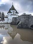 | |||
| Denork Cottage | 56°18′50″N 2°53′01″W | Category C(S) | 2652 | | |||
| Feddinch House | 56°18′39″N 2°50′02″W | Category C(S) | 144 | | |||
| Melville Home Farm Cottage | 56°19′11″N 2°50′17″W | Category C(S) | 2665 | | |||
| Bridgetoun Bridge | 56°17′53″N 2°47′24″W | Category B | 2676 | | |||
| Cameron School And Schoolhouse, Now Student Voluntary Service Building | 56°17′35″N 2°49′50″W | Category C(S) | 2681 | | |||
| Carngour Farmhouse | 56°18′13″N 2°46′38″W | Category B | 2684 | | |||
| Carngour Steading | 56°18′14″N 2°46′33″W | Category C(S) | 2685 | | |||
| Feddinch Steading And Cottage | 56°18′39″N 2°49′54″W | Category C(S) | 2694 | | |||
| Kinaldy House Dovecot | 56°17′03″N 2°47′31″W | Category B | 2702 | | |||
| Craigtoun Hospital | 56°19′09″N 2°50′31″W | Category B | 2644 | | |||
| Craigtoun Park Gatepiers On Cypress Avenue | 56°19′06″N 2°50′26″W | Category B | 2647 | | |||
| Cameron Farmhouse | 56°17′39″N 2°51′04″W | Category B | 143 | | |||
| Mount Melville House, Former Stables | 56°19′21″N 2°50′14″W | Category B | 4335 | | |||
| Denork House | 56°18′50″N 2°53′02″W | Category B | 2653 | | |||
| Peat Inn | 56°16′42″N 2°53′05″W | Category C(S) | 2667 | | |||
| Cameron Parish Churchyard | 56°17′39″N 2°50′04″W | Category B | 2677 | | |||
| Cameron House | 56°17′42″N 2°50′03″W | Category C(S) | 2678 | | |||
| Cameron House (Walled Garden) | 56°17′41″N 2°50′04″W | Category C(S) | 2679 | | |||
| Cottages At Kinaldy House Offices | 56°17′00″N 2°47′34″W | Category C(S) | 2701 | | |||
| Kinaldy Farmhouse And Steading | 56°17′10″N 2°47′53″W | Category B | 6710 | | |||
| Prior Letham Steading (Modern Additions Excluded) | 56°18′15″N 2°48′49″W | Category C(S) | 2669 | | |||
| Drumcarro Steading | 56°18′19″N 2°53′09″W | Category B | 2692 | | |||
| Drumhead Farmhouse Peat Inn | 56°16′48″N 2°52′54″W | Category B | 2693 | | |||
| Kinaldy House | 56°17′02″N 2°47′22″W | Category B | 2699 | | |||
| Kinaldy House Offices (Front Section Only) | 56°17′00″N 2°47′33″W | Category C(S) | 2700 | | |||
| Lathockar Steading | 56°17′20″N 2°49′15″W | Category C(S) | 2705 | | |||
| Craigtoun Park Archway At North End Of Cypress Avenue | 56°19′06″N 2°50′27″W | Category B | 2648 | | |||
| Craigtoun Park Walled Garden (Former Orchard) | 56°19′02″N 2°50′15″W | Category C(S) | 2650 | | |||
| Craigtoun Park Formal Garden | 56°19′09″N 2°50′20″W | Category B | 139 | | |||
| Denork House Cottage At Offices | 56°18′48″N 2°52′51″W | Category C(S) | 2655 | | |||
| Lathockar Mains Farmhouse | 56°16′29″N 2°49′38″W | Category C(S) | 2663 | | |||
| Mount Melville Home Farm Steading | 56°19′11″N 2°50′15″W | Category B | 2664 | | |||
| Winthank Farmhouse | 56°18′30″N 2°50′43″W | Category C(S) | 2671 | | |||
| Cameron Steading (Old Part Only) | 56°17′40″N 2°51′07″W | Category C(S) | 2682 | | |||
| Denork House Offices | 56°18′48″N 2°52′51″W | Category C(S) | 2690 | | |||
| Feddinch Mains Farmhouse | 56°18′53″N 2°49′40″W | Category B | 2695 | | |||
| Feddinch Mains Farm Cottages | 56°18′51″N 2°49′21″W | Category C(S) | 2696 | | |||
| Carngour Farm Cottages | 56°18′14″N 2°46′30″W | Category C(S) | 2641 | | |||
| Craigtoun Hospital Sundial | 56°19′09″N 2°50′32″W | Category B | 2645 | | |||
| Cameron Manse | 56°17′42″N 2°50′06″W | Category C(S) | 2680 | | |||
| Lathockar Farmhouse | 56°17′19″N 2°49′17″W | Category C(S) | 2704 | | |||
| Craigtoun Park Italian Wellhead On Cypress Avenue | 56°19′04″N 2°50′23″W | Category C(S) | 2649 | | |||
| Craigtoun Park Cottage At Walled Garden | 56°19′03″N 2°50′13″W | Category B | 2651 | | |||
| Mount Melville Home Farm Dovecot | 56°19′13″N 2°50′22″W | Category C(S) | 141 | | |||
| Greigston House | 56°17′21″N 2°53′40″W | Category B | 6709 | | |||
| Denork House Walled Garden At Offices | 56°18′48″N 2°52′52″W | Category C(S) | 2654 | | |||
| Drumcarro Farmhouse | 56°18′18″N 2°53′05″W | Category C(S) | 2691 | | |||
| Hazel Cottage | 56°17′27″N 2°49′47″W | Category C(S) | 2698 | | |||
| Cassindonald Farmhouse | 56°17′58″N 2°52′00″W | Category B | 2642 | | |||
| Cassindonald Steading (Excluding Modern Buildings On West) | 56°17′56″N 2°52′02″W | Category C(S) | 2643 | |
Key
The scheme for classifying buildings in Scotland is:
- Category A: "buildings of national or international importance, either architectural or historic; or fine, little-altered examples of some particular period, style or building type."[1]
- Category B: "buildings of regional or more than local importance; or major examples of some particular period, style or building type, which may have been altered."[1]
- Category C: "buildings of local importance; lesser examples of any period, style, or building type, as originally constructed or moderately altered; and simple traditional buildings which group well with other listed buildings."[1]
In March 2016 there were 47,288 listed buildings in Scotland. Of these, 8% were Category A, and 50% were Category B, with the remaining 42% being Category C.[2]
gollark: Yep.
gollark: <@107118134875422720> Does this type magic actually help with writing better code?
gollark: I think it will soon be able to autocraft microchips.
gollark: Mine better.
gollark: It's just annoying, because it seems to just vanish into oblivion.
See also
Notes
- Sometimes known as OSGB36, the grid reference (where provided) is based on the British national grid reference system used by the Ordnance Survey.
• "Guide to National Grid". Ordnance Survey. Retrieved 2007-12-12.
• "Get-a-map". Ordnance Survey. Retrieved 2007-12-17. - Historic Environment Scotland assign a unique alphanumeric identifier to each designated site in Scotland, for listed buildings this always begins with "LB", for example "LB12345".
References
- All entries, addresses and coordinates are based on data from Historic Scotland. This data falls under the Open Government Licence
- "What is Listing?". Historic Environment Scotland. Retrieved 29 May 2018.
- Scotland's Historic Environment Audit 2016 (PDF). Historic Environment Scotland and the Built Environment Forum Scotland. pp. 15–16. Retrieved 29 May 2018.
This article is issued from Wikipedia. The text is licensed under Creative Commons - Attribution - Sharealike. Additional terms may apply for the media files.