List of listed buildings in Ballater, Aberdeenshire
List
| Name | Location | Date Listed | Grid Ref. [note 1] | Geo-coordinates | Notes | LB Number [note 2] | Image |
|---|---|---|---|---|---|---|---|
| Deebank Road, Riverston | 57°02′49″N 3°02′21″W | Category C(S) | 21846 |  | |||
| 1 And 3 Bridge Street And 2 Deebank Road | 57°02′51″N 3°02′18″W | Category C(S) | 21849 | | |||
| Old Line Road, Sluievannachie Including Cheese Press And Boundary Wall | 57°03′00″N 3°03′13″W | Category B | 21852 | | |||
| Braemar Road, St Kentigern's Church (Scottish Episcopal) Including Walls | 57°03′02″N 3°02′34″W | Category C(S) | 21830 | | |||
| Station Square, Albert Memorial And Victoria Halls And Gordon Institute | 57°02′59″N 3°02′25″W | Category C(S) | 21833 | | |||
| 36 Braemar Road, Craigendarroch House And Boundary Wall | 57°03′05″N 3°02′46″W | Category C(S) | 50642 | | |||
| 44 Braemar Road, Aspen Lodge Summerhouse | 57°03′05″N 3°02′58″W | Category C(S) | 50644 | | |||
| Church Square, Commemorative Drinking Well | 57°02′56″N 3°02′22″W | Category C(S) | 50647 | | |||
| 11 Bridge Square, Inverdeen House | 57°02′51″N 3°02′17″W | Category C(S) | 21839 | | |||
| Deebank Road, Inchley | 57°02′50″N 3°02′20″W | Category B | 21847 | | |||
| 50 Braemar Road, The Old Coach House, The Neuk, Hillcrest And Including Boundary Wall | 57°03′03″N 3°03′03″W | Category C(S) | 49294 | | |||
| 42 Braemar Road, Glenbardie Guest House Including Ancillary Structure And Boundary Wall | 57°03′04″N 3°02′53″W | Category C(S) | 50643 | | |||
| 2 And 4 Church Square | 57°02′55″N 3°02′28″W | Category C(S) | 50648 | | |||
| Victoria Road, Pavilion | 57°02′53″N 3°02′27″W | Category C(S) | 50651 | | |||
| Station Square, Former Ballater Railway Station Including Platform | 57°03′00″N 3°02′26″W | Category B | 21854 | | |||
| Church Square, Glenmuick Parish Church, (Church Of Scotland) | 57°02′55″N 3°02′25″W | Category B | 21828 | 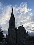 | |||
| 5 And 7 Victoria Road | 57°02′54″N 3°02′22″W | Category C(S) | 50652 | | |||
| 10 Bridge Square | 57°02′51″N 3°02′16″W | Category C(S) | 21838 | | |||
| Deebank Road, 9 Deebank Road And Boundary Wall | 57°02′50″N 3°02′19″W | Category B | 21848 | | |||
| Bridge Square, Monaltrie Hotel Including Boundary Wall | 57°02′52″N 3°02′13″W | Category C(S) | 21850 | | |||
| Bridge Street, Bank Of Scotland Including Boundary Walls | 57°02′52″N 3°02′19″W | Category C(S) | 21841 | | |||
| Dee Street, Deebank House Including Boundary Wall | 57°02′48″N 3°02′19″W | Category C(S) | 21843 | | |||
| Queen's Road, Abergeldie Road And School Lane, Victoria Barracks Including Boundary Wall | 57°02′55″N 3°02′49″W | Category B | 21832 | | |||
| School Lane, The Old School Including Boundary Walls And 6 Abergeldie Road | 57°02′54″N 3°02′42″W | Category C(S) | 50650 | | |||
| Church Square, Gordon Cottage And 1 Hawthorn Place Including Ancillary Buildings And Boundary Wall | 57°02′56″N 3°02′20″W | Category C(S) | 21829 | | |||
| 47 Braemar Road, Ravenswood Hotel including Boundary Wall | 57°03′01″N 3°03′02″W | Category C(S) | 50641 | | |||
| Corner Of Braemar Road And Invercauld Road, Commemorative Fountain | 57°03′02″N 3°02′44″W | Category C(S) | 50646 | | |||
| Dee Street, Ford House Including Boundary Walls And Gatepiers | 57°02′46″N 3°02′19″W | Category C(S) | 21842 | | |||
| Ballater, Royal Bridge | 57°02′49″N 3°02′11″W | Category B | 21851 | | |||
| Station Square, K6 Telephone Kiosk | 57°03′00″N 3°02′24″W | Category B | 21853 | | |||
| Golf Road, St Nathalan's Roman Catholic Church And Presbytery Including Boundary Walls And Gatepiers | 57°02′50″N 3°02′43″W | Category C(S) | 21831 | | |||
| Braemar Road, Oakhall (Now Darroch Learg Annexe), Including Boundary Wall And Gatepiers | 57°03′04″N 3°03′05″W | Category B | 21835 | | |||
| 19 And 21 Queen's Road, Ballater Masonic Lodge Including Boundary Wall, Gate And Lantern | 57°02′57″N 3°02′45″W | Category C(S) | 50649 | |
Key
The scheme for classifying buildings in Scotland is:
- Category A: "buildings of national or international importance, either architectural or historic; or fine, little-altered examples of some particular period, style or building type."[1]
- Category B: "buildings of regional or more than local importance; or major examples of some particular period, style or building type, which may have been altered."[1]
- Category C: "buildings of local importance; lesser examples of any period, style, or building type, as originally constructed or moderately altered; and simple traditional buildings which group well with other listed buildings."[1]
In March 2016 there were 47,288 listed buildings in Scotland. Of these, 8% were Category A, and 50% were Category B, with the remaining 42% being Category C.[2]
gollark: I don't.
gollark: I could add functionality to relay a limited number of channels and to make some peripherals optional if you had an actual need.
gollark: Well, you can, just not bidirectionally.
gollark: Very Large Array, 128 or 512 modems (I forgot which).
gollark: Chat Box-es, not Chatboxes or whatever.
Notes
- Sometimes known as OSGB36, the grid reference (where provided) is based on the British national grid reference system used by the Ordnance Survey.
• "Guide to National Grid". Ordnance Survey. Retrieved 12 December 2007.
• "Get-a-map". Ordnance Survey. Retrieved 17 December 2007. - Historic Environment Scotland assign a unique alphanumeric identifier to each designated site in Scotland, for listed buildings this always begins with "LB", for example "LB12345".
References
- All entries, addresses and coordinates are based on data from Historic Scotland. This data falls under the Open Government Licence
- "What is Listing?". Historic Environment Scotland. Retrieved 29 May 2018.
- Scotland's Historic Environment Audit 2016 (PDF). Historic Environment Scotland and the Built Environment Forum Scotland. pp. 15–16. Retrieved 29 May 2018.
This article is issued from Wikipedia. The text is licensed under Creative Commons - Attribution - Sharealike. Additional terms may apply for the media files.