List of listed buildings in Aberdeen/6
List
| Name | Location | Date Listed | Grid Ref. [note 1] | Geo-coordinates | Notes | LB Number [note 2] | Image |
|---|---|---|---|---|---|---|---|
| 13 Hadden Street And 1 Stirling Street | 57°08′46″N 2°05′52″W | Category C(S) | 20664 |  | |||
| Castle Street, The Mannie Or Green Fountain | 57°08′52″N 2°05′39″W | Category B | 20669 | | |||
| 11 And 12 Correction Wynd | 57°08′50″N 2°05′56″W | Category B | 20679 | | |||
| Polmuir Avenue, Ferryhill Motive Power Depot, Former Engine Shed | 57°07′56″N 2°05′55″W | Category B | 20617 | | |||
| 79 Hamilton Place At Blenheim Place, Including Gates, Gatepiers And Boundary Walls | 57°08′50″N 2°07′40″W | Category A | 20628 | 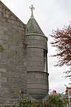 | |||
| 87 Fountainhall Road At Hamilton Place, Including Boundary Walls | 57°08′49″N 2°07′49″W | Category B | 20631 | | |||
| 87 Waterloo Quay And 1 Wellington Street | 57°08′43″N 2°04′52″W | Category B | 20594 | | |||
| Wrights' And Coopers' Place, (Houses 1 And 2; Old Numbers 1, 3 And 82 High Street) Old Aberdeen | 57°09′59″N 2°06′07″W | Category B | 20600 | | |||
| Union Street, 199, 201 | 57°08′42″N 2°06′13″W | Category B | 20531 | | |||
| Union Street, 401-415 (Odd Numbers) | 57°08′36″N 2°06′34″W | Category C(S) | 20544 | | |||
| 114-122 (Even Nos) Union Street And 1 Back Wynd | 57°08′48″N 2°06′00″W | Category B | 20555 | | |||
| Union Terrace, 15 | 57°08′47″N 2°06′14″W | Category C(S) | 20575 | | |||
| North Silver Street Migvie House | 57°08′49″N 2°06′24″W | Category B | 20489 | | |||
| North Silver Street, 12 | 57°08′48″N 2°06′20″W | Category B | 20493 | | |||
| North Silver Street, 18 | 57°08′49″N 2°06′21″W | Category B | 20495 | | |||
| North Silver Street, 24 | 57°08′50″N 2°06′22″W | Category B | 20499 | | |||
| Skene Terrace, 40 | 57°08′51″N 2°06′26″W | Category B | 20502 | | |||
| Skene Terrace, 46, 46A | 57°08′50″N 2°06′28″W | Category B | 20505 | | |||
| Thom's Place, 4 High Street Old Aberdeen | 57°09′57″N 2°06′09″W | Category B | 20511 | | |||
| 87 And 89 Union Street | 57°08′48″N 2°05′53″W | Category C(S) | 20523 | | |||
| 131 And A Half-139 (Odd Nos) Union Street | 57°08′46″N 2°06′00″W | Category C(S) | 20526 | | |||
| 143-153 (Odd Nos) Union Street | 57°08′45″N 2°06′03″W | Category B | 20527 | | |||
| 144 And 144A King Street | 57°09′04″N 2°05′38″W | Category C(S) | 20411 | | |||
| 10-14 (Even Nos) Marischal Street | 57°08′51″N 2°05′36″W | Category B | 20433 | | |||
| 1 Queen's Cross At Albyn Place And St Swithin Street, Including Gatepiers, Railings And Boundary Walls | 57°08′34″N 2°07′34″W | Category B | 20455 | | |||
| 33 Regent Quay And 59 Marischal Street (Formerly Town And County Bank) | 57°08′48″N 2°05′30″W | Category B | 20461 | | |||
| 43, 44 And 45 Regent Quay | 57°08′48″N 2°05′25″W | Category C(S) | 20464 | | |||
| 1 And 1A Rubislaw Den North, Including Ancillary Structure, Gatepiers And Boundary Walls | 57°08′39″N 2°08′07″W | Category B | 20473 | | |||
| High Street, 103, 105 (West Side) Old Aberdeen | 57°10′00″N 2°06′09″W | Category B | 20364 | | |||
| High Street, 100, 102 (East Side) Old Aberdeen | 57°10′00″N 2°06′08″W | Category B | 20375 | | |||
| Don Street, 126 (East Side) And 679 King Street | 57°10′13″N 2°05′48″W | Category B | 20393 | | |||
| Don Street, 76, Now Annexe To No. 78 (East Side) Old Aberdeen | 57°10′08″N 2°05′57″W | Category B | 20294 | | |||
| Don Street (N.W. Side) 2 Rocky Bank | 57°10′39″N 2°06′01″W | Category B | 20301 | | |||
| Don Street (N.W. Side) Brig End | 57°10′40″N 2°05′58″W | Category B | 20305 | | |||
| Don Street (S.E. Side) Rose Cottage | 57°10′38″N 2°06′02″W | Category B | 20306 | | |||
| Douglas Place, 4 Old Aberdeen | 57°09′54″N 2°06′09″W | Category B | 20308 | | |||
| Dunbar Street, 5 And 84 High Street | 57°09′59″N 2°06′05″W | Category C(S) | 20310 | | |||
| Dunbar Street, 5 (Garden Wall) | 57°09′59″N 2°06′04″W | Category C(S) | 20311 | | |||
| Duncan's Place, 2, 4 High Street Old Aberdeen | 57°09′52″N 2°06′08″W | Category B | 20313 | | |||
| College Bounds, 50, 52 Boundary Wall To No. 50 | 57°09′49″N 2°06′06″W | Category B | 20237 | | |||
| Crown Street, 23, 25 Prudential Building | 57°08′40″N 2°06′11″W | Category B | 20240 | | |||
| Dee Place, 15, 17 | 57°08′30″N 2°06′11″W | Category C(S) | 20256 | | |||
| Dee Street, 43 | 57°08′36″N 2°06′11″W | Category B | 20260 | | |||
| Dee Street, 63, 65 | 57°08′33″N 2°06′11″W | Category C(S) | 20262 | | |||
| Dee Street, 73, 75 | 57°08′32″N 2°06′10″W | Category C(S) | 20264 | | |||
| Don Street, 20, 22 (East Side) Bede House, Old Aberdeen | 57°10′03″N 2°06′06″W | Category A | 20288 | 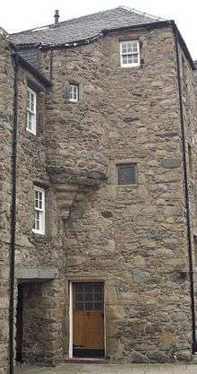 | |||
| 46-48 (Inclusive Nos) Castle Street | 57°08′52″N 2°05′35″W | Category C(S) | 20171 | | |||
| 53 Castle Street, Sheriff Court Annex And High Court Of Justiciary (Formerly Bank Of Scotland) | 57°08′51″N 2°05′37″W | Category A | 20174 | .jpg) | |||
| Chanonry, 3 Boundary Wall | 57°10′04″N 2°06′08″W | Category B | 20181 | | |||
| Chanonry, 14 Old Aberdeen | 57°10′09″N 2°06′07″W | Category B | 20194 | | |||
| Chanonry, 16 Old Aberdeen | 57°10′09″N 2°06′05″W | Category B | 20197 | | |||
| College Bounds, 41 (West Side) Music Department Old Aberdeen | 57°09′48″N 2°06′10″W | Category B | 20217 | | |||
| 26 Albyn Place, Including Gatepiers And Boundary Walls | 57°08′34″N 2°07′12″W | Category B | 20120 | | |||
| 47 Belmont Street | 57°08′50″N 2°06′07″W | Category B | 20131 | | |||
| Bon Accord Street 36 | 57°08′34″N 2°06′20″W | Category C(S) | 20144 | | |||
| Schoolhill, Robert Gordon's College Including North Gates And Boundary Walls | 57°08′57″N 2°06′10″W | Category A | 20088 | %2C_Aberdeen.jpg) | |||
| University Of Aberdeen King's College, Quadrangle, Library And Elphinstone Hall, College Bounds, Old Aberdeen | 57°09′50″N 2°06′04″W | Category B | 20092 | | |||
| King's College, New Building, Gateway | 57°09′53″N 2°06′07″W | Category B | 20094 | | |||
| King's College, Sports Pavilion, Off University Road | 57°09′49″N 2°06′00″W | Category B | 20095 | | |||
| Willowbank Road, Willowbank House, Including Boundary Walls | 57°08′23″N 2°06′34″W | Category B | 20109 | | |||
| Woodside House, Mugiemoss Road | 57°10′40″N 2°08′52″W | Category B | 20111 | | |||
| Gordon, Duke Of, Golden Square | 57°08′45″N 2°06′18″W | Category B | 20007 | | |||
| March Stone No. 54, At Junction Of Provost Rust Drive And Smithfield Drive | 57°09′56″N 2°08′26″W | Category B | 20034 | | |||
| Wellington Suspension Bridge Over River Dee, At Craiglug | 57°08′08″N 2°05′44″W | Category A | 20073 | 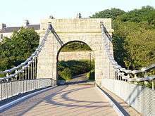 | |||
| Schoolhill And Belmont Street, Former Aberdeen Academy Building | 57°08′51″N 2°06′04″W | Category B | 20081 | | |||
| Spital, St Margaret Of Scotland Chapel And Former Convent Wing | 57°09′27″N 2°06′00″W | Category A | 19961 | .jpg) | |||
| 20 And 22 Back Wynd | 57°08′51″N 2°06′02″W | Category B | 19969 | | |||
| Woodside Parish Church, (Former Woodside South Church ) (C. Of S.) Church Street And King Street, Woodside | 57°10′13″N 2°07′36″W | Category B | 19976 | | |||
| Westburn Road, And Argyll Place Victoria Park At Watson Street, Lodge | 57°09′09″N 2°07′09″W | Category C(S) | 46990 | | |||
| 44 Belgrave Terrace, Including Boundary Wall | 57°08′52″N 2°07′10″W | Category C(S) | 47457 | | |||
| 2 Hamilton Place, At Craigie Loanings And Westfield Road, Including Gatepiers And Boundary Walls | 57°08′56″N 2°07′21″W | Category C(S) | 47484 | | |||
| Skene Street And Esslemont Avenue, Aberdeen Grammar School, Language Block (Formerly Part Of Westfield School) | 57°08′51″N 2°06′53″W | Category B | 47493 | | |||
| 13 Bayview Road, Including Gatepiers And Boundary Walls | 57°08′31″N 2°08′27″W | Category C(S) | 47918 | | |||
| 8 Holburn Street (Now Forming Part Of 1 Alford Place) | 57°08′34″N 2°06′44″W | Category C(S) | 47928 | | |||
| 32 Anderson Drive, Including Boundary Walls | 57°08′07″N 2°08′09″W | Category C(S) | 48520 | | |||
| Balgownie Road, Glenseaton Lodge | 57°10′24″N 2°06′26″W | Category B | 48925 | | |||
| Rosemount Viaduct, Bon Accord Free Church | 57°08′54″N 2°06′35″W | Category C(S) | 48974 | | |||
| 11 And 12 Russell Road, Smoke House | 57°08′22″N 2°05′43″W | Category C(S) | 50220 | | |||
| Frederick Street, Frederick Street Business Centre, (Former Frederick Street School), Including Boundary Wall | 57°09′01″N 2°05′30″W | Category C(S) | 50944 | | |||
| 26 John Street | 57°09′05″N 2°06′08″W | Category C(S) | 50947 | | |||
| 54 Castle Street | 57°08′50″N 2°05′36″W | Category B | 43850 | | |||
| Polmuir Avenue, Ferryhill Motive Power Depot, Locomotive Turntable | 57°07′52″N 2°05′59″W | Category A | 43378 | | |||
| 83 Westburn Road, Air Raid Shelter In Garden To Rear | 57°09′09″N 2°07′02″W | Category C(S) | 43022 | | |||
| 68 Rubislaw Den North, Including Gatepiers And Boundary Walls | 57°08′40″N 2°08′32″W | Category B | 20783 | | |||
| 76 Rubislaw Den North At Moray Place, Including Ancillary Structure, Gatepiers And Boundary Walls | 57°08′39″N 2°08′36″W | Category C(S) | 20787 | | |||
| 20 Rubislaw Den South, Including Gatepiers And Boundary Walls | 57°08′35″N 2°08′14″W | Category C(S) | 20801 | | |||
| 36 And 38 Rubislaw Den South, Including Gatepiers, Railings And Boundary Walls | 57°08′34″N 2°08′22″W | Category C(S) | 20809 | | |||
| 44, 44A And 44B Rubislaw Den South, Including Gates, Gatepiers, Railings And Boundary Walls | 57°08′34″N 2°08′27″W | Category B | 20811 | | |||
| 46 Rubislaw Den South, Beechwood, Including Gatepiers And Boundary Walls | 57°08′33″N 2°08′29″W | Category C(S) | 20812 | | |||
| 74 Riverside Drive, Former Park Hotel, Including Gatepiers And Boundary Walls | 57°07′35″N 2°07′07″W | Category B | 20835 | | |||
| 7-21 (Odd Nos) St Nicholas Street | 57°08′50″N 2°05′54″W | Category B | 20685 | | |||
| 31 Forest Road At Desswood Place And Beaconsfield Place, Callan Lodge, Including Gatepiers And Boundary Walls | 57°08′39″N 2°08′03″W | Category B | 20695 | | |||
| 13 Queen's Road, Including Gatepiers And Boundary Walls | 57°08′31″N 2°07′50″W | Category B | 20714 | | |||
| 15 Queen's Road, Including Ancillary Structure, Railings, Gatepiers And Boundary Walls | 57°08′31″N 2°07′51″W | Category B | 20715 | | |||
| 21 Queen's Road, Albyn School For Girls, Including Ancillary Structure, Gatepiers And Boundary Walls | 57°08′30″N 2°07′55″W | Category B | 20718 | | |||
| 25, 27 And 29 Queen's Road, Including Gatepiers And Boundary Walls | 57°08′29″N 2°08′00″W | Category C(S) | 20721 | | |||
| 61 And 63 Queen's Road, Including Gatepiers And Boundary Walls | 57°08′26″N 2°08′12″W | Category B | 20732 | | |||
| 80 Queen's Road, Including Gatepiers And Boundary Walls | 57°08′28″N 2°08′20″W | Category B | 20748 | | |||
| 82 Queen's Road, Including Gatepiers And Boundary Walls | 57°08′27″N 2°08′21″W | Category B | 20749 | | |||
| 86 Queen's Road At Bayview Road, Including Railings, Gatepiers And Boundary Walls | 57°08′27″N 2°08′24″W | Category C(S) | 20751 | | |||
| 21 Rubislaw Den North, Including Gatepiers And Boundary Wall | 57°08′39″N 2°08′26″W | Category C(S) | 20767 | | |||
| 23 Exchange Street | 57°08′44″N 2°05′48″W | Category C(S) | 20656 | | |||
| Blaikie's Quay, Former National Dock Labour Board | 57°08′42″N 2°05′22″W | Category C(S) | 20672 | | |||
| 7, 9 And 11 St Nicholas Lane | 57°08′49″N 2°05′54″W | Category C(S) | 20682 | | |||
| 55 Westburn Road, Including Boundary Walls | 57°09′10″N 2°06′56″W | Category B | 20598 | | |||
| Union Street, 245-255 (Odd Nos) | 57°08′40″N 2°06′20″W | Category B | 20536 | | |||
| 136-144 (Even Nos) Union Street And 5 Denburn Road | 57°08′46″N 2°06′04″W | Category B | 20557 | | |||
| 154 Union Street | 57°08′44″N 2°06′13″W | Category C(S) | 20561 | | |||
| 212, 214, 216 Union Street | 57°08′41″N 2°06′22″W | Category C(S) | 20566 | | |||
| Union Street, 230 | 57°08′40″N 2°06′24″W | Category B | 20571 | | |||
| Union Terrace, 1, 2, 3 And 146 Union Street | 57°08′45″N 2°06′10″W | Category A | 20573 | %2C_Aberdeen.jpg) | |||
| Union Terrace, 14 | 57°08′47″N 2°06′14″W | Category C(S) | 20574 | | |||
| Union Terrace, 16 | 57°08′47″N 2°06′15″W | Category B | 20576 | | |||
| 24 And 26 Upperkirkgate | 57°08′56″N 2°05′54″W | Category B | 20581 | | |||
| Skene Terrace, 52 | 57°08′50″N 2°06′29″W | Category C(S) | 20507 | | |||
| 168-174 (Even Nos) Market Street, Former Grimsby Chambers | 57°08′34″N 2°05′34″W | Category B | 20449 | | |||
| Footdee, 5 New Pier Road | 57°08′34″N 2°04′19″W | Category C(S) | 20452 | | |||
| 32 And 34 Queen's Road (Former Rubislaw Toll House), Including Boundary Walls | 57°08′31″N 2°08′02″W | Category C(S) | 20458 | | |||
| 46 And 47 Regent Quay | 57°08′48″N 2°05′25″W | Category C(S) | 20465 | | |||
| 20-26 (Even Nos) King Street | 57°08′56″N 2°05′36″W | Category C(S) | 20397 | | |||
| 30 And 32 King Street | 57°08′57″N 2°05′36″W | Category B | 20399 | | |||
| Don Street, 78 (East Side) Bishop's Gate, Old Aberdeen | 57°10′08″N 2°05′56″W | Category B | 20295 | | |||
| Don Street, (N.W. Side) Raeholm | 57°10′40″N 2°05′59″W | Category B | 20304 | | |||
| 111 Gallowgate Including Boundary Wall And Railings | 57°09′03″N 2°05′57″W | Category C(S) | 20316 | | |||
| College Bounds, 8 (East Side) Old Aberdeen | 57°09′43″N 2°06′05″W | Category B | 20223 | | |||
| College Bounds, 24 (East Side) Old Aberdeen | 57°09′44″N 2°06′05″W | Category B | 20228 | | |||
| College Bounds, 26 (East Side) Old Aberdeen | 57°09′45″N 2°06′05″W | Category B | 20229 | | |||
| Don Street, 23 (West Side) Old Aberdeen | 57°10′04″N 2°06′07″W | Category B | 20276 | | |||
| Chanonry, 6 (East Side) Old Aberdeen | 57°10′05″N 2°06′09″W | Category B | 20183 | | |||
| Chanonry, 7 And 7A (West Side) Old Aberdeen | 57°10′06″N 2°06′12″W | Category B | 20184 | | |||
| Chanonry, 20 (Chaplain's Court) | 57°10′08″N 2°06′00″W | Category B | 20200 | | |||
| Chanonry, 20 Boundary Wall | 57°10′08″N 2°06′00″W | Category B | 20201 | | |||
| Clark's Lane, 1, 2, Old Aberdeen | 57°10′07″N 2°05′56″W | Category B | 20204 | | |||
| College Bounds, 19 Garden Wall | 57°09′45″N 2°06′07″W | Category B | 20211 | | |||
| 25 Albyn Place At Albyn Grove, Including Boundary Walls | 57°08′34″N 2°07′11″W | Category B | 20119 | | |||
| 10 Bon Accord Street (Svl), 31 Langstane Place, East Craibstone Street And Frontage To Bon Accord Square | 57°08′37″N 2°06′23″W | Category B | 20138 | | |||
| Ashley Road, Ashley Road School, Including Ancillary Structure, Lodge, Gates, Gatepiers, Boundary Walls And Railings | 57°08′17″N 2°07′24″W | Category C(S) | 20085 | | |||
| Broad Street, Marischal College | 57°08′59″N 2°05′49″W | Category A | 20096 | | |||
| Friendville Great Western Road And Thorngrove Avenue | 57°07′58″N 2°08′10″W | Category B | 20102 | 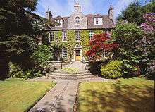 | |||
| Westburn Road And Cornhill Road, Westburn Park, Westburn House, Including Railings | 57°09′16″N 2°07′22″W | Category A | 20108 | 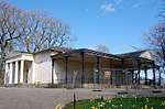 | |||
| 22 Adelphi | 57°08′48″N 2°05′44″W | Category C(S) | 20112 | | |||
| Union Street, South Silver Street And Golden Square, Music Hall | 57°08′44″N 2°06′18″W | Category A | 19991 | .jpg) | |||
| Castlegate, Mercat Cross | 57°08′54″N 2°05′33″W | Category A | 19999 | 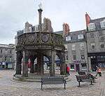 | |||
| Duthie Park, Mcgrigor Obelisk | 57°07′45″N 2°06′13″W | Category C(S) | 20010 | | |||
| Fonthill Road At Hardgate, March Stone No 2 | 57°08′15″N 2°06′49″W | Category C(S) | 20015 | | |||
| Nellfield Place At Great Western Road, Adjoining Nellfield Cemetery, March Stone Number 3 | 57°08′20″N 2°07′04″W | Category C(S) | 20016 | | |||
| March Stone No. 8, At 37 Craigton Road Nearly Opposite Kenfield Crescent | 57°07′51″N 2°08′36″W | Category B | 20021 | | |||
| March Stone No. 11, On South Side Of Craigton Road About 70 Yards West Of The House 'East Rocklands' | 57°07′29″N 2°10′06″W | Category B | 20024 | | |||
| Well Spring Of Nether Town, Hazledene Road | 57°08′25″N 2°09′49″W | Category C(S) | 20056 | | |||
| St. Peter's Cemetery, Gates. King Street | 57°09′37″N 2°05′47″W | Category B | 20060 | |
Key
The scheme for classifying buildings in Scotland is:
- Category A: "buildings of national or international importance, either architectural or historic; or fine, little-altered examples of some particular period, style or building type."[1]
- Category B: "buildings of regional or more than local importance; or major examples of some particular period, style or building type, which may have been altered."[1]
- Category C: "buildings of local importance; lesser examples of any period, style, or building type, as originally constructed or moderately altered; and simple traditional buildings which group well with other listed buildings."[1]
In March 2016 there were 47,288 listed buildings in Scotland. Of these, 8% were Category A, and 50% were Category B, with the remaining 42% being Category C.[2]
gollark: Space is now available for free in the giant cube, because nobody was using it, subject to reasonable restrictions. You can get a subclaim with full management access.
gollark: `[S] OakPlank: lol im breaking some1s house[S] OakPlank: xdgollark: Rule 1.-------------------- Server Rules --------------------1. Do not grief or deface the world.2. Do not attempt to crash the server or use excessive resources with malicious intent.3. Do not exploit or abuse bugs. If you find a bug, it must be reported.4. Do not spam the chat or advertise.5. Do not cheat in any way.6. Do not harass other players or exhibit hate speech.7. Do not steal or scam items or KST from other players. Above all, these rules are implied:- Use common decency.- Use common sense.------------------------ « » -------------------------GopherAtl: and his love for making penises?[S] OakPlank: i didnt[S] OakPlank: its unclaimedgollark: It never mentions claims.gollark: Griefing is griefing, claim or not.gollark: Please excuse me while I copy these chatlogs into discord or something.[S] OakPlank: ppft`
gollark: <@!229624651314233346>
gollark: HOW NEER IS NEER??????
gollark: Raspberry pis are actually not awful webservers. If you're being flooded with spam, the main constraint is probably bandwidth anyway.
See also
Notes
- Sometimes known as OSGB36, the grid reference (where provided) is based on the British national grid reference system used by the Ordnance Survey.
• "Guide to National Grid". Ordnance Survey. Retrieved 12 December 2007.
• "Get-a-map". Ordnance Survey. Retrieved 17 December 2007. - Historic Environment Scotland assign a unique alphanumeric identifier to each designated site in Scotland, for listed buildings this always begins with "LB", for example "LB12345".
References
- All entries, addresses and coordinates are based on data from Historic Scotland. This data falls under the Open Government Licence
- "What is Listing?". Historic Environment Scotland. Retrieved 29 May 2018.
- Scotland's Historic Environment Audit 2016 (PDF). Historic Environment Scotland and the Built Environment Forum Scotland. pp. 15–16. Retrieved 29 May 2018.
This article is issued from Wikipedia. The text is licensed under Creative Commons - Attribution - Sharealike. Additional terms may apply for the media files.