List of listed buildings in Aberdeen/3
List
| Name | Location | Date Listed | Grid Ref. [note 1] | Geo-coordinates | Notes | LB Number [note 2] | Image |
|---|---|---|---|---|---|---|---|
| 7 Alford Place, Including Boundary Walls | 57°08′35″N 2°06′48″W | Category C(S) | 47451 |  | |||
| 4 And 6 Hamilton Place At Westfield Road, Including Boundary Walls | 57°08′55″N 2°07′23″W | Category C(S) | 47485 | | |||
| 32 Hamilton Place, Including Boundary Walls | 57°08′54″N 2°07′29″W | Category C(S) | 47489 | | |||
| 30-56 And 56A (Even Numbers) Victoria Street, Including Letter Box And Boundary Wall | 57°08′42″N 2°06′55″W | Category B | 47499 | | |||
| 6 And 8 Westfield Terrace, Including Boundary Walls And Gates | 57°08′51″N 2°07′17″W | Category C(S) | 47500 | | |||
| 24 Albyn Place At Albyn Grove, Albyn Hospital, Including Gatepiers And Boundary Walls | 57°08′33″N 2°07′08″W | Category C(S) | 47913 | | |||
| 35 And 36 Albyn Place, Including Gatepiers And Boundary Walls | 57°08′34″N 2°07′25″W | Category C(S) | 47914 | | |||
| 6A Raik Road, Smoke House | 57°08′26″N 2°05′37″W | Category C(S) | 50219 | | |||
| Clarence Street And Limestreet Warehouse At Corner | 57°08′45″N 2°05′00″W | Category C(S) | 50934 | | |||
| Footdee, Pocra Quay, Navigation Control Centre (Former Pilot House) | 57°08′32″N 2°04′12″W | Category C(S) | 50941 | | |||
| Footdee, No 26 South Square | 57°08′35″N 2°04′18″W | Category C(S) | 50943 | | |||
| 119-125 (Odd Nos) George Street | 57°08′59″N 2°06′06″W | Category C(S) | 50946 | | |||
| 11-23 (Odd Nos) King Street | 57°08′55″N 2°05′38″W | Category B | 50949 | | |||
| 8 And 10 King Street | 57°08′55″N 2°05′35″W | Category B | 50950 | | |||
| 50 Marischal Street, Elim Pentecostal Church | 57°08′48″N 2°05′32″W | Category C(S) | 50951 | | |||
| 52A Market Street And 2 Guild Street | 57°08′44″N 2°05′46″W | Category C(S) | 50952 | | |||
| 6 Regent Road, United House | 57°08′39″N 2°05′25″W | Category C(S) | 50954 | | |||
| 35 St Clement Street | 57°08′47″N 2°04′53″W | Category C(S) | 50955 | | |||
| 6-10 (Even Nos) Virginia Street And 5 And 7 Weigh-House Square, Shore Porters Society | 57°08′48″N 2°05′35″W | Category B | 50960 | | |||
| York Street, York Place, Wellington Street And St Clement Street, Former Aberdeen Iron Works | 57°08′45″N 2°04′46″W | Category C(S) | 50963 | | |||
| Cranford Road, Cranford House, Including Lodge, Gatepiers And Boundary Wall | 57°07′45″N 2°07′59″W | Category C(S) | 43849 | | |||
| 74 Rubislaw Den North, Including Gatepiers And Boundary Walls | 57°08′39″N 2°08′35″W | Category C(S) | 20786 | | |||
| 18 And 18A Rubislaw Den South, Including Gatepiers And Boundary Walls | 57°08′35″N 2°08′13″W | Category C(S) | 20800 | | |||
| 24 Rubislaw Den South, Including Ancillary Structure, Gatepiers And Boundary Walls | 57°08′34″N 2°08′16″W | Category B | 20803 | | |||
| 26 Rubislaw Den South, Including Gatepiers And Boundary Walls | 57°08′34″N 2°08′17″W | Category B | 20804 | | |||
| 42 Rubislaw Den South, Marchmont, Including Balustrading, Gatepiers And Boundary Walls | 57°08′34″N 2°08′26″W | Category C(S) | 20810 | | |||
| 60 And 60A Rubislaw Den South, Including Gatepiers And Boundary Walls | 57°08′33″N 2°08′36″W | Category C(S) | 20817 | | |||
| 70 Rubislaw Den South, Dunrobin, Including Gatepiers And Boundary Walls | 57°08′32″N 2°08′43″W | Category C(S) | 20822 | | |||
| Eday Road Woodend Hospital Viaduct At South Approach | 57°08′42″N 2°10′20″W | Category B | 20830 | | |||
| Powis Terrace And Ashgrove Road, Kittybrewster Tollhouse | 57°09′38″N 2°06′55″W | Category B | 20687 | | |||
| 9 And 11 Forest Road, Including Gatepiers And Boundary Walls | 57°08′34″N 2°07′59″W | Category C(S) | 20692 | | |||
| 64 Forest Road At Morningfield Road, Including Gates, Gatepiers And Boundary Walls | 57°08′46″N 2°08′11″W | Category C(S) | 20706 | | |||
| 3 Queen's Cross At St Swithin Street And Queen's Road, Bishop's House Adjoining St Joseph's Roman Catholic Primary School, Including Addition To E With Chapel | 57°08′33″N 2°07′41″W | Category B | 20707 | | |||
| 7 Queen's Road, Including Gatepiers And Boundary Walls | 57°08′32″N 2°07′46″W | Category C(S) | 20711 | | |||
| 23 Queen's Road At Queen's Gate And Forest Avenue, Albyn School For Girls, Including Gatepiers And Boundary Walls | 57°08′30″N 2°07′55″W | Category B | 20719 | | |||
| 59 Queen's Road, Including Gatepiers And Boundary Walls | 57°08′27″N 2°08′11″W | Category C(S) | 20731 | | |||
| 8 Queen's Road, Including Gatepiers And Boundary Walls | 57°08′34″N 2°07′49″W | Category C(S) | 20735 | | |||
| 15 Rubislaw Den North, Glenburn Lodge, Including Gatepiers And Boundary Walls | 57°08′39″N 2°08′22″W | Category C(S) | 20765 | | |||
| 17 Rubislaw Den North, Cramond House, Including Ancillary Structure, Gatepiers And Boundary Walls | 57°08′39″N 2°08′24″W | Category B | 20766 | | |||
| 90 Queen's Road, Including Gatepiers And Boundary Walls | 57°08′26″N 2°08′27″W | Category B | 20637 | | |||
| 14 Exchange Street | 57°08′45″N 2°05′51″W | Category C(S) | 20660 | | |||
| 9 Queen's Road, Including Gatepiers And Boundary Walls | 57°08′32″N 2°07′47″W | Category B | 20671 | | |||
| 1-7 (Odd Numbers) Polmuir Road, Including Boundary Walls | 57°08′12″N 2°06′15″W | Category C(S) | 20613 | | |||
| 36 Regent Quay, Regent House | 57°08′48″N 2°05′27″W | Category B | 20618 | | |||
| 11, 11A Dee Street | 57°08′40″N 2°06′15″W | Category C(S) | 20621 | | |||
| West Church Of St Andrew (The Langstane Kirk) And Church Hall, Union Street And Langstane Place | 57°08′38″N 2°06′24″W | Category B | 20622 | | |||
| 63 Hamilton Place At Whitehall Road, Including Gates, Gatepiers And Boundary Walls | 57°08′51″N 2°07′34″W | Category B | 20626 | | |||
| 2A View Terrace, Including Gatepiers And Boundary Walls | 57°09′01″N 2°06′55″W | Category B | 20593 | | |||
| 47 And 49 Waverley Place, Including Boundary Walls | 57°08′38″N 2°06′59″W | Category C(S) | 20595 | | |||
| Union Street, 207-219 (Odd Numbers) Including The Grill | 57°08′42″N 2°06′15″W | Category B | 20532 | | |||
| Union Street, 225, 227 | 57°08′41″N 2°06′18″W | Category B | 20534 | | |||
| Union Street, 229, 231 | 57°08′40″N 2°06′19″W | Category B | 20535 | | |||
| Union Street, 265-271 (Odd Nos) | 57°08′39″N 2°06′22″W | Category C(S) | 20539 | | |||
| Union Street, 373-377 (Odd Nos) | 57°08′37″N 2°06′29″W | Category C(S) | 20541 | | |||
| 40 And 42 Union Street | 57°08′51″N 2°05′46″W | Category B | 20548 | | |||
| 52-58 (Even Nos) Union Street | 57°08′50″N 2°05′50″W | Category C(S) | 20551 | | |||
| 122 And A Half To 132 (Even Nos) Union Street | 57°08′47″N 2°06′02″W | Category C(S) | 20556 | | |||
| Union Street, 166-172 (Even Nos) | 57°08′43″N 2°06′16″W | Category C(S) | 20564 | | |||
| Union Street, 222 And 224 | 57°08′41″N 2°06′23″W | Category C(S) | 20569 | | |||
| 16 And 18 Upperkirkgate | 57°08′56″N 2°05′54″W | Category C(S) | 20579 | | |||
| 7-11 (Odd Numbers) Victoria Street, Including Boundary Walls | 57°08′36″N 2°06′48″W | Category C(S) | 20587 | | |||
| 17 Victoria Street, Including Boundary Wall | 57°08′38″N 2°06′48″W | Category C(S) | 20589 | | |||
| 19 Victoria Street, Including Boundary Wall | 57°08′39″N 2°06′49″W | Category C(S) | 20590 | | |||
| North Silver Street 20 And 43 Diamond Street | 57°08′49″N 2°06′21″W | Category B | 20496 | | |||
| North Silver Street, 22 | 57°08′50″N 2°06′22″W | Category B | 20498 | | |||
| 1-4 Skene Place (Inclusive) | 57°08′50″N 2°06′41″W | Category B | 20500 | | |||
| Spital, 45 | 57°09′31″N 2°06′00″W | Category B | 20508 | | |||
| 81-85 (Odd Nos) Union Street | 57°08′48″N 2°05′52″W | Category C(S) | 20522 | | |||
| 101-105 (Odd Nos) Union Street | 57°08′47″N 2°05′55″W | Category C(S) | 20525 | | |||
| 167, 169 Union Street And 2, 4 Bridge Street | 57°08′43″N 2°06′09″W | Category C(S) | 20528 | | |||
| 50-56 (Even Nos) King Street | 57°08′59″N 2°05′36″W | Category C(S) | 20401 | | |||
| 7 And 9 King's Gate, Including Boundary Walls | 57°08′50″N 2°07′51″W | Category B | 20414 | | |||
| 13, 13A And 15 King's Gate, Including Piers And Boundary Walls | 57°08′50″N 2°07′55″W | Category C(S) | 20415 | | |||
| Mackie Place, 3 | 57°08′52″N 2°06′44″W | Category C(S) | 20418 | | |||
| 23-27 (Odd Nos) Marischal Street | 57°08′51″N 2°05′34″W | Category B | 20426 | | |||
| 35-37A (Odd Nos) Marischal Street | 57°08′50″N 2°05′33″W | Category B | 20428 | | |||
| 41-45 (Odd Nos) Marischal Street | 57°08′49″N 2°05′32″W | Category B | 20429 | | |||
| Marischal Street, 47 | 57°08′49″N 2°05′31″W | Category B | 20430 | | |||
| 46 Marischal Street | 57°08′48″N 2°05′32″W | Category B | 20440 | | |||
| 9-11 (Odd Numbers) Rosebank Place, Including Railings | 57°08′23″N 2°06′36″W | Category B | 20469 | | |||
| 27 Rubislaw Den North (Formerly Rubislaw Den House And Gordon House), Including Folly, Terrace Walls, Gatepiers And Boundary Walls | 57°08′36″N 2°08′35″W | Category B | 20474 | | |||
| 72 Hamilton Place, Including Gatepiers, Boundary Walls And Provosts Lamps | 57°08′51″N 2°07′39″W | Category A | 20337 | 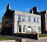 | |||
| 74 And 76 Hamilton Place, Including Gatepiers And Boundary Walls | 57°08′51″N 2°07′40″W | Category A | 20338 | 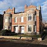 | |||
| 78 And 80 Hamilton Place, Including Gatepiers And Boundary Walls | 57°08′51″N 2°07′40″W | Category A | 20339 | .jpg) | |||
| 86, 86A, 88 And 88A Hamilton Place, Including Gatepiers And Boundary Walls | 57°08′51″N 2°07′42″W | Category A | 20341 | 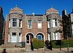 | |||
| High Street, 7 (West Side) And 1 Duncan's Place, Old Aberdeen | 57°09′52″N 2°06′08″W | Category B | 20346 | | |||
| High Street, 15. (West Side) Old Aberdeen | 57°09′53″N 2°06′08″W | Category B | 20347 | | |||
| High Street, 22 (West Side) Old Aberdeen | 57°09′53″N 2°06′08″W | Category B | 20349 | | |||
| High Street, 57-61 (Odd Nos) (West Side) Old Aberdeen | 57°09′56″N 2°06′09″W | Category B | 20357 | | |||
| High Street, 91 (West Side) And 1 Blackburn Place Old Aberdeen | 57°09′59″N 2°06′09″W | Category B | 20362 | | |||
| High Street, 111 And 113 Wall And Gate Pillars To 113 | 57°10′01″N 2°06′09″W | Category B | 20367 | | |||
| High Street, 86,88 (East Side) Old Aberdeen | 57°09′59″N 2°06′08″W | Category B | 20372 | | |||
| High Street, 108, 110 Old Aberdeen | 57°10′01″N 2°06′07″W | Category B | 20378 | | |||
| 154 Hutcheon Street | 57°09′14″N 2°06′40″W | Category B | 20383 | | |||
| 7 And 9 King Street | 57°08′54″N 2°05′37″W | Category B | 20387 | | |||
| 143 And 145 King Street | 57°09′04″N 2°05′40″W | Category C(S) | 20391 | | |||
| Don Street, 78, Boundary Walls | 57°10′08″N 2°05′56″W | Category B | 20296 | | |||
| Don Street,120-122 (East Side) | 57°10′13″N 2°05′49″W | Category C(S) | 20297 | | |||
| Don Street,124 (East Side) | 57°10′13″N 2°05′49″W | Category C(S) | 20298 | | |||
| Dunbar Street, 11-14 (Inclusive) | 57°10′03″N 2°06′01″W | Category B | 20312 | | |||
| George Street, 403-405 | 57°09′12″N 2°06′21″W | Category B | 20320 | | |||
| College Bounds, 2 (East Side) Old Aberdeen | 57°09′42″N 2°06′04″W | Category B | 20222 | | |||
| College Bounds, 28 (East Side) Old Aberdeen | 57°09′45″N 2°06′06″W | Category B | 20230 | | |||
| College Bounds, 40 (East Side) Old Aberdeen | 57°09′46″N 2°06′06″W | Category B | 20232 | | |||
| College Bounds, 50, 52 (East Side) Old Aberdeen | 57°09′49″N 2°06′06″W | Category B | 20236 | | |||
| Crown Street 89-105 (Odd Nos) | 57°08′36″N 2°06′07″W | Category B | 20244 | | |||
| Dee Street, 70-78 (Even Nos) | 57°08′32″N 2°06′12″W | Category B | 20267 | | |||
| 11 And 12 Devanha Terrace, Including Boundary Walls And Railings Enclosing Garden Across Road Opposite Front Elevation | 57°08′13″N 2°06′00″W | Category C(S) | 20270 | | |||
| 13 And 14 Devanha Terrace, Including Boundary Walls And Railings Enclosing Garden Across Road Opposite Front Elevation | 57°08′13″N 2°06′00″W | Category C(S) | 20271 | | |||
| Don Street, 21 (West Side) Old Aberdeen | 57°10′04″N 2°06′07″W | Category C(S) | 20275 | | |||
| Don Street, 55 Chanonry Boundary Wall | 57°10′07″N 2°06′00″W | Category B | 20283 | | |||
| Don Street, 69 (West Side) Old Aberdeen | 57°10′07″N 2°05′58″W | Category B | 20285 | | |||
| Don Street, 36, 38 (East Side) Old Aberdeen | 57°10′04″N 2°06′04″W | Category C(S) | 20290 | | |||
| 9, 10 And 11 Castle Street | 57°08′54″N 2°05′35″W | Category B | 20163 | | |||
| 31-35 (Inclusive Nos) Castle Street | 57°08′53″N 2°05′32″W | Category B | 20168 | | |||
| 40, 41 And 41A Castle Street | 57°08′53″N 2°05′33″W | Category C(S) | 20169 | | |||
| Chanonry, 8 (West Side) Old Aberdeen | 57°10′07″N 2°06′12″W | Category B | 20185 | | |||
| 46 Charlotte Street And Arched Gateway | 57°09′04″N 2°06′16″W | Category C(S) | 20202 | | |||
| College Bounds, 19 (West Side) Old Aberdeen | 57°09′45″N 2°06′07″W | Category B | 20210 | | |||
| College Bounds, 27 (West Side) Old Aberdeen | 57°09′46″N 2°06′07″W | Category B | 20214 | | |||
| College Bounds, 33 (West Side) Old Aberdeen | 57°09′46″N 2°06′07″W | Category B | 20216 | | |||
| College Bounds, 41 Boundary Wall | 57°09′48″N 2°06′10″W | Category B | 20218 | | |||
| 9 Albyn Place, Including Gatepiers And Boundary Walls | 57°08′33″N 2°06′52″W | Category B | 20116 | | |||
| 37, 37A Belmont Street | 57°08′50″N 2°06′07″W | Category B | 20130 | | |||
| Bon Accord Street, 63-71 (Odd Nos) | 57°08′33″N 2°06′18″W | Category C(S) | 20141 | | |||
| Bon Accord Street, 80,82 | 57°08′28″N 2°06′16″W | Category C(S) | 20151 | | |||
| Bon Accord Terrace, 26, 28 And 33 Hardgate | 57°08′34″N 2°06′30″W | Category B | 20152 | | |||
| Bon Accord Terrace, 50 And 55 Hardgate | 57°08′30″N 2°06′30″W | Category C(S) | 20155 | | |||
| 2 Devanha Gardens West | 57°08′09″N 2°06′10″W | Category B | 20099 | | |||
| Friendville Walled Gardens | 57°07′57″N 2°08′09″W | Category B | 20103 | | |||
| Summerhill House, Anderson Drive North | 57°08′51″N 2°09′00″W | Category B | 20105 | | |||
| Old Aberdeen, Tillydrone Road, Wallace's Tower (Benholm's Lodgings) | 57°10′16″N 2°06′30″W | Category B | 20107 |  | |||
| Cornhill Road, Royal Cornhill Hospital, Elmhill House | 57°09′27″N 2°07′19″W | Category B | 19984 | | |||
| 47-53 (Odd Nos) Market Street | 57°08′45″N 2°05′45″W | Category C(S) | 19989 | | |||
| Public Transport Department King Street | 57°09′28″N 2°05′46″W | Category C(S) | 19998 | | |||
| Burns, Robert Statue, Union Terrace | 57°08′47″N 2°06′13″W | Category B | 20002 | | |||
| Elphinstone, Bishop, Memorial, King's College Grounds, College Bounds, Old Aberdeen | 57°09′51″N 2°06′06″W | Category A | 20005 | 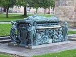 | |||
| Schoolhill, Statue Of General Gordon Of Khartoum | 57°08′53″N 2°06′07″W | Category B | 20009 | | |||
| 319-325 (Even Numbers) Great Western Road, March Stone Number 5 Against Rear Boundary Wall | 57°08′06″N 2°07′30″W | Category C(S) | 20018 | | |||
| March Stone No. 6, Within The Back Garden Of No. 11 Hammerfield Avenue | 57°07′55″N 2°08′00″W | Category B | 20019 | | |||
| March Stone No. 45 On The Farm Of Newton Of Auchmill West Of, And At The Bend Of The Road Leading To, The Steading | 57°10′22″N 2°10′31″W | Category B | 20025 | | |||
| March Stone No. 49, On The West Side Of The Scatter Burn Where It Joins The Don Near Persley Bridge | 57°10′33″N 2°09′05″W | Category B | 20029 | | |||
| March Stone No. 56, Beside No. 41 Clifton Road Near The Junction Of That Road And Great Northern Road | 57°09′45″N 2°07′02″W | Category B | 20036 | | |||
| March Stone No. 59, At Junction Of Elmbank Terrace, Froghall Terrace And Canal Road | 57°09′26″N 2°06′20″W | Category B | 20039 | 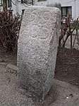 | |||
| March Stone No. 61, In Front Garden Of No. 37 King's Crescent | 57°09′25″N 2°05′59″W | Category B | 20041 | | |||
| Chanonry Well, At St. Machar's Cathedral Gateway, Old Aberdeen | 57°10′09″N 2°06′11″W | Category B | 20052 | | |||
| Firhill Well, "The Gibberie Wallie", St Machar Sports Centre, Sunnyside Road | 57°09′44″N 2°06′18″W | Category B | 20053 | 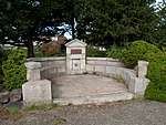 | |||
| Union Terrace Gardens, Arcades, Balustrades And Public Toilets | 57°08′45″N 2°06′08″W | Category B | 20066 | | |||
| Rosemount Viaduct Over Upper Denburn Valley | 57°08′53″N 2°06′31″W | Category B | 20076 | | |||
| Mid Stocket Road And Beechgrove Avenue, Beechgrove Church (Church Of Scotland), Including Gatepiers And Boundary Walls | 57°08′58″N 2°07′42″W | Category B | 19936 | |
Key
The scheme for classifying buildings in Scotland is:
- Category A: "buildings of national or international importance, either architectural or historic; or fine, little-altered examples of some particular period, style or building type."[1]
- Category B: "buildings of regional or more than local importance; or major examples of some particular period, style or building type, which may have been altered."[1]
- Category C: "buildings of local importance; lesser examples of any period, style, or building type, as originally constructed or moderately altered; and simple traditional buildings which group well with other listed buildings."[1]
In March 2016 there were 47,288 listed buildings in Scotland. Of these, 8% were Category A, and 50% were Category B, with the remaining 42% being Category C.[2]
gollark: yes
gollark: <@543131534685765673> HelloBoi is the smartest one here.
gollark: Base64 would be better, but I don't think pastebin would let me.
gollark: Ah. Well. I can't upload it, since it's 17MB.
gollark: Does anyone want a 17MB JPEG of a keyboard?
See also
Notes
- Sometimes known as OSGB36, the grid reference (where provided) is based on the British national grid reference system used by the Ordnance Survey.
• "Guide to National Grid". Ordnance Survey. Retrieved 12 December 2007.
• "Get-a-map". Ordnance Survey. Retrieved 17 December 2007. - Historic Environment Scotland assign a unique alphanumeric identifier to each designated site in Scotland, for listed buildings this always begins with "LB", for example "LB12345".
References
- All entries, addresses and coordinates are based on data from Historic Scotland. This data falls under the Open Government Licence
- "What is Listing?". Historic Environment Scotland. Retrieved 29 May 2018.
- Scotland's Historic Environment Audit 2016 (PDF). Historic Environment Scotland and the Built Environment Forum Scotland. pp. 15–16. Retrieved 29 May 2018.
This article is issued from Wikipedia. The text is licensed under Creative Commons - Attribution - Sharealike. Additional terms may apply for the media files.