List of historic places in St. John's, Newfoundland and Labrador
This article is a list of historic places in St. John's, Newfoundland and Labrador entered on the Canadian Register of Historic Places, whether they are federal, provincial, or municipal.
List of historic places
| Name | Address | Coordinates | IDF | IDP | IDM | Image | |
|---|---|---|---|---|---|---|---|
| Anderson House | 42 Powers Court, St. John's, NL | 47°34′22″N 52°41′48″W | 2242 | 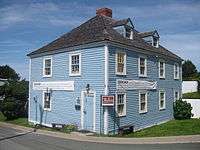 | |||
| Angel House Registered Heritage Structure | 146 Hamilton Avenue, St. John's, NL | 47°33′13″N 52°43′17″W | 2333 | 6127 | 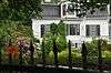 | ||
| Anglican Cathedral Parish House | 9 Cathedral Street, St. John's, NL | 47°33′57″N 52°42′31″W | 2429 |  | |||
| Apothecary Hall | 488 Water Street, St. John's, NL | 47°33′22″N 52°42′51″W | 2304 | 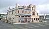 | |||
| Bannerman House | 54 Circular Road, St. John's, NL | 47°34′23″N 52°42′36″W | 2618 | 8062 | 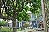 | ||
| 008 Barnes Road | 8 Barnes Road, St. John's, NL | 47°34′07″N 52°42′34″W | 5468 | | |||
| 010 Barnes Road | 10 Barnes Road, St. John's, NL | 47°34′07″N 52°42′34″W | 3298 | | |||
| Bartra | 28 Circular Road, St. John's, NL | 47°34′26″N 52°42′26″W | 2711 | 10390 | 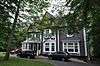 | ||
| Basilica of St. John the Baptist National Historic Site of Canada | 172 Military Road, St. John's, NL | 47°34′02″N 52°42′33″W | 4139 | 3056 | 10491 | 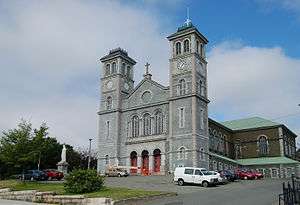 | |
| Basilica Cathedral of St. John the Baptist Entrance Archway Municipal Heritage Building | 200 Military Road, St. John's, NL | 47°34′02″N 52°42′34″W | 5867 | 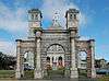 | |||
| Benevolent Irish Society (BIS) Building | 48 Queen's Road, St. John's, NL | 47°34′01″N 52°42′34″W | 3303 | 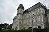 | |||
| Bishop Feild College | 46 Bond Street, St. John's, NL | 47°35′39″N 52°42′22″W | 2243 | 5272 |  | ||
| Bishop's Library | Bonaventure Avenue, between the Bishop's Palace and The Monastery, St. John's, NL | 47°34′02″N 52°42′44″W | 2188 |  | |||
| Bishop's Palace | Bonaventure Avenue, St. John's, NL | 47°34′03″N 52°42′44″W | 2289 |  | |||
| Building 202 | Former Pepperrell AFB, St. John's, NL | 47°34′56″N 52°41′45″W | 11364 | | |||
| Building 204 | Former Pepperrell AFB, St. John's, NL | 47°34′58″N 52°41′39″W | 11365 | | |||
| Building 205 | Former Pepperrell AFB, St. John's, NL | 47°35′06″N 52°41′39″W | 11437 | | |||
| Building 206 | Former Pepperrell AFB, St. John's, NL | 47°35′00″N 52°41′44″W | 11438 | | |||
| Building 207 | Former Pepperrell AFB, St. John's, NL | 47°35′00″N 52°41′39″W | 11439 | | |||
| Building 308 | Former Pepperrell AFB, St. John's, NL | 47°35′06″N 52°41′39″W | 7451 |  | |||
| Building 309 | Former Pepperrell AFB, St. John's, NL | 47°35′06″N 52°41′39″W | 7452 |  | |||
| Building 311 | Former Pepperrell AFB, St. John's, NL | 47°35′06″N 52°41′54″W | 11443 |  | |||
| Building 312 | Former Pepperrell AFB, St. John's, NL | 47°35′06″N 52°41′50″W | 11445 |  | |||
| Building 313 | Former Pepperrell AFB, St. John's, NL | 47°35′05″N 52°41′58″W | 11446 |  | |||
| Building 314 | Former Pepperrell AFB, St. John's, NL | 47°35′06″N 52°41′39″W | 11448 |  | |||
| Building 401 | Former Pepperrell AFB, St. John's, NL | 47°35′07″N 52°41′46″W | 11366 |  | |||
| Building 402 | Former Pepperrell AFB, St. John's, NL | 47°35′07″N 52°41′46″W | 11368 |  | |||
| Building 403 | Former Pepperrell AFB, St. John's, NL | 47°35′09″N 52°41′47″W | 11373 |  | |||
| Building 404 | Former Pepperrell AFB, St. John's, NL | 47°35′09″N 52°41′48″W | 11376 |  | |||
| Building 405 | Former Pepperrell AFB, St. John's, NL | 47°35′07″N 52°41′48″W | 11378 |  | |||
| Building 406 | Former Pepperrell AFB, St. John's, NL | 47°35′08″N 52°41′50″W | 11380 |  | |||
| Building 407 | Former Pepperrell AFB, St. John's, NL | 47°35′06″N 52°41′39″W | 7492 |  | |||
| Building 408 | Former Pepperrell AFB, St. John's, NL | 47°35′06″N 52°41′39″W | 7493 |  | |||
| Building 409 | Former Pepperrell AFB, St. John's, NL | 47°35′10″N 52°41′52″W | 11423 |  | |||
| Building 410 | Former Pepperrell AFB, St. John's, NL | 47°35′09″N 52°41′54″W | 11426 |  | |||
| Building 501 | Former Pepperrell AFB, St. John's, NL | 47°35′06″N 52°41′44″W | 11427 | | |||
| Building 507 | Former Pepperrell AFB, St. John's, NL | 47°35′10″N 52°41′42″W | 11431 | | |||
| Building 508 | Former Pepperrell AFB, St. John's, NL | 47°35′09″N 52°41′42″W | 11432 | | |||
| Building 509 | Former Pepperrell AFB, St. John's, NL | 47°35′07″N 52°41′42″W | 11433 |  | |||
| Building 511 | Former Pepperrell AFB, St. John's, NL | 47°35′09″N 52°41′40″W | 11434 | | |||
| Building 512 | Former Pepperrell AFB, St. John's, NL | 47°35′11″N 52°41′40″W | 11436 | | |||
| Building 517 | Former Pepperrell AFB, St. John's, NL | 47°35′12″N 52°41′37″W | 11491 | | |||
| Building 806 | Former Pepperrell AFB, St. John's, NL | 47°35′12″N 52°41′20″W | 11381 |  | |||
| Cabot Tower | Signal Hill Road, St. John's, NL | 47°34′23″N 52°40′58″W | 2974 |  | |||
| Canada House Municipal Heritage Building | 74 Circular Road, St. John's, NL | 47°34′19″N 52°42′48″W | 10609 |  | |||
| Cape Spear Lighthouse | Blackhead Road, Highway 11, St. John's, NL | 47°31′20″N 52°37′29″W | 2885 7404 |
20775 | .JPG) | ||
| Chapel Hill Condominiums | 39 Queen's Road, St. John's, NL | 47°34′03″N 52°42′30″W | 3302 |  | |||
| 24 Circular Road Municipal Heritage Building | 24 Circular Road, St. John's, NL | 47°34′27″N 52°42′24″W | 10389 | 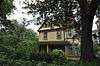 | |||
| Cochrane Street United Church | Cochrane Street, St. John's, NL | 47°34′10″N 52°42′10″W | 3054 | 5346 | 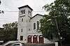 | ||
| 028 Cochrane Street | 28 Cochrane Street, St. John's, NL | 47°34′10″N 52°42′10″W | 2278 | 10409 |  | ||
| Colonial Building | Military Road, St. John's, NL | 47°34′15″N 52°42′23″W | 3063 | 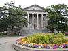 | |||
| Commercial Cable Company Building | 95 Water Street, St. John's, NL | 47°34′00″N 52°42′14″W | 2112 | 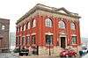 | |||
| Christ Church / Quidi Vidi Church National Historic Site of Canada | 100 The Boulevard, St. John's, NL | 47°34′58″N 52°41′33″W | 11958 | 5274 | 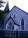 | ||
| Church of England Institute CEI Club | corner of Hamilton Avenue and Sudbury Street, St. John's, NL | 47°33′09″N 52°43′17″W | 2087 | 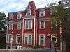 | |||
| 034 Circular Road Municipal Heritage Building | 34 Circular Road, St. John's, NL | 47°34′25″N 52°42′29″W | 5538 | 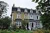 | |||
| Commercial Chambers Building | 197 Water Street, St. John's, NL | 47°33′50″N 52°42′25″W | 2149 | | |||
| Cornerstone Theatre | corner of Queen, George and Water Streets, St. John's, NL | 47°33′37″N 52°42′43″W | 2643 | | |||
| Crow's Nest Officer's Club | Water Street, St. John's, NL | 47°34′01″N 52°42′13″W | 18926 | 2279 | .jpg) | ||
| The Deanery (Anglican Cathedral Parish Rectory) | 22 Church Hill, St. John's, NL | 47°33′57″N 52°42′32″W | 2613 | 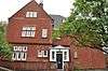 | |||
| Delgado Building Municipal Heritage Building | 169-173 Water Street, St. John's, NL | 47°33′54″N 52°42′22″W | 5537 |  | |||
| Devon House Registered Heritage Structure | 59 Duckworth Street, St. John's, NL | 47°34′14″N 52°41′59″W | 2283 |  | |||
| Devon Place | 3 Forest Road, St. John's, NL | 47°34′20″N 52°42′53″W | 3306 |  | |||
| Devon Row Municipal Heritage Building | 1-4 Devon Row (Duckworth Street), St. John's, NL | 47°34′14″N 52°41′59″W | 10419 |  | |||
| 261 Duckworth Street | 261 Duckworth Street, St. John's, NL | 47°33′58″N 52°42′21″W | 2637 |  | |||
| 271-275 Duckworth Street | 271-275 Duckworth Street, St. John's, NL | 47°33′56″N 52°42′22″W | 2495 |  | |||
| 333 Duckworth Street | 333 Duckworth Street, St. John's, NL | 47°33′50″N 52°42′28″W | 3426 |  | |||
| 377 Duckworth Street | 377 Duckworth Street, St. John's, NL | 47°33′46″N 52°42′40″W | 2284 |  | |||
| Elizabeth Manor Municipal Heritage Building | 21 Military Road, St. John's, NL | 47°34′16″N 52°42′12″W | 5542 |  | |||
| Emmanuel House Municipal Heritage Building | 83 Cochrane Street, St. John's, NL | 47°34′16″N 52°42′16″W | 6128 | 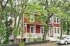 | |||
| Forest House | 50 Forest Road, St. John's, NL | 47°34′29″N 52°42′10″W | 2305 | 5343 | 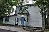 | ||
| Former Bank of British North America National Historic Site of Canada | 276 Duckworth Street, St. John's, NL | 47°33′57″N 52°42′23″W | 12643 | 2329 | 10478 | 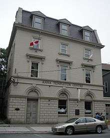 | |
| Former Newfoundland Railway Terminus & Headquarters | 495 Water Street, St. John's, NL | 47°33′17″N 52°42′49″W | 6501 15725 |
 | |||
| Fort Amherst National Historic Site of Canada | Southside Road, St. John's, NL | 47°33′49″N 52°40′48″W | 12850 | 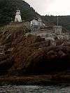 | |||
| Fort Townshend National Historic Site of Canada | Bonaventure Avenue and Harvey Roads, St. John's, NL | 47°33′58″N 52°42′44″W | 14342 | 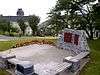 | |||
| Fort William National Historic Site of Canada | 115 Cavendish Square (plaque), St. John's, NL | 47°34′15″N 52°42′03″W | 13082 | | |||
| George Street United Church Municipal Heritage Building | George Street, St. John's, NL | 47°33′29″N 52°42′48″W | 2315 | 10485 | 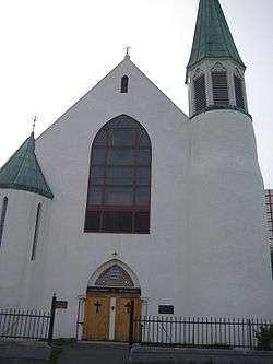 | ||
| Government House National Historic Site of Canada | 80 Military Road, St. John's, NL | 47°34′20″N 52°42′18″W | 13399 | .jpg) | |||
| Gower Street United Church | Queen's Road, St. John's, NL | 47°33′58″N 52°42′38″W | 2285 | 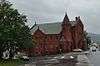 | |||
| 018 Gower Street Municipal Heritage Building | 18 Gower Street, St. John's, NL | 47°34′13″N 52°42′10″W | 5352 |  | |||
| 020 Gower Street Municipal Heritage Building | 20 Gower Street, St. John's, NL | 47°34′13″N 52°42′10″W | 5353 |  | |||
| 022 Gower Street Municipal Heritage Building | 22 Gower Street, St. John's, NL | 47°34′13″N 52°42′10″W | 5354 | | |||
| Grace Building, 283-285 Water Street Municipal Heritage Building | 283-285 Water Street, St. John's, NL | 47°33′44″N 52°42′32″W | 5850 |  | |||
| Harris Cottage | 43 Monkstown Road, St. John's, NL | 47°34′13″N 52°42′38″W | 2286 | 10502 |  | ||
| Horwood House | 718 Water Street, St. John's, NL | 47°32′57″N 52°43′17″W | 2287 |  | |||
| The House | 21 Rennie's Mill Road, St. John's, NL | 47°34′11″N 52°42′36″W | 2624 |  | |||
| Howard House Municipal Heritage Building | 7 Garrison Hill, St. John's, NL | 47°34′00″N 52°42′33″W | 2314 | 10483 |  | ||
| The Imperial | 22 Flavin Street (corner of Bond), St. John's, NL | 47°34′07″N 52°42′21″W | 3363 |  | |||
| Kelvin House and Conservatory Registered Heritage Structure | 49 Rennie's Mill Road, St. John's, NL | 47°34′15″N 52°42′38″W | 2619 | 5451 |  | ||
| King George V Building | 93 Water Street, diagonally across from War Memorial, St. John's, NL | 47°34′01″N 52°42′13″W | 1134 |  | |||
| 031 King's Bridge Road | 31 King's Bridge Road, St. John's, NL | 47°34′30″N 52°42′12″W | 3299 |  | |||
| 033 King's Bridge Road | 33 King's Bridge Road, St. John's, NL | 47°34′29″N 52°42′12″W | 3425 | | |||
| 035 King's Bridge Road Municipal Heritage Building | 35 King's Bridge Road, St. John's, NL | 47°34′31″N 52°42′12″W | 5539 |  | |||
| Kinkora | 36 King's Bridge Road, St. John's, NL | 47°34′30″N 52°42′09″W | 2638 | 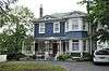 | |||
| Lakecrest Independent School | 58 Patrick Street, St. John's, NL | 47°33′14″N 52°43′02″W | 3178 | 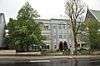 | |||
| The Lea | 39 Topsail Road, St. John's, NL | 47°32′44″N 52°43′25″W | 2167 | 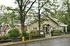 | |||
| Longshoremen's Protective Union (LSPU) Hall | 3 Victoria Street, St. John's, NL | 47°33′58″N 52°42′23″W | 2152 | 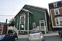 | |||
| Majestic Theatre Municipal Heritage Building | 390 Duckworth Street, St. John's, NL | 47°33′45″N 52°42′39″W | 5536 | .jpg) | |||
| Mallard Cottage | 2 Barrows Road, St. John's, NL | 47°34′19″N 52°41′51″W | 4226 | 2150 | 10380 |  | |
| Martin McNamara House | 15 Plank Road, St. John's, NL | 47°33′14″N 52°42′54″W | 2321 | 10506 | | ||
| Military Hospital | Forest Road, St. John's, NL | 47°34′31″N 52°41′40″W | 2430 | | |||
| 112 Military Road Municipal Heritage Building | 112 Military Road, St. John's, NL | 47°34′11″N 52°42′27″W | 2717 |  | |||
| The Monastery (Old St. Bonaventure's College) | Bonaventure Avenue (attached to Bishop's Library and St. Bonaventure's College), St. John's, NL | 47°34′03″N 52°42′46″W | 2623 |  | |||
| Monkstown Manor | 51 Monkstown Road, St. John's, NL | 47°34′13″N 52°42′39″W | 2639 |  | |||
| 007 Monkstown Road | 7 Monkstown Road, St. John's, NL | 47°34′08″N 52°42′32″W | 2718 | 10503 |  | ||
| Mount St. Francis Monastery | Merrymeeting Road, St. John's, NL | 47°34′02″N 52°42′52″W | 2113 | 10490 |  | ||
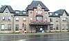
| Murray Premises | 5 Beck's Cove, St. John's, NL | 47°33′41″N 52°42′34″W | 12929 | 2232 |  | ||
| The New House, 335 Southside Road | 335 Southside Road, St. John's, NL | 47°33′04″N 52°42′58″W | 2621 |  | |||
| The New House, 337 Southside Road | 337 Southside Road, St. John's, NL | 47°33′00″N 52°42′58″W | 2620 | | |||
| Newman Building | 1 Springdale Street, St. John's, NL | 47°33′26″N 52°42′44″W | 2644 |  | |||
| Newman Wine Vaults Provincial Historic Site | 436 Water Street, St. John's, NL | 47°33′26″N 52°42′44″W | 2153 |  | |||
| The Observatory Municipal Heritage Building | 1 Bonaventure Avenue, St. John's, NL | 47°34′00″N 52°42′39″W | 10379 |  | |||
| O'Donel Memorial Hall | 58 Queen's Road and 189 Military Road, St. John's, NL | 47°34′01″N 52°42′34″W | 4071 |  | |||
| O'Dwyer Block | Water Street, St. John's, NL | 47°33′42″N 52°42′35″W | 2154 |  | |||
| The Old London, New York and Paris Building | 179-181 Water Street, corner of Baird's Cove, St. John's, NL | 47°33′53″N 52°42′22″W | 2083 |  | |||
| Oratory of the Sacred Heart, Our Lady of Mercy Convent | Military Road, St. John's, NL | 47°34′04″N 52°42′39″W | 2288 | | |||
| Our Lady of Mercy Convent | Military Road, St. John's, NL | 47°34′05″N 52°42′40″W | 2173 | | |||
| 003 Park Place | 3 Park Place, St. John's, NL | 47°34′13″N 52°42′33″W | 3304 | 10504 |  | ||
| 004 Park Place | 4 Park Place, St. John's, NL | 47°34′13″N 52°42′33″W | 2641 |  | |||
| Peppercorn House Municipal Heritage Building | 25 Monkstown Road, St. John's, NL | 47°34′10″N 52°42′35″W | 5543 |  | |||
| 007 Plank Road | 7 Plank Road, St. John's, NL | 47°33′16″N 52°42′54″W | 3839 | | |||
| Pleasantville-Building 223 | 2231 Legion Street, St. John's, NL | 47°35′06″N 52°41′39″W | 7590 |  | |||
| 015 Portugal Cove Road | 15 Portugal Cove Road, St. John's, NL | 47°34′35″N 52°42′36″W | 3179 | | |||
| 074-076 Prescott Street | 74-76 Prescott Street, St. John's, NL | 47°34′06″N 52°42′26″W | 3180 |  | |||
| 078 Prescott Street, Neville Framing | 78 Prescott Street, St. John's, NL | 47°34′06″N 52°42′26″W | 3181 |  | |||
| Presentation Convent and School | Cathedral Square, St. John's, NL | 47°34′05″N 52°42′40″W | 2290 |  | |||
| Provincial Museum of Newfoundland and Labrador | 285 Duckworth Street, St. John's, NL | 47°33′54″N 52°42′24″W | 2331 |  | |||
| Queen Victoria Wing | Forest Road, St. John's, NL | 47°34′31″N 52°41′40″W | 2431 | | |||
| 30 Queen's Road | 30 Queen's Road, St. John's, NL | 47°34′06″N 52°42′30″W | 3301 |  | |||
| 32 Queen's Road Municipal Heritage Building | 32 Queen's Road, St. John's, NL | 47°34′05″N 52°42′34″W | 12063 |  | |||
| 034 Queen's Road | 34 Queen's Road, St. John's, NL | 47°34′05″N 52°42′34″W | 2561 |  | |||
| Quidi Vidi Battery | Cuckhold's Cove Road, St. John's, NL | 47°34′49″N 52°40′29″W | 3061 | 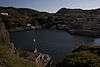 | |||
| Rennie's Mill Road Historic District National Historic Site of Canada | 21-79,12-54 Rennie's Mill Road, St. John's, NL | 47°34′16″N 52°42′34″W | 10699 | 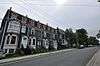 | |||
| Retreat Cottage | 14 Kenna's Hill, St. John's, NL | 47°34′45″N 52°42′14″W | 2302 |  | |||
| Richmond Hill | 18 Topsail Road, St. John's, NL | 47°32′49″N 52°43′25″W | 2719 |  | |||
| Ruby Church | Main Road, St. John's, NL | 47°29′08″N 52°46′05″W | 2194 | 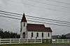 | |||
| S.O. Steele Building | 100 Water Street, St. John's, NL | 47°34′02″N 52°42′14″W | 2160 | 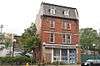 | |||
| St. Andrew's Church (The Kirk) | above Queen's Road at Long's Hill, St. John's, NL | 47°33′56″N 52°42′39″W | 2162 | | |||
| St. Bonaventure's College (Mullock Hall) Registered Heritage Structure | Bonaventure Avenue, St. John's, NL | 47°34′03″N 52°42′46″W | 2622 | 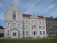 | |||
| St. John the Baptist Anglican Cathedral National Historic Site of Canada | 18 Church Hill, St. John's, NL | 47°33′55″N 52°42′31″W | 12663 | 5113 | 8063 | 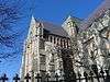 | |
| St. John's Court House National Historic Site of Canada | 194 Water Street, St. John's, NL | 47°33′50″N 52°42′22″W | 2923 | 2107 |  | ||
| St. John's Ecclesiastical District | roughly properties on Cathedral Street, Bonaventure Avenue, Church Hill, and adjacent, St. John's, NL | 47°34′05″N 52°42′40″W | 4039 |  | |||
| St. John's Masonic Temple | 6 Cathedral Street, St. John's, NL | 47°33′57″N 52°42′27″W | 2151 | 5300 |  | ||
| St. Joseph's Chapel | Blackhead neighborhood, St. John's, NL | 47°31′23″N 52°39′35″W | 2163 | 5271 |  | ||
| St. Michael's Convent, Belvedere | Bonaventure Avenue, St. John's, NL | 47°34′09″N 52°43′11″W | 2157 | 10489 | | ||
| St. Michael's Orphanage, Belvedere | Bonaventure Avenue, St. John's, NL | 47°34′10″N 52°43′08″W | 2332 | 10488 | | ||
| St. Patrick's Convent and School | 15 Convent Square, St. John's, NL | 47°33′14″N 52°42′59″W | 2614 |  | |||
| St. Patrick's Deanery Registered Heritage Structure | 6 Patrick Street, St. John's, NL | 47°33′12″N 52°42′58″W | 10849 | 2642 |  | ||
| St. Patrick's Roman Catholic Church National Historic Site of Canada | 40 Patrick Street, St. John's, NL | 47°33′13″N 52°43′02″W | 12845 | 2164 | 10505 |  | |
| St. Thomas' Church | 8 Military Road, St. John's, NL | 47°34′16″N 52°42′09″W | 2166 | 10492 |  | ||
| St. Thomas Rectory / Commissariat House and Garden National Historic Site of Canada | King's Bridge Road, St. John's, NL | 47°34′21″N 52°42′09″W | 15612 | 3062 | 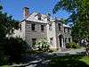 | ||
| Signal Hill National Historic Site of Canada | Signal Hill Road and the south side of The Narrows, St. John's, NL | 47°34′21″N 52°40′55″W | 4439 | 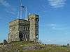 | |||
| Squires Barn and Carriage House | 315-317 Mount Scio Road, St. John's, NL | 47°34′15″N 52°45′35″W | 2293 | 8369 | | ||
| Star of the Sea Hall Municipal Heritage Building | 40 Henry Street, St. John's, NL | 47°33′48″N 52°42′35″W | 2082 | | |||
| The Stone House | 8 Kenna's Hill, St. John's, NL | 47°34′43″N 52°42′14″W | 3177 | 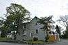 | |||
| Sunnyside Gatehouse Municipal Heritage Building | 60 Circular Road, St. John's, NL | 47°34′21″N 52°42′39″W | 5453 | 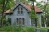 | |||
| Sunnyside House Registered Heritage Structure | 70 Circular Road, St. John's, NL | 47°34′20″N 52°42′46″W | 8061 | 5454 |  | ||
| Sutherland Place | 10-20 King's Bridge Road, St. John's, NL | 47°34′11″N 52°42′27″W | 4043 |  | |||
| Temperance Street Houses Registered Heritage Structure (Four Sisters) | 31, 33, 35, and 37 Temperance Street, St. John's, NL | 47°34′16″N 52°41′52″W | 10692 | 12901 |  | ||
| Thimble Cottage Registered Heritage Structure | 150 Oxen Pond Road, St. John's, NL | 47°33′57″N 52°45′21″W | 2625 | 8370 |  | ||
| Thompson Building | 303-305 Water Street, St. John's, NL | 47°33′42″N 52°42′35″W | 2168 |  | |||
| Tobin Building | 214 Duckworth Street, St. John's, NL | 47°34′03″N 52°42′16″W | 2294 | 10420 |  | ||
| Union Bank Building | 287 Duckworth Street, St. John's, NL | 47°33′54″N 52°42′25″W | 2515 |  | |||
| 027 Victoria Street | 27 Victoria Street, St. John's, NL | 47°34′00″N 52°42′28″W | 3364 |  | |||
| Water Street Historic District National Historic Site of Canada | 288-300 and 291-307 Water Street as well as the Murray Premises National Historic Site, St. John's, NL | 47°33′42″N 52°42′36″W | 7700 |  | |||
| 73, 75 and 77 Water Street Registered Heritage Structure | 73, 75, and 77 Water Street, St. John's, NL | 47°34′04″N 52°42′11″W | 10847 |  | |||
| 187-189 Water Street | 187-189 Water Street, St. John's, NL | 47°33′49″N 52°42′25″W | 2720 |  | |||
| 191 Water Street | 191 Water Street, St. John's, NL | 47°33′50″N 52°42′25″W | 2721 |  | |||
| 193 Water Street | 193 Water Street, St. John's, NL | 47°33′50″N 52°42′25″W | 2722 |  | |||
| 201 Water Street Municipal Heritage Building | 201 Water Street, St. John's, NL | 47°33′50″N 52°42′25″W | 5535 |  | |||
| 203 Water Street Municipal Heritage Building | 203 Water Street, St. John's, NL | 47°33′50″N 52°42′27″W | 5587 |  | |||
| 205 Water Street Municipal Heritage Building | 205 Water Street, St. John's, NL | 47°33′50″N 52°42′28″W | 6129 |  | |||
| 226 Water Street Municipal Heritage Building | 226 Water Street, St. John's, NL | 47°33′49″N 52°42′29″W | 6133 |  | |||
| 562-564 Water Street | 562-564 Water Street, St. John's, NL | 47°33′16″N 52°42′48″W | 2295 |  | |||
| Waterford Hall | 185 Waterford Bridge Road, St. John's, NL | 47°32′06″N 52°44′10″W | 2169 | 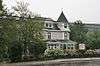 | |||
| Wesley United Church | 101 Patrick Street, St. John's, NL | 47°33′16″N 52°43′10″W | 3300 | 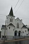 | |||
| Winterholme National Historic Site of Canada | 79 Rennies Mill Road, St. John's, NL | 47°34′21″N 52°42′37″W | 2914 | 5093 | 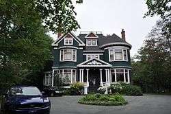 | ||
| Yellow Belly Corner Municipal Heritage Building | corner of Water Street, Beck's Cove and George Street, St. John's, NL | 47°33′44″N 52°42′36″W | 5341 | 1201 | 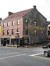 |
gollark: Down with most brackets!
gollark: Factorial != factorizer.
gollark: Something like that (pseudopython).
gollark: ```for i in range(2, sqrt(x)): if x // i == x / x: return falsereturn true```
gollark: Or scratch them.
See also
- List of historic places on the Avalon Peninsula
- List of historic places in Newfoundland and Labrador
- List of National Historic Sites of Canada in Newfoundland and Labrador
| National parks | |
|---|---|
| National historic sites |
|
| Provincial parks | |
| Wilderness & Ecological Reserves | |
| |
This article is issued from Wikipedia. The text is licensed under Creative Commons - Attribution - Sharealike. Additional terms may apply for the media files.