List of New York State Historic Markers in Washington County, New York
This is an incomplete list of New York State Historic Markers in Washington County, New York.[1]
Listings county-wide
| Marker name[1] | Image | Date designated | Location | City or Town | Coords | Marker text | |
|---|---|---|---|---|---|---|---|
| 1 | FIRST CHURCH | On Nys 40 About 1/2 Mile South Of Argyle | Argyle | And Manse Of Argyle United Presbyterian Congregation Built In 1792 Near Group Of Trees A Short Distance East Of This Spot. | |||
| 2 | KILMER MILL | On Nys 197 At Argyle | Argyle | Built Short Distance West Of Here Before Revolution. First Settlement In Argyle Village And First Grist Mill Within Forty Miles. | |||
| 3 | SITE OF | On Co. Rd. About 1½ Miles East Of South Argyle | Argyle | Allen House Where Nine People Were Killed By Le Loup's Indians July 1777 | |||
| 4 | THE STREET | On Nys 40 About 1/2 Mile South Of Argyle | Argyle | Road Laid Out In 1764 By Grantees Of Argyle Patent. Extended East Seven Miles From Hudson River Bordered By Town Lots Of Settlers | |||
| 5 | CONTINENTAL ROAD | On So. Union St., Cambridge | Cambridge | (Di-on-on-da-wa-ha Trail) Col. Baum's Route From Ft. Miller To Bennington August 14, 1777 | |||
| 6 | GREAT NORTHERN | At Intersection Of Nys 22 & Nys 313 At Cambridge | Cambridge | War Trail 1628–1764 Over Which Indians Led New England Captives To Canada During Indian Wars | |||
| 7 | SITE OF | On Town Rd. At South End Of Village Of Cambridge | Cambridge | First Church In Cambridge Patent Building Started 1775 Interrupted By Revolution Completed 1783 | |||
| 8 | Buskirk Bridge | 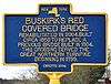 |
2004 | Southwest corner of Buskirk Road (Washington County Route 59) and Buskirk-West Hoosick Road | Cambridge | 42°57′30.6″N 73°26′0.4″W | Buskirk's Red Covered Bridge; Rehabilitated in 2004. Built circa 1850 to replace a previous bridge built in 1804. This crossing served the great Northern Turnpike in 1799. |
| 9 | SITE OF | On Town Rd. About 2 Miles East Of Center Cambridge | Cambridge | King's M.e. Church Erected 1823, Named For Fenner King, Leader And Promoter. Destroyed 1897. | |||
| 10 | SITE OF | On Academy St. In Cambridge | Cambridge | Cambridge Washington Academy Incorporated By Regents, 1815 Merged In Union School, 1873 | |||
| 11 | FRIEND'S LOG MEETING HOUSE | On Town Rd. About 3/4 Mile East Of Easton | Easton | Surrounded By Burgoyne's Indian Alliews In 1777 But Finding Friends Unarmed Stacked Arms And Attended Meeting Peaceably. | |||
| 12 | BLOCK HOUSE | On Island At Kanes Falls | Fort Ann | Built During Revolutionary War Probably To Protect Sawmill And Water Pipes To Fort Ann | |||
| 13 | BLOCK HOUSE | On Co. Rd. At Kanes Falls | Fort Ann | On Island | |||
| 14 | DEWEY PLACE | On Tn. Rd. At Dewey Bridge | Fort Ann | Built In 1788 By Thaddeus Dewey, Owned By Dewey, White, Collins And Parrish Families. Once An Old Tavern. | |||
| 15 | FORT ANN | On Us 4 At Fort Ann | Fort Ann | "Gateway To North" Here Stood Five Forts 1690–1777 On Route Between Lake Champlain & Hudson River | |||
| 16 | HALF-WAY CREEK | On Us 4 At Fort Ann | Fort Ann | Used In French And Indian & Revolutionary Wars For Transport Of Supplies | |||
| 17 | HOME OF COL. GEORGE WRAY | On Tn. Rd. 2 Mi. West Of Ft. Ann | Fort Ann | Original Manor House Built 1778, Contains Slave Pens. Grave Of Col. Wray In The Orchard. | |||
| 18 | HOME OF COL. GEORGE WRAY | On Us 4 At Fort Ann | Fort Ann | Two Miles West, Built About 1778, Contains Slave Pens. | |||
| 19 | OLD POWDER HOUSE | On Co. Rd. To W. Fort Ann In Fort Ann Village | Fort Ann | Used During French And Indian Wars And Revolutionary War | |||
| 20 | OLD WELL | On Charles St. At Fort Ann | Fort Ann | Used In Fort Site. Built Before Revolutionary War By Queen Anne Of England | |||
| 21 | OLDEST HOUSE | On Us 4 At Fort Ann | Fort Ann | Built Before 1800, Owned Successively By Moore Pike And Shipman Families | |||
| 22 | "THE ISLAND" | On Old Fort St. In Ft. Edward | Fort Edward | Barracks Hospital, Brick-kiln 1755 | |||
| 23 | 1/4 MILE | On Us 4 At Fort Miller | Fort Edward | Duer House British Headquarters Aug. 14–Sept. 10, 1777 | |||
| 24 | BAGLEY'S BRIDGE | On Us 4 About 1 Mile South Of Fort Edward | Fort Edward | (Pontoon Type) Blockhouses Guarded Approaches Built During French And Indian War | |||
| 25 | BLOCKHOUSE | On Bridge St., Fort Edward | Fort Edward | An Outpost Of The Fort Built During French And Indian War | |||
| 26 | FORT EDWARD | On Us 4 At S. End Of Ft. Edward | Fort Edward | 1755 Great Carrying Place Fort Nicholson 1709 Fort Lydius 1731 Fort Lyman 1755 | |||
| 27 | FORT EDWARD | On Us 4 At N. End Of Ft. Edward | Fort Edward | 1755 Great Carrying Place Fort Nicholson 1709 Fort Lydius 1731 Fort Lyman 1755 | |||
| 28 | GENERAL SCHUYLER'S | On Us 4 About 5 Miles South Of Fort Edward | Fort Edward | Entrenchments Headquarters Of American Army After The Evacuation Of Fort Edward July 1777 | |||
| 29 | JANE MC CREA | On B'way In Ft. Edward | Fort Edward | House 1777 | |||
| 30 | NEAR HERE STOOD | On Bank Of Old Canal Off B'way Between State & Argyle Sts., Ft. Edwd. | Fort Edward | The Red House, Mentioned In Madame Riedesel's Memoirs Built About 1765 | |||
| 31 | NEAR HERE WAS | At Intersection Of B'way & Moon Sts., Ft. Edward | Fort Edward | Northeast Bastion, Part Of Outworks Fort Edward 1755 | |||
| 32 | OLD MILITARY ROAD | At Intersection Of Case St. & Burgoyne Ave., Ft. Edward | Fort Edward | Followed The General Direction Of Burgoyne Avenue To Moss Street In Kingsbury | |||
| 33 | ON THE OPPOSITE SIDE | On Us 4 At Fort Miller | Fort Edward | Of The River Fort Miller Built During French And Indian War | |||
| 34 | ON THE WEST BANK | On Us 4 About 5 Miles South Of Fort Edward | Fort Edward | Was The Home Of Colonel John Mc Crea Patriot Brother Of Jane Mc Crea | |||
| 35 | ORIGINAL BURIAL PLACE OF | On Us 4 About 2½ Miles South Of Fort Edward | Fort Edward | Jane Mc Crea July 28, 1777 | |||
| 36 | REMAINS OF | On Old Fort St. Ft. Edward | Fort Edward | Old Moat Hospital, Part Of Outworks Fort Edward 1755 | |||
| 37 | REVOLUTIONARY | On Case St., Ft. Edward | Fort Edward | Blockhouse Attacked July 27, 1777 | |||
| 38 | SITE OF HOME | On Town Rd. About 3/4 Mile East Of Fort Miller | Fort Edward | Judge William Duer Statesman And Patriot | |||
| 39 | STATE ST. BURYING GROUND | At Intersection Of State & Notre Dame Sts., Ft. Edward | Fort Edward | Original Burial Place Of Duncan Campbell Second Burial Place Of Jane Mc Crea | |||
| 40 | THE GRAVE OF | On Us 4 Between Fort Edward & Hudson Falls | Fort Edward | Duncan Campbell & Jane Mc Crea Are Just Within And To The Left Of This Gateway | |||
| 41 | TO THE SITE OF | At Intersection Of Old Fort & Montgomery Sts., Ft. Edward | Fort Edward | Old Ft. Edward Built 1755 | |||
| 42 | TO THE SOUTH | On Notre Dame St. In Ft. Edward | Fort Edward | Putnam's Rangers And Provincial Troops Defeated French And Indians After They Had Killed Twelve Men July 23, 1757 | |||
| 43 | ERECTED 1784 | On Old Rte. Nys 22 In Truthville | Granville | The First Baptist Church In The Town Of Granville | |||
| 44 | ERECTED 1789 | On Nys 149 At S. Granville | Granville | The First Congregational Church In The Town Of Granville | |||
| 45 | FIRST CHURCH | On Nys 22 In Middle Granville | Granville | In The Town Of Granville Erected In 1782 By The Union Religious Society | |||
| 46 | FRIENDS | At Intersection Of State & Notre Dame Sts., Ft. Edward | Granville | Meeting House Erected 1806 Beside Church Site Of Log School House Of Friends Later A District School | |||
| 47 | FROM THIS PLACE | On Co. Rd. At Clarks Mills | Greenwich | Burgoyne's German Troops Marched To The Battle Of Bennington | |||
| 48 | MC NEAL'S FERRY | On Us 4 At Bridge Over Hudson R. At Thomson | Greenwich | Operated During Revolutionary Days | |||
| 49 | POSITION OF | On Tn. Rd. Leading To Abandoned Bridge Over Hudson R., Clarks Mills | Greenwich | Burgoyne's Bridge Of Boats On Which He Crossed The Hudson | |||
| 50 | POSITION OF | On Co. Rd. Between Clarks Mills & Thomson | Greenwich | General Stark Before Crossing The River | |||
| 51 | SITE OF | On Tn. Rd. Leading To Abandoned Bridge Over Hudson R., Clarks Mills | Greenwich | The British Camp Before Crossing Hudson Later Occupied By General Fellows' Continentals | |||
| 52 | SITE OF | On Co. Rd. At Clarks Mills | Greenwich | Captain Furnival's Battery Commanding Marshall House And River Crossing | |||
| 53 | BROWN'S TAVERN | On Nys 40 At S. Hartford | Hartford | Erected 1802 By Caleb Brown | |||
| 54 | CLINTON GIFT | On Co.rd. At Hartford | Hartford | Gov. Clinton Gave This Land To Baptist Society, 1798, Log Meeting House, 1788 Stood 50 Feet To The South, Church Erected Here, 1805 | |||
| 55 | HAWK'S CORNERS | On Nys 149 About 4 Miles West Of Hartford | Hartford | Saville's Tavern Built 1800 M. Bull's Blacksmith Shop 1794, A Town Pound 1794 Higley's Shoe Shop, 1850 | |||
| 56 | MILL CREEK | On Nys 40 At S. Hartford | Hartford | Covell's Mills East 1810, Hatch Tannery 100 Ft. South 1800, Scott's Clothing Works And Other Mills Below. Woolen Mill, 1 Mile West, 1836 | |||
| 57 | SITE OF | On Nys 149 At Hartford | Hartford | Old Mills I. Norton Built Dam 1814 Down's Clothing Works Woodell Starch Mill 1866 Daicy Cabinet Works 1870 Higby Tannery Below 1818 | |||
| 58 | HOME AND LABORATORY | On Rte. 29, 2 Miles S.w. Of Salem | Salem | Dr. Asa Fitch, Jr. 1809–1879 First State Entomologist, 1854-71. Pioneer In Study Of Crop Pests And Their Control | |||
| 59 | A LOG CHURCH | On Co. Rd. About 1½ Miles West Of White Creek | White Creek | Which Stood Here Was Burned By The British Battle Of Walloomsac Aug. 16, 1777 | |||
| 60 | GREAT NORTHERN | On West Side Of S. Park St. In Cambridge | White Creek | War Trail C. 1650–1700 Over Which Indians Led New England Captives To Canada During Indian Wars | |||
| 61 | SITE OF | On Nys 22 About 4 Miles South Of C | White Creek | Skirmish Between Hessian Troops & Cambridge Settlers Several Patriots Taken Prisoners, Aug. 15, 1777. | |||
| 62 | SITE OF | On Us 22 About 4 Miles South Of Cambridge | White Creek | British Encampment August 13, 1777 Col. Baum's Forces Camped Here | |||
| 63 | SITE OF | On Co. Rd. At White Creek | White Creek | Union Academy Established In 1810 | |||
| 64 | SITE OF | On Tn. Rd. At White Creek | White Creek | "John Allen's Hat Shop" Born 1775 - Died 1855 | |||
| 65 | SITE OF | On Tn. Rd. At White Creek | White Creek | Friends Meeting House Erected By Society Of Friends Of White Creek. Preparative Meeting In 1783. Finished In 1785. Larger One Built 1804. | |||
| 66 | SITE OF | On Tn. Rd. At Ash Grove | White Creek | Ash Grove Cemetery And 2D M.e. Church In U.s. Organized 1770 By Irish Methodists Under Thomas Ashton And Philip Embury | |||
| 67 | SITE OF HOME | On Co. Rd. About 1 Mile West Of White Creek | White Creek | John Wood Field Officers Were Voted For Here, May 11, 1776. Also Birthplace John Wood's Son, Jethro Wood, Inventor First Iron Mould Plow (1814) | |||
| 68 | NEAR THIS SPOT | On Us 4 At Whitehall | Whitehall | March 21, 1780, 3 Tories And Many Indians Murdered A Settler And His Wife And Captured Lemma Bartholomew. After His Return He Served As Ensign In Revolution | |||
gollark: Compilers did that, not people, probably.
gollark: I'm actually always correct so yes.
gollark: Premature optimisation is bad, so avoid spending ages for dubiously useful speed gains. But really inefficient code in some contexts is also bad, so optimise tight loops, frequently called stuff and real time stuff.
gollark: <@331320482047721472> h?
gollark: Why not just emulate a better CPU?
See also
References
- "New York State Historic Markers". New York State Historic Markers. New York Museum. 2009-07-15. Archived from the original on 2013-03-24.
This article is issued from Wikipedia. The text is licensed under Creative Commons - Attribution - Sharealike. Additional terms may apply for the media files.