List of Indiana state historical markers in Pulaski County
This is a list of the Indiana state historical markers in Pulaski County.
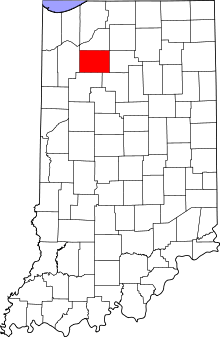
Location of Pulaski County in Indiana
This is intended to be a detailed table of the official state historical marker placed in Pulaski County, Indiana, United States by the Indiana Historical Bureau. The location of the historical marker and its latitude and longitude coordinates are included below when available, along with its name, year of placement, and topics as recorded by the Historical Bureau. There is 1 historical marker located in Pulaski County.[1]
Historical markers
| Marker title | Image | Year placed | Location | Topics |
|---|---|---|---|---|
| First Indiana Natural Gas Well[2] | 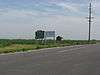 |
1988 | Western side of U.S. Route 421, about 1.5 miles south of Francesville, across from the quarry entrance 40°57′46″N 86°53′30″W |
Business, Industry, and Labor |
gollark: It's also somewhat tied to PotatOS.
gollark: Can't be bothered, it's in the code somewhere, try Ctrl f.
gollark: PotatOS uses YAFSS (Yet another file system sandbox). It's not very good. Although despite the name I'm not sure there are other modern ones.
gollark: My domain is used for things other than hosting random PotatOS source code.
gollark: No.
See also
References
- "Indiana Historical Markers by County". State of Indiana. Retrieved 2012-03-15.
- First Indiana Natural Gas Well, Indiana Historical Bureau, n.d. Accessed 2012-03-14.
External links
Municipalities and communities of Pulaski County, Indiana, United States | ||
|---|---|---|
| Towns | Map of Indiana highlighting Pulaski County | |
| Townships | ||
| CDP | ||
| Other unincorporated communities | ||
This article is issued from Wikipedia. The text is licensed under Creative Commons - Attribution - Sharealike. Additional terms may apply for the media files.