List of Indiana state historical markers in Fayette County
This is a list of the Indiana state historical markers in Fayette County.
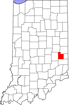
Location of Fayette County in Indiana
This is intended to be a detailed table of the official state historical marker placed in Fayette County, Indiana, United States by the Indiana Historical Bureau. The location of the historical marker and its latitude and longitude coordinates are included below when available, along with its name, year of placement, and topics as recorded by the Historical Bureau. There is 1 historical marker located in Fayette County.[1]
Historical marker
| Marker title | Image | Year placed | Location | Topics |
|---|---|---|---|---|
| The Whitewater Canal[2] | 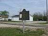 |
1966 | Northeastern corner of the junction of S. Grand Avenue (State Road 121) and Eastern Avenue, between a railroad line and the highway, in the southern part of Connersville 39°37′57″N 85°8′37″W |
Transportation, Business, Industry, and Labor |
gollark: I know, it's just that without any containers running those shouldn't reach several gigabytes in size.
gollark: Which is weird, since I don't think I actually had any Docker containers.
gollark: Yes, this is apparently what filled up my disk.
gollark: I am very annoyed by how moderately often my servers fill their entire disk with logfiles. Who *designed* this?
gollark: It's not a machine. It's literally just rights to a number you can have IP blocks and such assigned to.
See also
References
- "Indiana Historical Markers by County". State of Indiana. Retrieved 2012-03-15.
- The Whitewater Canal, Indiana Historical Bureau, n.d. Accessed 2012-03-14.
External links
Municipalities and communities of Fayette County, Indiana, United States | ||
|---|---|---|
| City | Map of Indiana highlighting Fayette County | |
| Town | ||
| Townships | ||
| Unincorporated communities | ||
| Footnotes | ‡This populated place also has portions in an adjacent county or counties | |
This article is issued from Wikipedia. The text is licensed under Creative Commons - Attribution - Sharealike. Additional terms may apply for the media files.