Lingda
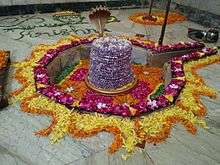
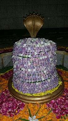
Lingda is a village in Anand district in the Indian state of Gujarat. It is located in Umreth Taluka on the Nadiad-Dakor road. The name was derived from the temple of Lord Shiva, named લીંગડા (Shree Siddhanath Mahadev).
Lingda Lingpur | |
|---|---|
Village - town | |
 Lingda Location in Gujarat, India  Lingda Lingda (India) | |
| Coordinates: 22°41′19″N 73°04′24″E | |
| Country | India |
| State | Gujarat |
| District | Anand |
| Taluka | Umreth |
| Named for | Paddy fields & Peanut fields |
| Population | |
| • Total | 6,000 |
| Languages | |
| • Official | Gujarati, Hindi |
| Time zone | UTC+5:30 (IST) |
| PIN | 388220[1] |
| Vehicle registration | GJ 23 |
| Website | gujaratindia |
Geography
It is 4 km from the town of Umreth (The Silk Nagari), 11 kilometers from Dakor (Temple of Lord Krisna), 19 km from NH-8 and from Anand (The Milk City) and 22 km from Nadiad.
Fifteen ponds surround the village and are used for agriculture. The main canal is Mahi Sichai and many sub canals divert water to cover more than 75% of agricultural land. The water in the land is 10 to 20 feet.
There are many NRI (Non-residence of Indian) belongs to this wonderful village. They visits village often and makes it better place.


Shree Sidhhnath Mahadev

Sidhhnath Mahadev
Notes and references
gollark: In any case, ZIM files aren't *entirely* archivey, as it has to be efficient to FTS them and look up a specific page.
gollark: https://sqlite.org/sqlar.html
gollark: This is vaguely worrying, Google found the potatOS privacy policy on osmarks.tk even though it's *not linked anywhere*.
gollark: But for most of it that wouldn't be necessary.
gollark: Admittedly you probably would have to work around SQLite to some extent for compression efficiency, for example by encoding article data and stuff in msgpack blobs or whatever, concating a lot together, and compressing them.
This article is issued from Wikipedia. The text is licensed under Creative Commons - Attribution - Sharealike. Additional terms may apply for the media files.