Leverett Circle Connector Bridge
The Leverett Circle Connector Bridge is a highway bridge over the Charles River, carrying two lanes each of northbound and southbound traffic. It connects to Interstate 93 in Somerville, Massachusetts (the "Northern Expressway") at the north end (exit 26 from I-93 South) and splits at the south end, providing direct access to both Storrow Drive and Leverett Circle in Boston. Going northbound, there is also a fork which provides access to the City Square Tunnel under Charlestown to proceed on U.S. 1 North via the Tobin Bridge.
Leverett Circle Connector | |
|---|---|
 | |
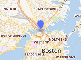
| Coordinates | 42.36909°N 71.06459°W |
| Carries | highway access ramp |
| Crosses | Charles River |
| Locale | Boston, Massachusetts to Somerville, Massachusetts |
| Characteristics | |
| Design | steel box girder bridge |
| Total length | 1.7 miles (2.7 km)[1] |
| History | |
| Opened | October 7, 1999 |
| |
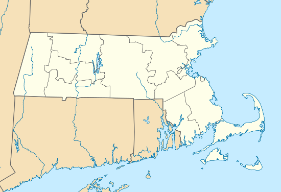 Location in Massachusetts | |
The span was built in conjunction with the more dramatic Leonard P. Zakim Bunker Hill Bridge as part of the Central Artery/Tunnel Project, widely known as the Big Dig. During construction, the Leverett Circle Connector Bridge was sometimes called "Baby Bridge".[2] The bridge opened for traffic on October 7, 1999,[3] at a cost of $22.27 million.[4]
Also known as the Storrow Drive Connector, it is the largest steel box girder bridge in the United States. It was the winner of a July 2001 National Steel Bridge Alliance (NSBA) "prize bridge" Award.[5] Its weaving design was determined by the other major structures involved in the Big Dig but unlike other parts of the project, it was finished eight days ahead of schedule.[4]
Major intersections
The entire route is in Boston, Suffolk County. All exits are unnumbered.
| Location | mi[1] | km | Destinations | Notes | |
|---|---|---|---|---|---|
| West End | 0.0 | 0.0 | At-grade intersection; North Station access via Nashua Street | ||
| 0.2 | 0.32 | Southbound exit and northbound entrance; no commercial vehicles | |||
| Charles River | 0.4– 0.5 | 0.64– 0.80 | Bridge | ||
| Charlestown | 0.7 | 1.1 | Loop ramp via City Square Tunnel | ||
| 1.7 | 2.7 | Exit 26 on I-93; Somerville city line | |||
| 1.000 mi = 1.609 km; 1.000 km = 0.621 mi | |||||
Gallery
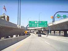
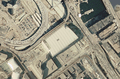 Leverett Circle as seen behind North Station during Big Dig construction.
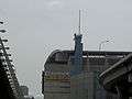 Part of the rebuilt connector bridge at right.
References
- Google (June 2, 2019). "Leverett Circle Connector" (Map). Google Maps. Google. Retrieved June 2, 2019.
- Howe, Peter J. (August 10, 1998). "Masterpiece or monster". Boston Globe. p. C3.
- Leonard P Zakim-Bunker Hill Memorial Bridge (I-93 and US 1)
- "Archived copy". Archived from the original on 2008-11-21. Retrieved 2008-12-05.CS1 maint: archived copy as title (link)
- https://web.archive.org/web/20030506212922/http://www.aisc.org/ContentManagement/ContentDisplay.cfm?ContentID=1003