Lethapora
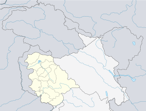
Lethapora or Lethpora is a village in the Pulwama district of Jammu and Kashmir, India. It is located in the Pampore tehsil, of Kashmir valley.
Lethapora | |
|---|---|
village | |
 Lethapora Location in Jammu and Kashmir, India | |
| Coordinates: 33°57′50″N 74°57′50″E | |
| Country | India |
| State | Jammu and Kashmir |
| District | Pulwama |
| Tehsil | Pampore |
| Elevation | 1,620 m (5,310 ft) |
| Population (2011) | |
| • Total | 6,131 |
| Census code | 002982 |
Location
Lethapora is located on the banks of Jhelum River. It lies at the foothills of south-western corner of Zabarwan mountain range locally known as Vastoorwun. The Srinagar Jammu National Highway passes through the village.[1][2]
Demographics
According to the 2011 census of India, Lethapora has 828 households. The average literacy rate (i.e. the literacy rate of population excluding children aged 6 and below) is 70.53%. Most people of the village are associated with agriculture. Saffron is the main crop and the main source of income for the village.
gollark: If not nuclear, then the obvious way to provide power is to just blanket every available desert in solar panels.
gollark: Hmm. Is solar responsible for any deaths?
gollark: Wow, way to invalidate GTech™ sentient mathematical objects™.
gollark: What of GTech™ sentient mathematical objects™?
gollark: It does not. Nuclear waste is tiny and buried in sensible underground locations.
References
- "Kashmir's Legendary Saffron". Outlook Traveller. Retrieved 16 February 2019.
- "The Tribune, Chandigarh, India - JAMMU TRIBUNE". www.tribuneindia.com. Retrieved 16 February 2019.
This article is issued from Wikipedia. The text is licensed under Creative Commons - Attribution - Sharealike. Additional terms may apply for the media files.