Les Moulins Regional County Municipality
Les Moulins is a regional county municipality in the Lanaudière region of Quebec, Canada.
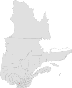
Les Moulins | |
|---|---|
 | |
| Coordinates: 45°45′N 73°36′W[1] | |
| Country | |
| Province | |
| Region | Lanaudière |
| Effective | January 1, 1982 |
| County seat | Terrebonne |
| Government | |
| • Type | Prefecture |
| • Prefect | Guillaume Tremblay |
| Area | |
| • Total | 266.30 km2 (102.82 sq mi) |
| • Land | 261.13 km2 (100.82 sq mi) |
| Population (2016)[3] | |
| • Total | 158,267 |
| • Density | 606.1/km2 (1,570/sq mi) |
| • Change 2011–2016 | |
| Time zone | UTC−5 (EST) |
| • Summer (DST) | UTC−4 (EDT) |
| Area code(s) | 450 and 579 |
| Website | www |
| [4] | |
It is located immediately north of Laval on the north shore of the Rivière des Mille-Îles, and comprises the municipalities of Terrebonne and Mascouche. Historic communities in the region, which are now arrondissements of the two existing cities, include Lachenaie and La Plaine.
The population according to the 2016 Canadian Census was 158,267[3]
Transportation
Access Routes
Highways and numbered routes that run through the municipality, including external routes that start or finish at the county border:[5]
gollark: Governments are total bees.
gollark: "This is part of the solution" really does not mean "this is entirely useless".
gollark: Geoengineering would be good if it's workable, although nuclear is just pretty good generally even if it will not fix everything instantly.
gollark: A significant amount of energy use is electricity. If we make that cleanly, that is a significant step toward reducing climate change, and you can then throw cheap electricity at other problems.
gollark: "This wouldn't fix literally all problems at once so why even do it?"
References
- Reference number 141067 of the Commission de toponymie du Québec (in French)
- Geographic code 640 in the official Répertoire des municipalités (in French)
- "Census Profile, 2016 Census Les Moulins, Municipalité régionale de comté [Census division], Quebec". Statistics Canada. Retrieved November 27, 2019.
- "(Code 2464) Census Profile". 2011 census. Statistics Canada. 2012.
- Official Transport Quebec Road Map
External links
Adjacent Counties & Equivalent Territories | |
|---|---|
| Regional county municipalities and equivalent territories | |
|---|---|
| Municipalities | |
This article is issued from Wikipedia. The text is licensed under Creative Commons - Attribution - Sharealike. Additional terms may apply for the media files.