Lemaire Island
Lemaire Island (64°49′S 62°57′W) is an island 4.5 nautical miles (8 km) long and 1.5 nautical miles (3 km) wide, lying 1 nautical mile (2 km) west of Duthiers Point off the west coast of Graham Land, Antarctica. It was discovered by the Belgian Antarctic Expedition, 1897–99, under Adrien de Gerlache, who named it for Charles Antoine Lemaire.[1] The island is bordered by the Aguirre Passage which separates it from the Danco Coast.[2]
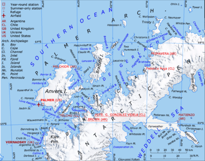
The southwest point of the island is marked by Siebert Rock (64°49′S 63°2′W), which sits at the entrance to the Lientur Channel. Siebert Rock was first charted by the Chilean Antarctic Expedition, 1950–51, and named after Capitan de Corbeta Ernesto Siebert G., engineer officer on the expedition transport ship Angamos.[3]
See also
- Gerlache Strait Geology
- List of Antarctic and sub-Antarctic islands
References
- "Lemaire Island". Geographic Names Information System. United States Geological Survey. Retrieved 2013-06-10.
-

- "Siebert Rock". Geographic Names Information System. United States Geological Survey. Retrieved 2018-08-03.
External links
![]()