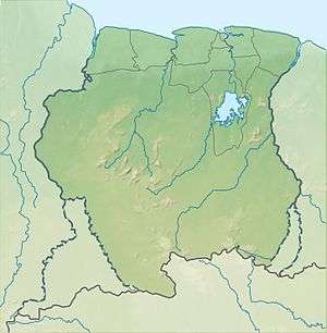
Lely Mountains
The Lely Mountains (Dutch: Lelygebergte, Ndyuka: Ando Busiman Mongo) are a mountain plateau on the left bank of the Tapanahony and Marowijne rivers in Suriname. The plateau has a maximum altitude of about 685 metres (2,247 ft). In 2005, 25 new species were discovered in the Lely Mountains.[1]
| Lely Mountains | |
|---|---|
 Lely Mountains Location in Suriname | |
| Highest point | |
| Elevation | 685 m (2,247 ft) |
| Coordinates | 4.3714°N 54.6632°W |
| Geography | |
| Country | Suriname |
| District | Sipaliwini District |
The mountain range is served by the Lelygebergte Airstrip.
Name
The mountain range is named after Cornelis Lely, a former governor of Suriname. The Ndyuka maroons call the mountains the Ando Busiman Mongo after the famed Ndyuka explorer Ando Busiman.[2]
gollark: "GTech™ experimental tetrahedral apioform #908411" is highly serious.
gollark: No, their real name is "GTech™ experimental tetrahedral apioform #908411".
gollark: I made an IQ test once. The sequel is pending.
gollark: Are the curves defined by parametric, polar or Cartesian equations?
gollark: Asymmetric crypto, yes.
References
Notes
- "Villa Lelydorp". Villa Lelydorp (in Dutch). Retrieved 29 May 2020.
- Van Wetering & Thoden van Velzen 2013, p. 57.
Bibliography
Van Wetering, Wilhelmina; Thoden van Velzen, H.U.E. (2013). Een Zwarte Vrijstaat in Suriname: de Okaanse samenleving in de negentiende en twintigste eeuw. Leiden: Brill.CS1 maint: ref=harv (link)
This article is issued from Wikipedia. The text is licensed under Creative Commons - Attribution - Sharealike. Additional terms may apply for the media files.