Le Tremblay
Le Tremblay is a former commune in the Maine-et-Loire department in western France. On 15 December 2016, it was merged into the new commune Ombrée d'Anjou.[2]
Le Tremblay | |
|---|---|
Part of Ombrée d'Anjou | |
Location of Le Tremblay 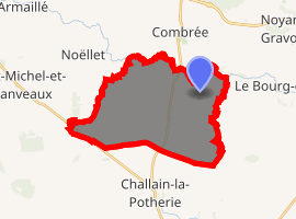
| |
 Le Tremblay  Le Tremblay | |
| Coordinates: 47°40′43″N 1°00′59″W | |
| Country | France |
| Region | Pays de la Loire |
| Department | Maine-et-Loire |
| Arrondissement | Segré |
| Canton | Segré |
| Commune | Ombrée d'Anjou |
| Area 1 | 22.97 km2 (8.87 sq mi) |
| Population (2017)[1] | 370 |
| • Density | 16/km2 (42/sq mi) |
| Demonym(s) | Tremblaysien, Tremblaysienne |
| Time zone | UTC+01:00 (CET) |
| • Summer (DST) | UTC+02:00 (CEST) |
| Postal code | 49520 |
| Elevation | 32–105 m (105–344 ft) (avg. 47 m or 154 ft) |
| 1 French Land Register data, which excludes lakes, ponds, glaciers > 1 km2 (0.386 sq mi or 247 acres) and river estuaries. | |
Geography
The river Verzée forms all of the commune's northern border.
gollark: I personally enjoy writing SQL directly.
gollark: * defense
gollark: I have to admit NSFW esolangs is a highly effective gollark defends.
gollark: I'm sure you'd like to think so, or maybe wouldn't like to but were lasered into thinking so.
gollark: are you forgetting the orbital mind control lasers?
References
- Téléchargement du fichier d'ensemble des populations légales en 2017, INSEE
- Arrêté préfectoral 7 December 2016 (in French)
| Wikimedia Commons has media related to Le Tremblay (Maine-et-Loire). |
| Authority control |
|
|---|
This article is issued from Wikipedia. The text is licensed under Creative Commons - Attribution - Sharealike. Additional terms may apply for the media files.