Le Roncenay-Authenay
Le Roncenay-Authenay is a former commune in the Eure department in northern France. On 1 January 2016, it was merged into the new commune of Mesnils-sur-Iton.[2]
Le Roncenay-Authenay | |
|---|---|
Part of Mesnils-sur-Iton | |
Location of Le Roncenay-Authenay 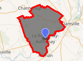
| |
 Le Roncenay-Authenay  Le Roncenay-Authenay | |
| Coordinates: 48°51′35″N 1°02′48″E | |
| Country | France |
| Region | Normandy |
| Department | Eure |
| Arrondissement | Bernay |
| Canton | Verneuil-sur-Avre |
| Commune | Mesnils-sur-Iton |
| Area 1 | 8.79 km2 (3.39 sq mi) |
| Population (2013)[1] | 379 |
| • Density | 43/km2 (110/sq mi) |
| Time zone | UTC+01:00 (CET) |
| • Summer (DST) | UTC+02:00 (CEST) |
| Postal code | 27240 |
| Elevation | 132–171 m (433–561 ft) (avg. 158 m or 518 ft) |
| 1 French Land Register data, which excludes lakes, ponds, glaciers > 1 km2 (0.386 sq mi or 247 acres) and river estuaries. | |
Population
| Year | Pop. | ±% |
|---|---|---|
| 1962 | 162 | — |
| 1968 | 171 | +5.6% |
| 1975 | 167 | −2.3% |
| 1982 | 204 | +22.2% |
| 1990 | 300 | +47.1% |
| 1999 | 296 | −1.3% |
| 2008 | 390 | +31.8% |
gollark: Yes. Unicode → comedy 106.9993.
gollark: Exæcŧły.
gollark: Go ė̀ͦmͤ͛͂b̉̿ͪ҉̶̨͇ṙͣ̽a͐̓͊cͤͧ̇e̐ͮ̚ ͛͋̐ṫ͊͊h͑͑͗e͐̒͆ ̾̎̌҉̠̮͟Vͨ̿̎ ͆̈́̍Oͧ̆̐ ̇ͧ̐I̊̈́̅ ̓̓̉Ḋ̄ͩ yourself.
gollark: I just draw around a gluestick or something.
gollark: https://media.discordapp.net/attachments/348702212110680064/744581775589638154/void-cactus.png?width=443&height=421
See also
References
- Populations légales 2013: Téléchargement du fichier d'ensemble, INSEE
- Arrêté préfectoral 23 November 2015 (in French)
| Wikimedia Commons has media related to Le Roncenay-Authenay. |
| Authority control |
|
|---|
This article is issued from Wikipedia. The text is licensed under Creative Commons - Attribution - Sharealike. Additional terms may apply for the media files.