Le Mée, Eure-et-Loir
Le Mée is a former commune in the Eure-et-Loir department in northern France. On 1 January 2017, it was merged into the new commune Cloyes-les-Trois-Rivières.[2]
Le Mée | |
|---|---|
Part of Cloyes-les-Trois-Rivières | |
Location of Le Mée 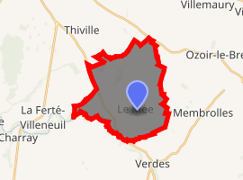
| |
 Le Mée  Le Mée | |
| Coordinates: 47°59′11″N 1°25′00″E | |
| Country | France |
| Region | Centre-Val de Loire |
| Department | Eure-et-Loir |
| Arrondissement | Châteaudun |
| Canton | Brou |
| Commune | Cloyes-les-Trois-Rivières |
| Area 1 | 19.11 km2 (7.38 sq mi) |
| Population (2017)[1] | 265 |
| • Density | 14/km2 (36/sq mi) |
| Time zone | UTC+01:00 (CET) |
| • Summer (DST) | UTC+02:00 (CEST) |
| Postal code | 28220 |
| Elevation | 106–134 m (348–440 ft) (avg. 128 m or 420 ft) |
| 1 French Land Register data, which excludes lakes, ponds, glaciers > 1 km2 (0.386 sq mi or 247 acres) and river estuaries. | |
Population
| Year | Pop. | ±% |
|---|---|---|
| 1962 | 226 | — |
| 1968 | 265 | +17.3% |
| 1975 | 265 | +0.0% |
| 1982 | 234 | −11.7% |
| 1990 | 222 | −5.1% |
| 1999 | 209 | −5.9% |
| 2008 | 265 | +26.8% |
gollark: ```<> 167.172.53.64 [19/Aug/2020:11:17:45 +0000] "batman" 400 157 "-" "-" ```
gollark: What even?
gollark: ```<> 167.172.53.64 [19/Aug/2020:11:17:45 +0000] "145.ll|'|'|SGFjS2VkX0Q0OTkwNjI3|'|'|WIN-JNAPIER0859|'|'|JNapier|'|'|19-02-01|'|'||'|'|Win 7 Professional SP1 x64|'|'|No|'|'|0.7d|'|'|..|'|'|AA==|'|'|112.inf|'|'|SGFjS2VkDQoxOTIuMTY4LjkyLjIyMjo1NTUyDQpEZXNrdG9wDQpjbGllbnRhLmV4ZQ0KRmFsc2UNCkZhbHNlDQpUcnVlDQpGYWxzZQ==12.act|'|'|AA==" 400 157 "-" "-" ```
gollark: ```<i.osmarks.tk> 1.202.114.140 [19/Aug/2020:19:35:08 +0000] "GET /_h5ai/public/css/styles.css HTTP/1.1" 200 6386 "https://i.osmarks.tk/?&" "Mozilla/4.049897920 Mozilla/4.0 (compatible; MSIE 6.0; Windows NT 5.1; SV1; .NET CLR 2.0.50727; .NET CLR 3.0.04506.648; .NET CLR 3.5.21022; .NET CLR 3.0.4506.2152; .NET CLR 3.5.30729)" secure```What *is* this request?
gollark: Okay, so I now have suspicious-looking requests redirected to my program which then logs them to a SQLite database.
References
- Téléchargement du fichier d'ensemble des populations légales en 2017, INSEE
- Arrêté préfectoral 25 May 2016 (in French)
| Wikimedia Commons has media related to Le Mée. |
| Authority control |
|
|---|
This article is issued from Wikipedia. The text is licensed under Creative Commons - Attribution - Sharealike. Additional terms may apply for the media files.