Le Gouray
Le Gouray (Breton: Gorre) is a former commune in the Côtes-d'Armor department of Brittany in northwestern France. On 1 January 2016, it was merged into the new commune Le Mené.[2]
Le Gouray Gorre | |
|---|---|
Part of Le Mené | |
 | |
.svg.png) Coat of arms | |
Location of Le Gouray 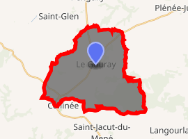
| |
 Le Gouray  Le Gouray | |
| Coordinates: 48°19′41″N 2°29′15″W | |
| Country | France |
| Region | Brittany |
| Department | Côtes-d'Armor |
| Arrondissement | Dinan |
| Canton | Plénée-Jugon |
| Commune | Le Mené |
| Area 1 | 30.50 km2 (11.78 sq mi) |
| Population (2017)[1] | 1,292 |
| • Density | 42/km2 (110/sq mi) |
| Time zone | UTC+01:00 (CET) |
| • Summer (DST) | UTC+02:00 (CEST) |
| Postal code | 22330 |
| Elevation | 79–305 m (259–1,001 ft) |
| 1 French Land Register data, which excludes lakes, ponds, glaciers > 1 km2 (0.386 sq mi or 247 acres) and river estuaries. | |
Population
| Year | Pop. | ±% |
|---|---|---|
| 1962 | 1,028 | — |
| 1968 | 1,068 | +3.9% |
| 1975 | 988 | −7.5% |
| 1982 | 932 | −5.7% |
| 1990 | 944 | +1.3% |
| 1999 | 939 | −0.5% |
| 2008 | 1,140 | +21.4% |
gollark: Brimstone, storm, yellow crowned.
gollark: Okay, right, you can do storms then.
gollark: What if we flood it with *multiple* bad breeds?
gollark: In that case, when should we schedule the APocalypse?
gollark: Are they that common though?
References
- Téléchargement du fichier d'ensemble des populations légales en 2017, INSEE
- Arrêté préfectoral 5 October 2015 (in French)
External links
| Wikimedia Commons has media related to Le Gouray. |
- French Ministry of Culture list for Le Gouray (in French)
| Authority control |
|
|---|
This article is issued from Wikipedia. The text is licensed under Creative Commons - Attribution - Sharealike. Additional terms may apply for the media files.