Lale Buttress
Lale Buttress (Bulgarian: рид Лале, ‘Rid Lale’ \'rid la-'le\ is the ice-covered buttress rising to 1850 m on the northwest side of Detroit Plateau on Davis Coast in Graham Land, Antarctica. It is situated between tributaries to Wright Ice Piedmont, and has steep and partly ice-free southwest, northwest and northeast slopes.
The buttress is named after the settlement of Lale in Southern Bulgaria.
Location
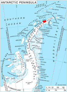
Lale Buttress is located at 64°11′20″S 60°22′30″W, which is 7.3 km east of Mount Ader, 26.4 km southeast of Cape Andreas, 19.97 km southwest of Matov Peak, and 24.06 km northwest of Darzalas Peak on Nordenskjöld Coast. British mapping in 1978.
Maps
- British Antarctic Territory. Scale 1:200000 topographic map. DOS 610 Series, Sheet W 64 60. Directorate of Overseas Surveys, Tolworth, UK, 1978.
- Antarctic Digital Database (ADD). Scale 1:250000 topographic map of Antarctica. Scientific Committee on Antarctic Research (SCAR). Since 1993, regularly upgraded and updated.
References
- Bulgarian Antarctic Gazetteer. Antarctic Place-names Commission. (details in Bulgarian, basic data in English)
- Lale Buttress. SCAR Composite Gazetteer of Antarctica
External links
- Lale Buttress. Copernix satellite image
This article includes information from the Antarctic Place-names Commission of Bulgaria which is used with permission.