Lake Dynda
Lake Dynda (Russian: Дында)[2] is a freshwater lake in Turukhansky District, Krasnoyarsk Krai, Russia. The lake is located in the Upper Taz Nature Reserve.[3]
| Lake Dynda | |
|---|---|
| Дында | |
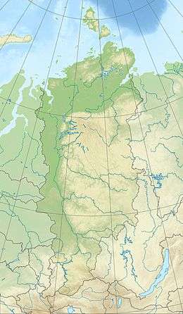
 Lake Dynda Location in Krasnoyarsk Krai, Russia | |
| Location | Turukhansky District |
| Coordinates | 62°49′N 85°43′E[1] |
| Basin countries | Russia |
| Max. length | 8 km (5.0 mi) |
| Max. width | 1.5 km (0.93 mi) |
| Max. depth | 4.5 m (15 ft) |
Geography
The lake lies in the basin of the Taz River, close to its source, and near the basin of the Yeloguy River which flows to the southeast of the lake.[4] Lake Dynda extends in a roughly northwest–southeast direction. Its depth is between 3 m (9.8 ft) and 4.5 m (15 ft).[3]
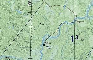
 Map section centered on Kellog, a section of the Yeloguy River and Lake Dynda, the places where folk singer Alexander Kotusov found inspiration for his songs. |
gollark: It's kind of unintuitive.
gollark: `a` is just one value, so the second return is discarded, so it works sensibly.
gollark: `gsub` actually returns multiple values. Because Lua, since it's the last thing passed to that function, `table.insert` is passed the string it returns and a number from it. `table.insert` has an overload where it takes `(table, position, value)` or something instead of `(table, value)`.
gollark: The alternative to having it be a GPS server thing would be per-dimension "dimservers" or something providing the dimension name (and possibly server name and metadata), which could work too I guess.]
gollark: The main problem I envision is that I haven't worked out a standard for dimension naming, so it just uses the one it receives the most fixes containing, which can be basically anything the GPS servers want, and that it won't function reliably without a large amount of dimension-enabled GPS servers.
See also
References
- "Gazetteer - BirdLife Data Zone - BirdLife International" (PDF).
- "Ozero Dynda - Russia". www.indexmundi.com.
- Upper Taz Nature Reserve
- Google Earth
This article is issued from Wikipedia. The text is licensed under Creative Commons - Attribution - Sharealike. Additional terms may apply for the media files.