Lac des Brenets
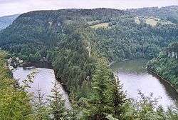
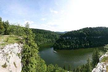
Lac des Brenets (Swiss name) or Lac de Chaillexon (French name) is a lake on the Doubs River on the border of Switzerland and France.
| Lac des Brenets Lac de Chaillexon | |
|---|---|
 | |
| Location | Franche-Comté, Canton of Neuchâtel |
| Coordinates | 47°4′9″N 6°41′52″E |
| Primary inflows | Doubs, Rançonnière |
| Primary outflows | Doubs |
| Basin countries | France, Switzerland |
| Max. length | 3.5 km (2.2 mi) |
| Max. width | 250 m (820 ft) |
| Surface area | 0.8 km2 (0.31 sq mi) |
| Max. depth | 26 m (85 ft) |
| Water volume | 5.7 hm3 (4,600 acre⋅ft) |
| Surface elevation | 750 m (2,460 ft) |
| Settlements | Villers-le-Lac |
Characteristics
The depression in which the lake lies was formed by the movements of a glacier, while the lake itself was formed by a natural barrier around 12 000 years ago. At the downstream end is a waterfall known as the Saut du Doubs. A few hundred metres away, a bridge connects the French and Swiss sides of the lake.
Photographs
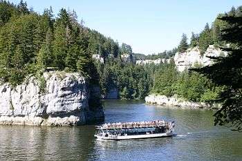
A tourist boat on the narrow lake
gollark: Why not?
gollark: 2. Why does that actually matter most of the time?
gollark: 1. Try reading a 100KB minified JS bundle.
gollark: So what?
gollark: Half the uses of PHP can just be replaced with a static site generator, too.
See also
External links
| Wikimedia Commons has media related to Lac des Brenets. |
This article is issued from Wikipedia. The text is licensed under Creative Commons - Attribution - Sharealike. Additional terms may apply for the media files.