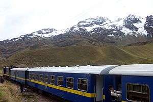
La Raya mountain range
The La Raya mountain range (Spanish for the line, the limits, the border) is situated in the Andes of Peru. It extends in a northeasterly direction approximately between 14º 20’ and 14º 33’S and 70º 57’ and 71º 02’W for about 10 km.[1] It is located in the Cusco Region as well as in the Puno Region, northwest of the Peruvian Altiplano and Lake Titicaca, near the La Raya pass.
| La Raya mountain range | |
|---|---|
 | |
| Highest point | |
| Elevation | 5,489 m (18,009 ft) |
| Dimensions | |
| Length | 10 km (6.2 mi) NE-SW |
| Geography | |
| Country | |
| Region | Cusco Region, Puno Region |
| Parent range | Andes |
Mountains
One of the highest peaks of the range is Chimpulla (5,489 metres (18,009 ft)). Other mountains are listed below:[2][3][4]
- Yana Khuchilla, 5,472 m (17,953 ft)
- Chinchina, 5,463 m (17,923 ft)
- Muskaya, 5,414 m (17,762 ft)
- Kuntur Quta, 5,425 m (17,799 ft)
- Qillqa, 5,360 m (17,590 ft)
- Awkar Utaña, 5,310 m (17,420 ft)
- Huch'uy K'uchu, 5,300 m (17,400 ft)
- Hatun Awkara, 5,230 m (17,160 ft)
- Kunka, 5,200 m (17,100 ft)
- Wila Quta, 5,200 m (17,100 ft)
- Yanaqucha, 5,105 m (16,749 ft)
- Mamaniri, 5,077 m (16,657 ft)
- Qullqini, 5,025 m (16,486 ft)
- Chawpi Tiyana, 5,000 m (16,000 ft)
- Hatun Ichhuna Kunka, 5,000 m (16,000 ft)
- Huch'uy Awkara, 5,000 m (16,000 ft)
- Puka Urqu, 5,000 m (16,000 ft)
- Taruja Marka, 5,000 m (16,000 ft)
- Yana Ranra, 5,000 m (16,000 ft)
- Hatun Wasi, 4,800 m (15,700 ft)
- Inka Kancha, 4,800 m (15,700 ft)
- Ñiq'i Quta, 4,800 m (15,700 ft)
- Silluta, 4,800 m (15,700 ft)
- Yaritani, 4,800 m (15,700 ft)
gollark: Well, by health, yes.
gollark: Oh, yes, it's true.
gollark: Seriously what?
gollark: Seriously?
gollark: <@!332271551481118732>, you should sign up.
See also
References
- Inventario de Glaciares del Perú, Ministerio de Agricultura y Riego, Autoridad Nacionaldel Agua, Huaraz 2014
- Peru 1:100,000, Palca 2742, Map prepared and published by the Defense Mapping Agency, Hydrographic/Topographic Center, Bethesda, MD
- escale.minedu.gob.pe - UGEL map of the Melgar Province (Puno Region)
- Peru 1:100,000, Sicuani 2642 J632 Edition I-DMA, Map prepared and published by the Defense Mapping Agency
| Wikimedia Commons has media related to La Raya mountain range. |
This article is issued from Wikipedia. The text is licensed under Creative Commons - Attribution - Sharealike. Additional terms may apply for the media files.