La Prévière
La Prévière is a former commune in the Maine-et-Loire department in western France. On 15 December 2016, it was merged into the new commune Ombrée d'Anjou.[2]
La Prévière | |
|---|---|
Part of Ombrée d'Anjou | |
Location of La Prévière 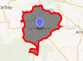
| |
 La Prévière  La Prévière | |
| Coordinates: 47°43′06″N 1°10′36″W | |
| Country | France |
| Region | Pays de la Loire |
| Department | Maine-et-Loire |
| Arrondissement | Segré |
| Canton | Segré |
| Commune | Ombrée d'Anjou |
| Area 1 | 7.24 km2 (2.80 sq mi) |
| Population (2017)[1] | 240 |
| • Density | 33/km2 (86/sq mi) |
| Demonym(s) | Epervier, Epervière |
| Time zone | UTC+01:00 (CET) |
| • Summer (DST) | UTC+02:00 (CEST) |
| Postal code | 49420 |
| Elevation | 47–100 m (154–328 ft) (avg. 79 m or 259 ft) |
| 1 French Land Register data, which excludes lakes, ponds, glaciers > 1 km2 (0.386 sq mi or 247 acres) and river estuaries. | |
Geography
The river Verzée forms all of the commune's north-eastern border.
gollark: That sounds kind of like a stack language but backward.
gollark: Excellent. Deploying MPU6050. None are safe.
gollark: The input thing or possibly newarithmetjce eoprtiacommabds.
gollark: Which are also quaternions and vectors and matrices and tensors.
gollark: Idea: brain[EXPLETIVE DELETED] with arbitrary surreal and/or rational bigint ordinal complex numbers per cell?
References
- Téléchargement du fichier d'ensemble des populations légales en 2017, INSEE
- Arrêté préfectoral 7 December 2016 (in French)
| Wikimedia Commons has media related to La Prévière. |
This article is issued from Wikipedia. The text is licensed under Creative Commons - Attribution - Sharealike. Additional terms may apply for the media files.